Planning a Circumnavigation
THIS POST MAY CONTAIN AFFILIATE LINKS. PLEASE READ OUR DISCLOSURE FOR MORE INFO.
Last Updated on September 13, 2023 by Amy
Plotting world circumnavigation routes is a lot easier than it sounds. There are cruising boats LITERALLY all over the world. There are boats in the Northwest passage (up and over Canada), in the Antarctic, and everywhere in between. There are a few key things to take into consideration, but 95%* of circumnavigation routes follow the same general course.
Table of Contents - Click to Jump
Insurance Restrictions on Circumnavigation Routes
There are two major restrictions put on us by our vessel insurance; stay out of highly pirated areas and stay out of named storm zones. Insurance restrictions come with the option to ignore them. You can always go to these restricted places, BUT if something happens, your insurance will not be covered. Another option is that you can pay significantly more to be covered in these places as well. We have made the choice for ourselves to follow the restrictions set by our insurance.
By definition, piracy is the act of attacking and robbing ships at sea. By that main definition, the Caribbean is one of the worst places for piracy. Petty theft of boats and their tenders is a major issue in some parts of the Caribbean, and steps should be taken to protect yourself and your assets.
However, the piracy of the biggest concern is murder and kidnapping. There are two main hotspots where our insurance will not cover us; the Philippines and the Red Sea/Suez Canal (hereby referred to as simply Suez). Again, people cruise literally everywhere in the world, and there are people who cruise the Philippines (2015 reports state 200 yachts). The other side of the coin is true too. Just because you avoid the Suez or the Philippines does not mean you will avoid being kidnapped or murdered.
It’s up to you to decide the level of risk you are willing to take when planning out a circumnavigation route.
Tropical Storms
In North America, it’s a hurricane. South of the equator, it’s cyclones. In Asia-Pacific, it’s typhoons. Either way, your insurance probably has a word or two to say about where you spend tropical storm season.
Our insurance requires us to avoid certain parts of the world during storm seasons. This is why there is a mass exodus of boats from the Caribbean every year. Our insurance requires us to be north of roughly the Florida-Georgia line. Now, that doesn’t mean we are safe from hurricanes, but it does mean if something happens, we will have the privilege of consoling ourselves of our losses by applying for an insurance claim.
For those moving quickly, your primary concern is systems in the southern hemisphere. Just make sure you are moving from east to west quickly enough to pass through the storm zone.
World circumnavigation routes, like ours, usually have you dipping out of these storm zones for the season. It’s a great time to haul your boat out for annual maintenance, like we did in New Zealand, Australia, and Thailand.
Tradewinds for Circumnavigating
Around the equator lies the doldrums. This is typically an area with very little wind. However, each ocean has a wind pattern. In the northern hemisphere, winds circulate clockwise. In the southern hemisphere, winds circulate counterclockwise. This means that on either side of the equator lies a band of wind flowing from east to west. This is why 95%* of cruisers plan their circumnavigation routes to sail from east to west.
Factoring the Wind into Outfitting Your Boat
Knowing where you will sail will help you determine what kind of sail performance you are looking for in a boat. For someone doing a typical circumnavigation route, sailing east to west, you’ll be sailing downwind a lot. Some monohull owners have complained to us about how uncomfortable their boat is sailing dead downwind. Catamarans, however, typically perform best downwind. We have a very smooth ride when we are traveling with the wind and waves.
Outfitting your sail locker also factors in where you are sailing. For a downwind circumnavigation, spinnakers are highly useful – or so we hear. We’ve not had terrible success with our spinnaker, but find our screecher to be very useful. That could possibly be because we deviate enough from the standard downwind route.
For more about sail configurations in a cruising catamaran, read our Sail Trim blog post.
Those Who Sail West to East Circumnavigation Routes
There are a few who do sail the “wrong way”. It can definitely be done and done fast. However, you need to have a boat that sails well to wind. While most catamarans sail well downwind, we do not sail well into the wind. However, if your catamaran has daggerboards, you’ll sail much better to wind than a catamaran without daggerboards.
Circumnavigation Routes & Bottlenecks
This is why most circumnavigations follow the same basic route. There are major bottlenecks to passing around the continents, so again, we’ve got the 95%* of boats funneling into one narrow part of the world.
Panama Canal
We paid $1300 to transit the Panama Canal because the only other option is to sail against the wind and waves around either North America or South America. Taking one of the high latitudes routes is pretty dang extreme, takes a significant amount of time, and a toll on ship and crew. Ushuaia, a port of call in Argentina, reported 64 boats in 2015, versus 1,079 boats transiting the canal – 95% transiting the canal*.
Torres Strait
The Torres Strait occupies the space between Australia and New Guinea. It’s fairly small, just 650 nm between Thursday Island and Indonesia’s first port of clearance.
There are some cruisers (like our friends on S/V Field Trip) who are going over the top of New Guinea to get to Southeast Asia. Getting any further north than that requires dealing with the Philippines – either through or around the top of the Philippines into the South China Sea.
Cape of Good Hope
Traveling around South Africa requires tackling the Cape of Good Hope, which is not to be taken lightly due to the challenges in the winds and currents. The alternative is the Suez. There used to be a rally passing through the Suez. The other alternative is to hire private security, but that’s pretty complex. Reports show 358 boats sailing through Cape Town verses 19 through the Suez – again, 95% choose Cape Town*. I know the Mediterranean is a great cruising ground, but we decided if we want to cruise it, we’d rather cross the Atlantic twice than go through the Suez.
How Long Should a Circumnavigation Take?
Barring racing yachts who are smashing world records, it’s not uncommon to complete a circumnavigation in a year and a half. This is a fairly straightforward and quick route.
The World ARC is a one and a half year rally that circumnavigates the world. They have a fantastic route and schedule on their website.
Longer circumnavigation routes still use the same general track, but add on detours. For example, we extended our South Pacific portion into two seasons by sailing south to spend cyclone season in New Zealand.
We’ve met sailors who have taken 15 or more years to circumnavigate. That’s a lot of detours!
Our Circumnavigation Route
Our sailing circumnavigation route took us four years and three months to travel all the way around the world. You can read the summary of our world circumnavigation for more details.
Book: World Cruising Routes
This is LITERALLY the bible of sailing around the world. If you have ever asked yourself (or, god help you, asked on a forum) “I wonder when the best time to sail from X to Y is?” the answer is in this book.
Even though we know our route, I’m still pulling out this book every so often to look up possibilities. It’s a great guide to planning your circumnavigation route overall and planning each individual passage.
Buy Jimmy Cornell’s World Cruising Routes .
Book: Cornell’s Ocean Atlas
This handy reference book is full of windgrams – “a summary of wind direction and strength derived from the individual windroses along a specific ocean route “. Basically this means you can open a chart for a particular region and month and you will be able to tell where the wind “usually” blows from.
Buy Cornell’s Ocean Atlas .
Book Review: How to Sail Around the World Part-Time
- Who: Linus Wilson and his wife, Janna
- Available: Kindle, Kindle Unlimited or Paperback
- Published: January 2016
- Editing (scale of 1-10, 10 is best): 10
Linus Wilson has been cruising part-time on his 31-foot Island Packet. This is his second book, and in it, he details how one could sail a circumnavigation part-time. I agree – it is possible and might be the solution more potential cruisers should consider.
Wilson pulls a lot of statistics about sailing. Did you know fewer people complete a sailing circumnavigation every year than climb Mount Everest? An hour spent above base camp on Mount Everest is 264 times more dangerous than an hour sailing?
One question unanswered is how long it would actually take to sail the world part-time. Of course, it depends on how much time you dedicate every year, but hypothetically:
- Year 1: the Caribbean to Panama, store in Panama
- Year 2: Panama to French Polynesia, store in FP
- Year 3: French Polynesia to Fiji, store in Fiji
- Year 4: Fiji to Australia, store in Australia
- Year 5: Australia to South Africa, store in SA
- Year 6: SA to the Caribbean
Of course, you’d see a lot less than you would on a 6-year circumnavigation like ours, but you get it done in a fraction of the cost and less risk.
Bottom line: it was a short, interesting, and informative read. If you don’t want to full-time sail, or can’t convince your partner to full-time sail, consider how fulfilling a part-time adventure could be.
*Jimmy Cornell is the foremost expert on tracking cruising boats, and the statistics for this blog post were pulled from his article Where do all the boats go?
23 Comments
Wonderful article. I am from Goa, India. I wish you had come to Goa. I would have happily looked after your boat, and you could have travelled through India and enjoyed its majestic and diverse cultures and sites. I am 67 years old grandfather. I have been coastal and competitive sailing for the past 50 years. I am now planning to go on a circumnavigation on a Leopard 39 sailboat starting from Goa. Hoping to do it in 2 to 3 years. Your article and videos have inspired me. All the best. Thank you for your well written and detailed articles.
Wow, great to hear from you! It is amazing to us when we hear from people like you all over the world! We have some friends who visited Cochin last year on their boat, I think that’s a popular stop for cruisers. I know that formalities in India are complicated.
I have never been, but I love the food and the culture that I’ve experienced so far! I hope we get to visit someday.
Do sail down to Goa anytime you want. I will sort out all you entry formalities. Wish you all the best. Keep inspiring us with your wonderful sailing and videos.
Hi, how many miles is it when circumnavigating around the earth please? Captain cook did it in 60k, but is this because you cant just sail direct around the earth due to islands and storms etc?
Hi! Our circumnavigation was about 34,000 nm. You can read more about it here: https://outchasingstars.com/world-sailing-circumnavigation-summary/
Amy, when you and David are on a long passage, what kind of watch schedule do you keep? Assuming you’re both healthy (unlike your passage to St. Helena), what do you find to be a comfortable limit for the number of days at sea before exhaustion begins to set in?…or does it ever set in for you guys?
We do a soft 7-hour watch. The only actual watch is I do 7 pm to 2 am. Then David goes on watch while I sleep. When I wake up we switch, and he naps. Then when he’s up, I nap. By then it’s time to do the whole thing all over again! The worst night is the second. You’ve been tired, but not tired enough to sleep off your normal routine yet. But after the second night it gets a lot better. Exhaustion does not set in long-term – boredom does!
I really enjoyed reading your article, it’s very informative although that I don’t have a boat, it’s too expensive where I’m from, and it would take a fortune to be registered if it’s allowed in the first place, as authorities put a lot of restrictions for civil citizen to do so after military took over in 60s, for example we can’t camp as a first without a security permit bla bla bla that it raerly issued or thread fishing without a license and permit bla bla bla….etc, there isn’t a proper Marina for docking not even mention the amount of visas that it required. I love to sail one-day but till that time I’m really enjoy reading and watching. I’m from Egypt, and it makes me sad that sailors stop passing by, as we have a great shores, great diving spots, the Suez canal, and the right wind, but to be considered as unstable area for the Somalian pirates acts, and all the Egyptian governmental claims about fighting terrorist and repel ghost they imagine, this is horrible. It’s really tearing me that after around 8000 years on Earth people couldn’t yet handle their conflicts. I’m sorry to make it very long. Glad that some people had the privilege to try and be able to chasing stars and wind. Godspeed
Sarah, thank you for your comment! It’s amazing to us that we have someone reading from Egypt!
I recently read a memoir about a yacht who sailed through the Suez, and it sounded like they had a lot of difficulties, not just with pirates and corruption, but it’s hard sailing too! Egypt is very high up on my list of places I would truly love to visit because of its amazing history and culture.
We hope that somehow you get to enjoy sailing, even if it’s just continuing to follow us along.
You are amazing, all the best in your upcoming, and hopefully everyone can enjoy sailing in Egypt one day, and be able to see you here in the future.
Hi Amy, first, what a nice simple but very informative blog. I have run a ‘sailing for disabled people’ organisation for the last 25 years and as part of our 25th anniversary are planning to build a 20m cat for a round the world adventure. Planned for start in 2025 I need to get people to understand the real dangers and risks of such travel as well as the good things, would you mind if I used your blog in this matter, I would of course say that is yours. Details of us are under the ‘new projects button’ at http://www.disabledsailing.org
Hi Mike! You are welcome to link to our blog post. If you need anything beyond that, send us an email and we can talk more!
Excellent and informative article. I’d just like to point out the following statement where it states: “Ushuaia, a port of call in Chile, reported 64 boats in 2015….”
Please note that Ushuaia is not located in Chile, but rather within the Tierra del Fuego province of Argentina.
Thank you so much for the correction! I will fix it right away. Geography lesson of the day. 😉
Now you can completely delete my comment 🙂 It’s all sorted. Happy and safe sailing to you and your family. Antonella
Nice write up. Very helpful. Keep up the good work. However sailing through the suez is not really that dangerous. My friends Ingo and Maya sailed through from turkey to India and onward to thailand and had no probs with pirates.
I do hear that the piracy situation is improving. I do think there are a lot of good reasons to go around South Africa though, and I am glad we did.
Great informative article, thanks for sharing.
Where do you store your bladder when it is full? Also, thanks for all the info and videos. It has helped us a great deal in preparation for purchasing our boat,
Thank you! I’m glad you’ve found it helpful. We store the duel bladder in the cockpit.
On the longer passages, how much extra fuel do you carry in your blatter tank. What motering range do you think is sufficient for your longer passages?. I’m thinking the Helia goes about 750 miles on 125 gallons of diesel. Thanks Jon
Our fuel tank holds 125 gallons, plus four 5-gallon jerry cans, plus the 50-gallon fuel bladder, to total 195 gallons. If we motor at 1800 rpms with one engine it’s roughly .8 gph. Theoretically, our tanks should take us about 900 nm. Of course, we go months and thousands of miles without using all of our diesel.
Leave a Reply Cancel reply
Your email address will not be published. Required fields are marked *
This site uses Akismet to reduce spam. Learn how your comment data is processed .
“QuickStart” to Choosing Your World Route and Timing:
Trade Winds, Cyclones and Currents
Posted: August 12, 2015
With limitless possibilities for sailing around the world, how do you select which way to go choosing the safest and most comfortable route around the world depends largely on the weather. most cruisers choose warmer climates, sailing down wind, avoiding areas/seasons of storms and hurricanes (called “cyclones” in the southern hemisphere) and using current boosts when possible. by looking at the probabilities of good conditions, it is possible to select a route for the most safe and comfortable sailing experience., trade winds: there is a more-or-less continuous flow of air called the trade winds. because the earth is warmer at the equator and colder at the poles, and because of the earth’s rotation, this flow is generally westerly (from the west) near the poles and easterly nearer the equator (as shown in the fig. 2)., a popular circumnavigation route (starting at the panama canal) follows the trade winds across the south pacific, north of australia, across the indian ocean south of the equator, around south africa, and back across the south atlantic as shown by the satellite track of our circumnavigation in celebrate ., note the large area of westerly wind in the far southern latitudes. you’ll find most round-the-world racers taking advantage of this wind and rounding the world eastbound instead of the more cruiser-friendly westbound. this far southern route is doable but is likely to be rougher, colder, and less pleasant along with being faster., avoiding cyclones/hurricanes: most cruisers avoid hurricanes by staying out of areas at times when they are most likely to occur. hurricanes are powered by warm ocean waters and the water is warmest at the end of summer. the worst major hurricanes/cyclones (“storms”) will occur in the northern hemisphere in july-october and in the southern hemisphere in december-april (although dangerous storms can and do sometimes occur outside these periods). as shown in fig 3, there are few cyclones at all in the south atlantic and the eastern south pacific., a suggested timing for the route pictured in fig. 1 is to depart panama in early february, arriving in french polynesia as the cyclone season winds down at the end of march. then, the direct route is to proceed through the cyclone zone (stopping along the way) to arrive in south africa in early november before the start of the next storm season in the indian ocean. then one crosses the south atlantic in mid january, early enough to get to the caribbean and leave prior to the start of its hurricane season in june. this “one-year” circumnavigation takes about 15 months and may sound like a rigid and speedy schedule but in reality there is considerable time and flexibility for sight-seeing. for example, rather than spending four weeks in french polynesia, you might choose to stay longer and spend less time in fiji., in order to have more time in the south pacific, you might choose to spend a summer (dec-april) in new zealand. note that to stay in sync with the storm seasons, any significant stopover adds a year to the circumnavigation route. by planning to spend the extra year, you don’t have to be in new zealand until november and you have an extra few months in the south pacific., some sailors choose to risk the storm seasons and plan on safe harbors and/or outrunning storms as demonstrated by the large number of boats that spend summers in the caribbean. this is ok as long as one understands the risks and prepares appropriately but i prefer not to take on this added risk., major ocean currents: the world has areas of major ocean currents such as the gulf stream (caribbean and eastern atlantic), agulhas (south africa), south atlantic and the north brazilian that must be considered while cruising the significant bodies of water that must be crossed. in general, the currents flow with the trade winds and are helpful to downwind sailors (except for about 500 miles rounding south africa). on the occasion of an adverse wind, however, be aware that a wind-against-current situation will cause an unpleasant and potentially dangerous sea-state., this article is intended just to get you started. the possibilities are limitless but by following the weather patterns, winds, and currents, you can plan a cruise which is safer and more comfortable..

- Skip to primary navigation
- Skip to main content
- Skip to primary sidebar
- Skip to footer
Yacht Cruising Lifestyle
Everything fun you can do from your yacht
Sailing Around The World – Planning For Global Circumnavigation
August 14, 2021 by Martin Parker Leave a Comment

There’s something about sailing around the world that captures the imagination and inspires. For some, it’s the reason for learning to sail in the first place. Others only start to think about global circumnavigation as their skills and experience grow. Regardless of what motivates you to circumnavigate, one thing remains true. For most, it will be the challenge of a lifetime.
But how do you start the process? For someone new to sailing, the prospect of circumnavigation can be truly daunting. With so much to think about and plan for, many get overwhelmed and abandon their dreams before they begin.
This brief article aims to get you thinking about the task of circumnavigation and what it takes to practically and successfully navigate the process, from start to finish.
What Constitutes a Global Circumnavigation?
The definition of circumnavigation is a matter of debate, but there are some defined rules regarding a nautical, wind-powered trip where racing is concerned. A basic description would be to follow a route that forms a great circle. The passage must be at least 21,600 nautical miles for racing, and you must cross the equator, starting and finishing in the same port.
A cruising circumnavigation will often take a route that covers a much greater distance, with multiple diversions to visit places of interest. So long as you meet the essential criteria stated above, it can be classed as a circumnavigation.
If you are in a hurry, the current world record is held by Francois Gabart. He completed an official circumnavigation in just 42 days, 16 hours, and 40 minutes in December 2017.
No Substitute for Experience When Sailing Around the World

Some people spend a lifetime planning their trip, while others have just thrown the basics together and departed. In both cases, some have been successful, and some have not. We are trying to point out that while your planning is a necessary task, it does not guarantee success. Our best advice? Don’t keep putting off your departure because you haven’t planned everything 100%.
Start with the basic, most important tasks, and get ready to learn as you go. After all, thinking on your feet will be a big part of your circumnavigation journey.
Solo Circumnavigation, or Go With a Crew?

Single-handed circumnavigation is perfectly possible. However, it’s a huge challenge that presents certain obstacles and dangers you could avoid with a crew. We highly recommend going with a crew for your first attempt, be it friends, family, or staff. The average time for cruising circumnavigation is around 18 months, although many people travel slowly over multiple years.
If none of your family and friends are keen, you can use websites like Ocean Crew Link to find crew. You could also consider joining another boat as part of a crew to complete your first journey.
How Long Will it Take to Circumnavigate the Globe?

This really is an open-ended question. How long you have might be a better question. If you’re in a hurry, the current world record is just under 43 days. For most of us, though, we’re circumnavigating to see more of the world at a leisurely pace.
On average, most complete their journey in approximately 18 months. Riley and Elayna from Sailing La Vagabonde started their trip in 2014 and are still going strong. They have even begun raising their young son on board during the journey. Theirs is a lifestyle choice that most won’t want, though. They even took a risky approach and started sailing around the world with little to no experience. It’s a route we wouldn’t recommend, but it shows that circumnavigation is possible – even for beginners.
In the end, your circumstances and endurance will determine how long you spend on your journey.
Is Sailing Around the World Dangerous?

If anyone tries to tell you that it’s not slightly dangerous to circumnavigate the globe, don’t believe them. Sailing thousands of miles from land, passing through inclement weather, and relying on yourself and your crew presents many challenges and at least some level of risk. With proper knowledge, planning, and execution, though, you should be able to navigate your way through safely. By correctly preparing for your journey, you’ll have a better understanding of the risks, allowing you to reduce or even eliminate certain dangers.
A good starting point is learning your basic sailing skills. These skills include setting your sails and trim, boat handling, and basic navigation, to name a few. Practicing emergency procedures also helps to set yourself up to manage emergency scenarios if they arise. Man-overboard scenarios, how to make a mayday or pan-pan call, having sufficient rescue equipment, and having excellent navigation skills will all help prepare you to make the best of a bad situation. There is a wealth of information and training available both online and through professional organizations, and we strongly recommend taking several training courses until you feel adequately prepared.
Choosing a Boat for Global Circumnavigation

When you consider that people have successfully traversed the oceans in a myriad of craft – including small rowing boats – perhaps the type of boat you choose is not the most critical factor. It’s true that with help, you can cross oceans in almost anything, but the less suitable the boat, the more challenging, uncomfortable, and dangerous it will ultimately be.
The range of boats available may seem baffling, but the standard for making significant passages are the cruising bluewater style yachts. Our recent article on bluewater sailboats for under $100,000 offers insight into some well-known, competent, and affordable cruising yachts .
Vessel Considerations For Sailing Around the World
- Size: Yacht size affects many different aspects of sailing. Since you’ll be spending a lot of time onboard, having the extra space of a 40-foot yacht or bigger will undoubtedly come in handy. In this yacht category, you’ll also get a good sail area to cater to the varying conditions you’ll encounter.
- Weight: Although a heavy yacht won’t break any speed records, it will keep you steady when the sea conditions are challenging. Strong winds can become challenging in the open ocean, and having a heavy-displacement vessel will help you keep your course.
- Keel Design: Fin keels are very popular, and they’re featured on many modern boat designs. However, carefully consider where you intend to go. A bilge keel, for example, gives you a lower draught so you can visit more shallow waterways and will allow you to moor in areas where the tide will leave you aground. Additional benefits include easier maintenance when aground and reduced roll for added comfort.
- Sailing Winches: There are pros and cons to electric and manual winches, but hand winches make sense on circumnavigation passages from a practical point of view. Electric winches save you effort and help if you are sailing short-handed, but they need an efficient power source. Manual winches are more straightforward and less likely to cause you trouble.
What Gear Do You Need for Sailing Around the World?

There is some sailing gear that is essential for safely navigating a circumnavigation. While this list is far from exhaustive, your boat should be equipped with the following:
- Life Jackets: This should go without saying, but it’s amazing how many don’t consider it essential. Ending up in the water thousands of miles from land is scary enough, but it could very well be a death sentence without a buoyancy device.
- Lifeline: Prevention is better than a fix, so attaching yourself to the boat by a lifeline should be common sense when conditions call for it.
- Ocean Liferaft: Inside should be an equipment and ration pack that will last longer than 24 hours.
- Emergency Position Indicating Radio Beacon (EPIRB): An EPIRB is a device that automatically begins transmitting a rescue signal as soon as it’s submerged in water.
- Battery Charging System: You will spend most of your time sailing during a circumnavigation. Running your engine to charge your batteries will not last long, and it’s also not advisable. Install at least one method, but preferably two or more, that can charge your batteries under sail. Solar panels, wind turbines, and towed impellors give you three different options for power, depending on the conditions.
- SSB Radio: A Single Side Band (SSB) radio is a commonly used maritime communication system in the open ocean and remote parts of the world. Although AM radios are also widely used, SSB radios offer much better reliability and performance.
- Pactor Modem: Connecting your SSB to a modem will allow you to send and receive emails nearly anywhere at sea.
- Flare Pack: Flare packs are used to signal distress to other boats or rescue services, and having them on board could potentially save your life.
Other Items to Consider for Sailing Around the World:
- AIS Transponder: Safe navigation at sea, particularly at night, requires at least one pair of eyes to monitor the sea for natural obstacles and other ships. While using an AIS transponder does not remove this requirement, it gives you additional information to avoid collisions at sea.
- Satellite Phone: Keeping in contact with friends and family can be a lifeline that keeps you going in the most challenging times. A satellite phone will allow you to make direct calls from nearly anywhere on the ocean.
Natural Factors to Consider Before Global Circumnavigation

Your circumnavigation journey will cover more than 21,000 miles, and during that time, you will likely encounter everything mother nature can throw at you. Through good planning, though, you can choose to avoid the worst of the weather and take advantage of favorable winds and ocean currents.
Trade Winds
The trade winds blow continuously throughout the year, thanks to cold air at the poles and warm air at the equator. These temperature differences create westerly winds (from the west) at the poles and easterly winds around the equator.
Trade winds nearer the poles are much stronger than at the equator, and racers tend to take advantage of this – the passage will be colder and far less comfortable, though.
Cyclone and Hurricane Season
Cyclones and hurricanes occur mainly when the ocean water is warm. This happens between July and October in the northern hemisphere and between December and April in the southern hemisphere. Using this information, it’s a simple task to plan your passage, avoiding the main storm seasons. Of course, storms can still occur at any time in the year, so always be prepared for the unexpected.
Major Ocean Currents
In general, the ocean’s major currents follow the direction of the trade winds, but in some areas, such as South Africa, they can work against you. This makes following the trade winds even more appealing when sailing around the world.
Things To Do Before Sailing Around the World

Below, we outline some of the ways you should prepare before setting out on your first circumnavigation.
As we mentioned previously, some intrepid sailors have completed circumnavigations with no formal training and have learned while en route. While it is possible to do this, we wholeheartedly recommend you get some basic training before setting off.
Most sailing courses around the world offer certification that is acceptable in other countries. The Royal Yachting Association is the primary certification agency in the UK, and the US Sailing School is the leading agency in the US.
The most widely accepted certificate is the International Certificate of Competence for Operator of Pleasure Craft (ICC). Once you have your national license, you can apply for the ICC, which is accepted in virtually every country worldwide. Even if a country doesn’t accept the ICC, most charter companies will, allowing you to charter a yacht nearly anywhere.
A variety of insurance policies are available for sailors, but there will likely be clauses in the policy referring to piracy and storms. If you ignore the clauses and visit restricted areas, your insurance will not cover an incident.
Piracy refers to anything from abduction and murder to petty theft and assault. Depending on where you’re at in the world, you’ll need to be vigilant to combat potential downfalls.
The Philippines and the Suez Canal are two hotspots for more severe piracy, and your insurance likely will specify these areas as high risk.
Only you can assess the risk you are willing to take. Avoiding known problem areas can be beneficial, but incidents can still occur anywhere in the world.
Get the Right Sails For Your Route
Assuming you will follow a typical cruising circumnavigation route, you’ll spend most of your time downwind. Aside from the fact that many monohull sailors find continuous downwind sailing uncomfortable, you’ll need to kit out the sail locker appropriately. Spinnakers and screechers are the order of the day, along with standard genoa sizes or furling genoa.
Many countries require visas for transit through them, and depending on where you’re going, they could take weeks or even months to traverse. You need to plan carefully, as arriving in a country’s waters without the correct paperwork could prove troublesome.
Interested in joining a like-minded social circle? Get a conversation started on the new #BoatLife forum by leaving a question or comment today!
If you found this article helpful, please leave a comment below, share it on social media, and subscribe to our email list.
For direct questions and comments, shoot me an email at [email protected]
Sharing is caring!
Reader Interactions
Leave a reply cancel reply.
Your email address will not be published. Required fields are marked *
Save my name, email, and website in this browser for the next time I comment.
MB #20512 PO BOX 480 Sevenoaks Kent TN13 9JY
Tel: +44 56 0386 9163
Keep In Touch
Thank you for reading.
Join our online crew and find more about the #boatlife
My Cruiser Life Magazine
Sail Around the World Route – Best Options Explained
Before you ponder your route to sail around the world, think about why you’re even thinking about such an undertaking.
There are countless sailing routes you can take to circumnavigate the globe, but each one is for a different sort of sailor. The two most common routes are the mid-latitudes “Milk Run” and the high-latitudes journey through the Southern Ocean or Northwest Passage.
Here’s a look at some of these very different trips and the types of sailors and vessels that accomplish each one every year.
Table of Contents
Basic planning factors – winds, currents, and storms, the classic sail around the world route – the milk run, circumnavigating in the southern ocean, an alternate sail around the world route the northwest passage, which sailing routes would you pick for your circumnavigation, sailing routes around the world faqs.

The Basics of Sailing Routes Around the World
First, some lingo. Sailors refer to a sail around the world route as a “circumnavigation.”
Taking a boat around the world requires some gumption. So why do it at all? For some, it is the goal of having done it. For others, it’s a fun way to combine their passions of sailing and travel. Some folks compete in races to see who can do it fastest. And some folks think it would be a good lark and a neat way to see the world.
Whatever reason draws you to the idea of completing a circumnavigation, you aren’t alone. Every year there are rallies or races that you can join to meet up with like-minded people. And for as many people who compete in rallies, there are likely an equal number of people doing it on their own.
No matter how you cut it, a circumnavigation is made up of numerous legs. So if traveling and seeing the sights is your goal, then it only makes sense to take your time and visit as many places as you can along the way.
Folks with a limited time frame will inevitably miss something or rush through someplace they want to see.
For sightseers, the goal of a circumnavigation might be secondary to seeing the places they want to see. In other words, someone with their heart set on circumnavigating might set a schedule of two years to get it done, while another sailor who wants to complete loops in the Atlantic and Pacific might have a lot more time to visit more countries and ports of call.
Every sailor and every boat comes into this adventure with different goals. Therefore, it’s important to think about your motivations and the sort of circumnavigation that you’d like to have. What’s the most important part to you, and how much money and time can you dedicate to the endeavor?

Most pleasure boaters contemplating a circumnavigation are interested in the safest route to sail around the world. Part of the safety and enjoyment of the crew comes from planning the trip to follow the prevailing wind patterns around the globe.
When sitting on land, you might think of the wind as unpredictable and variable depending on the day and weather conditions. And while that is true all over the world, at sea prevailing weather patterns tend to be more steady.
That means by understanding the causes and patterns in the winds, you can use them to your advantage on a circumnavigation.
For example, let’s look at the North Atlantic circuit. If a yacht wants to depart Europe for North America, its best bet is to head south first and follow the area between 10 and 30 degrees north latitude westbound. Why? Because this is the area where the winds flow from the east almost constantly. Since ships used these winds to get to the Caribbean in the old days, they are still known as the Trade Winds.
What if you want to go the other way, back to Europe? In that case, your best bet is to head north and make your easterly course between 40 and 60 degrees north latitudes. There, the prevailing winds are westerly and will push you back to Europe.
While sailboats can sail into the wind, doing so is called “beating” for a reason. It’s rough on the boat and crew; it’s tiring and unpleasant. You’ll have to do it occasionally, but a successful and comfortable passage is usually the result of planning so you don’t have to sail to weather.
Similarly, you can use the world’s ocean currents to your advantage. If the Gulf Stream can give you a knot or two of an extra push toward Europe, you should take it! It makes a big difference when your normal speed is six knots. Trying to fight against it for any length of time could double your trip planning and make for a very nasty ride.
And then there is the risk of storms at sea. With good trip and weather planning, a boat can circumnavigate without ever experiencing a bad storm at sea.
That requires conservative planning to avoid areas and times of the year when the weather is bad. To do this means you must plan to be in the right places at the right times. Pilot charts are published for every ocean sector on Earth, showing the prevailing winds for any given month and the probability of encountering a severe storm in the area.
Using pilot charts and the historical prevalence of hurricanes or cyclones, sailors can plan to transit these areas only during quiet times. In other words, no one wants to be in the middle of the North Atlantic during peak hurricane season or during winter gales, but being in the middle of the North Atlantic in May is pretty optimal.
Likewise, you don’t want to be in the middle of the South Pacific during February when it is peak cyclone season, but June or July is good.
The classic route for circumnavigating is based on the path of least resistance, making it the safest route to sail around the world. These routes utilize the prevailing winds to make as many downwind, fair-weather passages as possible.
The goal of this route is not speed but comfort and safety. This is the route you take your family on. This is the route that around the world rallies, like the World ARC Rally , use for every trip.
Starting from the Caribbean, this route travels westbound and keeps close to the equator. Of course, you can start anywhere, but many yachts cross their wakes (begin and end their voyage) somewhere in the Lesser Antilles.
After crossing the Caribbean Sea, transit is arranged through the Panama Canal. Canal transits are expensive and time-consuming, and they usually involve a broker to arrange all the paperwork and scheduling.
Before the canal was constructed, the only way to make the journey was to travel south in the Atlantic and pass Cape Horn. There, you can follow Drakes Passage through Argentina’s islands and Patagonia’s wild lands. Many expedition yachts still choose this route to see this remote and beautiful part of the world.
After the Panama Canal, most yachts take familiar sailing routes across the Pacific . The first stop is the Galapagos Islands. This takes you mostly south along the coast of Central America and across the equator into the Southern Hemisphere.
From the Galapagos, the single longest passage lies ahead–roughly 3,200 nautical miles to the Marquesas Islands of French Polynesia. This trip takes most sailboats about 14 days. An alternate route takes you farther south. It doesn’t shorten the trip but allows you to visit Rapa Nui (Easter Island) and Pitcairn Islands.
Once in French Polynesia, you can island hop your way through the South Pacific island nations, but with a weary eye on the weather. The point is to avoid the area during cyclone season, roughly the summer months (December through April or so).
At this point, many yachts find a hurricane hole where they can relax during storm season. Usually, it is time to haul out and complete some maintenance after so many sea miles. Some make it south and out of the cyclone belt to New Zealand or Australia. Others opt to stay in the islands but find a well-sheltered marina or boatyard where they can haul out.
Once cyclone season is winding down, the next big passage awaits. After passing through the Torres Straits, stops in Northwestern Australia and Indonesia welcome you to the Indian Ocean. There are only a few isolated stops after that. Many yachts make one long passage out of it, although many enjoy a few stops, like Cocos Keeling, Maldives, Diego Garcia, or Seychelles.
This is where the route branches in two directions. Traditionally, boats would transit on a northwest course and into the Gulf of Aden. From there, you follow the Red Sea to the Suez Canal and the Mediterranean Sea. The Mediterranean is, of course, one of the most storied cruising grounds on the planet. You can cruise from Turkey and Greece to Italy, France, and Spain, with countless famous ports of call along the way.
Unfortunately, the route to get there, through the Gulf of Aden and around the Horn of Africa, is home to bands of pirates who have been known to prey on leisure yachts and commercial vessels alike. For this reason, this route has fallen out of favor in recent years.
Instead, boats head to South Africa. The country makes a good landfall point from which you can travel home or take land excursions to see the rest of Africa. Popular stops on the way are the islands of Reunion and Mauritius. Some folks also like to visit Madagascar.
After rounding the Cape of Good Hope, yachts are back in the Atlantic and can head northwest toward the Caribbean. You can make a few stops along the way, mostly isolated island nations like St. Helena and Ascension Islands. After that, it’s a straight shot back across the equator and to the Windward Islands of the Caribbean.
When coming from the Mediterranean, boats heat westbound through the Straights of Gibraltar. The next stop is the Canary Islands. How long does it take to sail across the Atlantic? It’s a roughly 17-day passage downwind to the Windward Islands.

Most people take two full years or longer to complete a circumnavigation as described above, but even that only allows a little time to see the sights. So a more realistic number would be four or five years.
This route isn’t for those looking to get it done in the shortest amount of time. Instead, the Southern Ocean Route is the favored path for those looking to trade a bit of safety for speed. This route, due to the prevailing winds along the route, is completed from west to east.
Races like the Clipper Around the World , Vendee Globe , and the Golden Globe Around the World Race use this path. It utilizes the open expanses of the Southern Ocean. Once you get into these high latitudes, there are no real landmasses in your way, and you can steer a course all the way around the world in record time.
Of course, the Southern Ocean is not for the faint of heart. High-latitude sailing involves biting cold weather and dangerous gales. You’ll be rounding Cape Horn through Drakes Passage, one of the dicest stretches of water on the planet.
It’s a punishing stretch of ocean, and boats are often beaten and bruised. Dismastings and equipment failures are common. In other words, a sailor who chooses this route must be ready for anything, capable of handling whatever the sea throws at them, and sailing an extremely well-founded bluewater vessel.

In recent years it has been in vogue to attempt a transit of the Northwest Passage, thereby making it possible to circumnavigate the high latitudes of the Northern Hemisphere. Obviously, this is a summertime endeavor only, and even then, only during years when the ice pack has completely melted. This is happening more and more, so the route is gaining popularity.
The leg that makes this possible starts from the United Kingdom going west across the Atlantic to Greenland through the Labrador Sea. The Northwest Passage itself then bisects Canada’s northern territories. Finally, you end up on the northern coast of Alaska. Then, keeping the mainland of North America to port, you continue south into the Pacific Ocean.
From the Aleutian Islands, the most favorable course is to transit to the west coast of North America. After that, you can make your way south along the famous Inside Passage, a network of fjords in British Columbia that can link you to Puget Sound and the Seattle metro area.
Once in the US, your next steps are southbound transits to Baja, Mexico, or jumps like sailing to Hawaii from California . You can then join the normal routes across the South Pacific islands to Australia or Southeast Asia.
Both the Southern Ocean and the Northwest Passage routes are high-latitude routes that carry more risk than the Milk Run. High-latitude sailing involves dealing with more frequent severe weather systems, stronger winds, and greater variability in the weather in general. They’re also farther from services and more remote, so self-sufficiency is even more vital.
While you can do the Milk Run in nearly any of best bluewater cruising sailboats , these high-latitudes routes are more comfortable in a robust expedition-level vessel. These are the perfect places for that aluminum sailboat you’ve been dreaming about.

There is much to learn and think about if you want to circumnavigate. If you’re dreaming of sailing the world, consider starting your research by picking up a book or two written by someone who has done it. Here are three stories of circumnavigations, but there are countless others and blogs galore to be found on the internet.

- Add custom text here
Prices pulled from the Amazon Product Advertising API on:
Product prices and availability are accurate as of the date/time indicated and are subject to change. Any price and availability information displayed on [relevant Amazon Site(s), as applicable] at the time of purchase will apply to the purchase of this product.
Jimmy Cornell is the master of how to sail around the world. His “World Cruising” series of guides includes everything you’d ever need to know, from weather systems and route planning to legal formalities. This book, 200,000 Miles , combines some of those technicalities with a biographical story of his journey.

Sailing Around the World Alone is Joshua Slocum’s story of his journey. It’s not a modern tale–Slocum set out in the late 1890s from Nova Scotia. But his adventure is the OG tale of sailing around the world and is worth a read.

- Used Book in Good Condition
Lin and Larry Pardey circumnavigated several times (both eastbound and westbound), but if you totaled up the miles they sailed, it would be more like seven times. The difference, of course, is enjoying every port and stop along the way.
While they never wrote a book specifically about sailing around the world, their cruising tales live on in the various tales and how-to guides they produced over the years.
Capable Cruiser discusses techniques that will get you there, interwoven by the Pardey’s inimitable charm and wit. For more travel inspiration, check out their original series of books: Cruising in Seraffyn , Seraffyn’s European Adventure, Seraffyn’s Mediterranean Adventure, and Seraffyn’s Oriental Adventure.
What route do you take to sail around the world?
There are several ways to circumnavigate, but the most common is the “Milk Run.” This route goes from the Caribbean through the Panama Canal. From there, it heads south to the Galapagos Islands and into the South Pacific. After Tahiti, yachts head to Australia, across the Indian Ocean, and through the Suez Canal into the Mediterranean Sea. Finally, leaving the Med, boats cross the Atlantic to the Caribbean to close the circle, or “cross their wake,” as they say.
How long does it take to sail around the world?
The WorldARC around the world sailing rally usually lasts 18 months, but you can do it quicker by selecting fewer stops or taking faster routes. For most sailors, however, the length of the trip around the world really depends on how much they stop along the way and for how long. If the purpose of the trip is to travel and see the world, it makes little sense to rush and do it in the shortest possible time. Many circumnavigations take five or more years.
How much does it cost per month to sail around the world?
Sailing has been described as the most expensive way to get somewhere for free. The cost to sail around the world is extremely variable–it is impossible to pin down any price. On the one hand, the type of boat makes a difference. The larger the boat, the larger the costs. The lifestyle you choose while sailing matters, too–lavish resort marinas cost more than anchoring away from town. Hiring professionals to do boat maintenance costs more than doing it all yourself. There are ways to do it lavishly and ways to be cheap about it. Comfortable cruising is somewhere in the middle, but where exactly that depends entirely on you.
How big of a sailboat do you need to sail around the world?
Many solo sailors and couples have circumnavigated in boats less than 30 feet long. Lin and Larry Pardy wrote many novels as they circled the globe on 22-foot-long Seraffyn , a Lyle Hess-designed cutter. The size of the boat has everything to do with your cruising style and budget. So long as the vessel is well-founded and designed to take the rigors of bluewater passages, size matters less than many people think.

Matt has been boating around Florida for over 25 years in everything from small powerboats to large cruising catamarans. He currently lives aboard a 38-foot Cabo Rico sailboat with his wife Lucy and adventure dog Chelsea. Together, they cruise between winters in The Bahamas and summers in the Chesapeake Bay.
Leave a comment
Your email address will not be published. Required fields are marked *
Save my name, email, and website in this browser for the next time I comment.
Offshore Sailing Routes an Ultimate Guide to Sailing Around the World
I can remember quite clearly when I first decided that I wanted to sail around the world on offshore sailing routes. I was five years old, and my parents had taken me to visit the boat show in the Tacoma Dome for the first time. Within minutes of our arrival, I had already made friends with a boater who was displaying a self-built sailboat he had sailed all over the world.
I climbed into the cabin with my little brother and decided that a boat wasn’t a bad place to call home. Later that day, I had already begun to draw a design for a boat of my own and I had traced my future sailing route around the world with a green crayon in my father’s atlas.
Twenty three years later, I am writing these words as a licensed yacht delivery captain with 65,000 nautical miles (NM) of offshore sailing routes under my keel. My profession has allowed me to sail all over the world – from Greenland to the Southern Ocean and many places in between.
I still have yet to close a circle around the world, but I have a heck of a lot of experience planning offshore sailing routes across the oceans.
When you make up your mind to sail into the sunset, the endless possibilities of potential sailing routes can seem overwhelming. I have written this guide to help you decide what sailing routes to choose and to give you a solid understanding of them so you can carve your own watery wake into the great blue beyond.
Trans-Atlantic Offshore Sailing Routes
Every year there is a great migration of ocean-going sailboats crossing the Atlantic from Europe to the Americas. The vast majority of these boats are traveling between the two most popular cruising destinations in the world – the Mediterranean and the Caribbean.
The ideal time of year to cruise the Med is in the summer, when the water is warm and the sun is shining. If you are planning to cross from the Med to the Caribbean, it’s best to plan to get to the Strait of Gibraltar by early fall.
For people who plan to depart from Northern Europe, it’s a good idea to make sure to give yourself plenty of time to get to Southern Spain or Portugal before the weather gets ugly in October or November.
For the purpose of this guide, we will discuss crossing the Atlantic from the most popular port of departure in mainland Europe – Gibraltar . Here you can wait for the ideal weather window to sail the 700 NM to the Canary Islands.
A typical cruising vessel should easily be able to make this passage in five to seven days, even faster if the Portugese trade winds give you a boost. Most of the time, this is an easy downwind sail which will provide you an opportunity to see how your vessel and crew handle offshore sailing before the much longer passage ahead.
The Canary Islands
The Canary Islands are a perfect place to solve any issues that come up on the passage from Gibraltar. Here you can rest, reprovision and make your final preparations for the crossing to the Caribbean. Even Christopher Columbus spent several weeks here topping up his water and supplies before sailing into the unknown on his first voyage to the Americas in 1492.
The Cape Verde Option
You may choose to make a detour to the Cape Verde Islands 800 NM south of the Canaries. Stopping here can add a few hundred miles to your crossing, but some sailors decide to stop here in order to take advantage of stronger trade winds further south. It’s also a beautiful cruising ground of its own – well worth the extra miles for the adventurous sailor.
Crossing the Atlantic
The sail from the Canaries to the Caribbean is about 2700 to 3000 NM depending on your routing and your port of arrival. The average cruising vessel should be able to make this crossing in under three weeks.
For many of the sailors departing Europe for the Caribbean, the passage from the Canary Islands to the Caribbean is their first long-distance offshore passage. It can seem daunting to someone who has never spent much time away from the security of land.
But fear not – the passage from the Canaries to the Caribbean is downhill all the way! This passage is famous for consistent trade winds, and the prevailing weather will push you all the way to the Caribbean. Ocean-going rowboats choose a similar route to cross the Atlantic because of the favorable winds and currents. This passage has been successfully completed by a six foot boat , a liferaft , and even a man in a dinghy who left port without food or water. Sailors in a well found and properly prepared seagoing yacht should have no problem.
To take advantage of the best weather you need to leave between December and April. Early winter is best as it gives you the most time to find a safe place to keep your vessel before hurricane season begins in June.
Under no circumstances should you try to make this passage during hurricane season. Even during the winter, you will want to watch the weather carefully and consider the use of a professional weather router to help make your crossing as safe and enjoyable as possible..
Keep in mind, even in the right season the sailing can sometimes get exciting. Squalls (a kind of localized storm with strong wind and rain) can strike with little notice. Always keep an eye on the horizon and be ready to reef the sails quickly if necessary.
Life At Sea
Once the trade winds set in and the crew have adjusted to life at sea, it’s time to enjoy one of the most beautiful places in the world – the open ocean. Out here there is no rush hour traffic or pollution. You don’t need to worry about work deadlines or bills. You can’t spend too much money even if you want to because there is nowhere to spend it! Personally, I find offshore passages like this to be one of the most enjoyable aspects of the cruising life.
Instead of blowing money, you get to spend your days reading and writing, keeping watch for birds and dolphins, trying to catch a mahi-mahi or tuna, and learning how to bake bread at sea. You are in one of the few places left in the world where you don’t need to check for emails or phone calls every twenty minutes. You are an oceangoing sailor and thus one of the luckiest people alive.
Like they say, it’s a tough job, but somebody’s gotta do it.
Before you know it, three weeks will have passed and you will be scanning the horizon for the first glimpse of a paradise island in the Caribbean.
Planning for a return passage to Europe from the Caribbean is a little more complex. We will discuss this route in further detail in the next section. .
Atlantic Circuit Offshore Sailing Routes
In the next three sections, we will explore sailing circuits of the Atlantic, the Pacific, and the Caribbean. This is a great option for sailors who want to take a year off to sail offshore and see much of the world, but don’t quite want to commit to a round the world sail. We will begin with a one-year sailing circumnavigation of the North Atlantic from the East Coast of the USA.
The ideal time to cross the North Atlantic is between March and May, depending upon your port of departure (Unless you are crossing the far north via Newfoundland, Greenland, and Iceland, which is better done between June through August.). This is when the rough winter weather starts to die down, but before the risk of hurricanes begins in June.
If you make this crossing later in the year you will need to keep a very close eye on the tracks of tropical storms . Fortunately, this sailing route is near the end of their trajectory, which means by the time most tropical depressions get this far they have been on the radar long enough to get out of the way.
Early in your passage, you will have to traverse the Gulf Stream current . If you watch the weather this shouldn’t be a problem, just make sure that you don’t cross on a day when the wind is blowing against the current. Then the seas can get quite dangerous.
Bermuda is less than a week’s sail from most ports on the East Coast, and makes an excellent port of call on the way across the Atlantic. Rest and reprovision in Bermuda for a few days (or a few weeks), and when the weather report looks good you can depart for the Azores.
The Azores are 2,000 NM to the east, and it should take most boats two to three weeks to get there. As you make your way east, be careful to watch the position of the Azores High. If you are lucky, you will be able to sail north of it and get consistent winds the whole way across. If you get stuck in the middle you may find yourself motoring for much of the passage.
From the Azores it’s 900 miles to Gibraltar, an excellent first stop in mainland Europe and the gateway to the Mediterranean. If you arrive in Gibraltar by May or June, you have the whole summer to cruise the Med.
Mediterranean
You now have the entirety of Southern Europe to your disposal. Some cruisers will want to stick to the Western Med and thoroughly explore Spain and Southern France. Others may choose to put their boat up in a marina and enjoy an overland tour of the continent. Personally, I am extremely tempted to cruise the Greek Islands and the coast of Turkey before wrapping up my Meditteranean sail with some off-the-beaten-track side trips to Northern Africa or the Middle East.
Regardless of how you choose to spend your summer in the Med, you will definitely want to make sure to be back at the entrance to the Strait of Gibraltar by September or October. Then you are in the perfect position to safely complete your transatlantic sail to the Caribbean (described in the previous section, Trans-Atlantic Sailing Routes ).
If you leave the Canary Islands in December, you should have three or four months to enjoy the Caribbean before closing the circle on the East Coast USA. Just make sure to be safely home before hurricane season in June.
Trans-Pacific Offshore Sailing Routes
Every year, about 400 cruising sailboats leave Panama, Mexico or the West Coast of North America for the “Coconut Milk Run” (Milk Run) or the “ Pacific Puddle Jump ” across the Pacific. This route is called the Milk Run because it is considered easy when compared to rounding Cape Horn or sailing through the Southern Ocean.
Departing From US West Coast
Cruisers who sail directly from the US West Coast have various weather patterns to keep in mind. Those departing from the Pacific Northwest will want to sail down the coast of Washington, Oregon and Northern California between May and October. I have made the passage down the coast in the winter, and I wouldn’t recommend it for anyone but highly experienced sailors on bulletproof boats.
Once south of Point Conception, the weather becomes much nicer, even during the winter. If you are planning to sail to French Polynesia, you can choose one of three options:
1. Sailing directly from California to Polynesia in the winter.
2. Keeping the vessel in California until the following spring and departing for Polynesia in March or April, or…
3. Cruising Mexico through the winter and making the puddle jump in the spring.
Most sailors choose option 3.
Hurricane Season
When sailing from the West Coast to the South Pacific, you need to keep in mind two different hurricane seasons . The first is the North Pacific Hurricane Season, which lasts from June until November, and the other is the South Pacific Cyclone Season, which is between November and May.
The schedule for most sailors is to make the crossing some time in March or April while the North Pacific is clear of storms, arrive in French Polynesia in April or May, and cruise the South Pacific until November.
The possibility of encountering a cyclone in French Polynesia is much lower than further west in the South Pacific, so some cruisers keep sailing through the year. In between 1969 and 2010, there were thirteen cyclones recorded in or near French Polynesia. In the same period of time, 286 such storms were recorded in the North Atlantic region. Clearly, the chance of encountering a cyclone in French Polynesia is much lower, but the risk is still very real.
It’s about 3,300 NM from California directly to the Marquesas Islands (the first stop in the South Pacific for most cruisers), which should take most boats about three to four weeks.
Inter Tropical Convergence Zone (ITCZ or the Doldrums)
This passage is a little more complicated than the Atlantic crossing in the previous section because you will be transiting the Inter Tropical Convergence Zone (known among sailors as the ITCZ or the doldrums). The ITCZ is an area of variable winds in between the NE trade winds in the Northern Hemisphere and the SE trade winds in the Southern Hemisphere. Here, you can have days (or weeks) of little to no wind, punctuated by sudden, violent squalls which seemingly come from nowhere and typically last less than an hour. It’s also extremely hot and humid.
I once spent eighteen awful days in the ITCZ, during which I covered less than 200 NM. It was my slowest speed record of all time, but when I feel bad about my progress, I have to remind myself that year was the worst El Nino in recorded history , and I was aboard a 27 foot boat with no engine.
With a little luck, and the help of an iron genny, (sailor-speak for engine) you will be back in the trades in 3 to 5 days. Once you break through the ITCZ, it’s a relatively short reach through the SE trade winds to the Marquesas.
Departing From Mexico
If you choose instead to depart from Mexico, you will want to plan to depart Southern California in late November and cruise Mexico through the winter. In the spring, you will make a very similar passage as those who left directly from California, but it will be a significantly shorter trip.
The best sailing conditions are usually encountered if you depart from Cabo San Lucas or Puerto Vallarta. Further south, you have a greater chance of light winds and more time getting across the ITCZ.
Departing From Panama
Sailors who leave from Panama will want to plan to be through the Panama Canal by December or January. Fortunately, the region between Panama and the Marquesas is not affected by tropical storms.
Many cruisers choose to stop in the Galapagos Islands on the way to the South Pacific. This offers an excellent opportunity to see exotic wildlife and search for the ghost of Charles Darwin, but keep in mind the strict cruising restrictions and the high cost of permits to visit these areas.
It’s about 850 NM directly from Panama to the Galapagos Islands, but you will most likely end up sailing over 1,000 NM. The first half of this passage is against the Humboldt Current, which is one of the strongest ocean currents in the world. This is the cold water that flows up the west coast of South America, and it’s the reason that there are penguins on the Equator in the Galapagos. It also makes for a very challenging first few days out of Panama.
The best way to manage this passage is to motor-sail directly south along the coast of Colombia and Ecuador until you are past the Equator. Then turn west, and you will be sailing across the prevailing winds and currents the rest of the way to the Galapagos Islands. By the time you get to Darwin’s old cruising ground, the wind and current will be behind you. The remainder of the sail to French Polynesia should be a downhill sleigh ride.
The distance from the Galapagos to the Marquesas is about 3,400 NM. This is often the longest nonstop passage that sailors will make in the Pacific. It’s a long trip, but it’s downwind the whole way and you don’t have to worry about crossing the ITCZ, so most cruisers enjoy this leg of the voyage.
West from French Polynesia
Once you get to the Marquesas Islands, you are in the heart of one of the most loved cruising grounds anywhere in the world. From here onward the passages are much shorter and you shouldn’t have to sail more than a week in between landfalls until it’s time to leave the South Pacific.
Most cruisers choose to spend at least six months cruising through French Polynesia, the Cook Islands, Tonga, Fiji, Vanuatu and New Caledonia before finishing in New Zealand, Australia, or hauling out their boat and flying home for the cyclone season.
A few brave cruisers choose to sail back to North America by way of Hawaii or the Great Circle route via Japan and Alaska. But it’s no easy task to sail eastbound across the Pacific.
One popular alternative is to hire a yacht delivery captain to bring your vessel back home for you. But some cruisers who have made it this far realize it’s actually easier to just keep sailing – all the way around the world .
Pacific Circuit Offshore Sailing Routes
For sailors who are based on the West Coast who want to experience a voyage similar to the North Atlantic circuit, an excellent alternative is a one year sailing circumnavigation of the Eastern Pacific Ocean.
If you are departing from the Pacific Northwest, you will want to sail down the Pacific Coast to California before the end of September for the most favorable weather. Keep in mind that all of the ports of the Pacific coast of Washington and Oregon are river bar crossings, and thus can only be safely entered when conditions are calm. If you get stuck out in a nasty blow it’s much safer to stay offshore than to try and cross a river bar at the wrong time.
Weather by Location
I’ve seen my share of bad weather at sea, but the scariest waves I have ever seen were while trying to cross Grays Harbor Bar (In Southern Washington) as an unexpected gale was building in mid-winter. I don’t know the height of the waves, but needless to say, I won’t try that again any time soon!
If you make it to Southern California by the end of September, you have two months to relax before the season begins to sail down the coast of Baja California. Your options are to cruise Southern California, put up your boat in a marina and explore inland for a few months, or cross the border and wait in Ensenada, Mexico.
Personally, I would choose to wait in Ensenada, which is home to Marina Coral , one of my all time favorite marinas in the world. Marina Coral is complete with it’s own hotel, restaurants, showers, swimming pool, spa, and jacuzzis and it’s a perfect place to begin the good life south of the border. There is also a free daily shuttle to the customs office downtown.
In late November, it’s time to begin your Mexican cruise. After the one week passage to Cabo San Lucas, you have the choice of either heading north into the Sea of Cortez or sailing directly over to Puerto Vallarta and cruising the Mexican Riviera until it’s time to make the crossing to French Polynesia in March or April.
We discussed the crossing from Mexico to French Polynesia in the “Trans-Pacific Sailing Routes” section above. If you arrive in the Marquesas in April, you should have three months to cruise French Polynesia before it’s time to turn north toward Hawaii. Plan on leaving for Hawaii by early July.
Planning for the Weather
The next legs of this voyage require more careful planning with the weather. In order to have enough time to cruise Polynesia, you will need to make the sail north to Hawaii during hurricane season.
This time of year, it’s only north of the Equator where there is risk of encountering a hurricane. For this reason, I like to make a stop at Christmas Island , Kiribati on the voyage between Tahiti and Hawaii. This will allow you to reassess the weather situation before the final leg to Hawaii, and will give you the opportunity to explore a fascinating remote island that few people get to visit.
The hurricanes that pose a risk on this passage usually develop in the Gulf of Mexico with many days warning before making it this far west. So get a solid weather report in Kiribati, and once the coast is clear you can head north toward Hawaii.
The first two or three days out of Kiribati are through the ITCZ, so it’s a good idea to take advantage of the light wind to motor NE instead of due north. This will give you a better sailing angle later on in the passage.
Hawaii- Pacific High
You should plan to arrive in Hawaii by mid to late July to rest up for a few weeks and prepare for the final offshore passage of your Pacific circuit. Just like the passage north from Tahiti, prior to departure from Hawaii you will want to make sure that the coast is clear for tropical depressions that could affect your route.
Regardless of your destination on the West Coast, when you cross from Hawaii to the mainland you will need to sail around the Pacific High . This means sailing due north for the first week or so out of Hawaii. The position of the high will determine how far north you need to sail before turning east. If my destination is California, I usually sail to about 40 degrees north before turning east and if I am headed to Washington State or British Columbia I sail to 45 degrees north.
If the Pacific High is located further south, you may need to motor through light winds for 3 or 4 days. If you are lucky, you will be able to sail the whole way, but make sure to bring enough fuel in case you get stuck. I like to leave Hawaii with enough fuel to motor for 1,000 NM, and I have always had enough for the entire passage.
If you are feeling adventurous, a detour to Alaska can make an excellent grand finale to your one year sailing sabbatical. By sailing directly north from Hawaii, you may even be able to avoid the Pacific High altogether and finish your circuit with a coastal cruise down the beautiful Inside Passage.
Caribbean Offshore Sailing Routes
Another option for cruisers with limited time is a six or seven month clockwise circuit of the Caribbean Sea. This route offers sailors the unique opportunity to visit more than two dozen countries on their own boat without making a single long distance ocean crossing. The longest passage you should have to make on this route is under one week, so this route is a good choice if long offshore passages aren’t your thing.
Departing Florida in November, you can begin your journey island hopping through the Bahamas. From the Southern Bahamas, cross to the Dominican Republic, and make your way to the Virgin Islands via Puerto Rico.
Thorny Path
This route through the Caribbean is known as the ‘Thorny Path’ because it’s upwind all the way to the Leeward Islands. The good news is the further south you sail, the more favorable the sailing conditions will get. By the time you arrive in Antigua, the wind should be on the beam and it’s just a one day beam reach between islands all the way down to Trinidad.
From Trinidad, the wind is behind you all the way to Panama. Most sailors stop in the ABC islands (Aruba, Bonaire and Curacao) and Cartagena, Colombia before landing in Panama to explore the San Blas Islands and Bocas del Toro.
The next leg of the Caribbean circuit is north along the coast of Central America. You will want to keep well to windward of the Mosquito Coast (a dangerous lee shore), but San Andreas Island and Providencia Island both make for good stops on your way to the Bay Islands of Honduras.
There are a variety of places to explore on the final sail back to Florida. If your boat’s draft is 6 feet or less, you won’t want to miss Lago Isabela in Guatemala – a freshwater lake surrounded by jungle that is accessible via the navigable Rio Dulce. Then you can sail north along the coast of Belize and Mexico to Cancun, which is a perfect final stop before crossing over to Cuba or directly across the Gulf Stream to Florida, whichever you prefer.
This circuit is very doable in 6 or 7 months, but if you find yourself wanting to slow down there are many options available to wait out the hurricane season . Anywhere south of Grenada is considered outside the hurricane belt, including all of Trinidad, Venezuela, Colombia and Panama. The Rio Dulce is also known as an inexpensive yet secure place to wait out the hurricane season.
If you plan to remain in the Caribbean for the summer months, make sure to check with your insurance company before you leave. Some refuse to insure boats that stay, and others impose heavy fees on clients who do so.
Classic Westabout Circumnavigation Offshore Sailing Routes
In this section, we will explore the typical westabout sailing circumnavigation by way of the Panama Canal. For the purpose of this article, we will presume you are departing from the Caribbean, but the same routing could easily be adapted to apply to sailors who sail from Europe or either coast of North America.
A Whirlwind One Year Circumnavigation
This option is much too fast for most sailors, but it is certainly possible to circumnavigate in one year if you have a fast boat and a very determined crew.
Leaving Florida in January, you would transit the Panama Canal in February and cross to the South Pacific in March, arriving in Tahiti by April. The challenge of the next section of the voyage is to cross the entire South Pacific and Indian Ocean in six to seven months in order to arrive in South Africa by October. Then you would round the Cape of Good Hope in November and cross the South Atlantic directly to the Caribbean. This could get you back to Florida in under a year.
Voyages like this are certainly possible , but they don’t leave much time for enjoying the sights along the way. The advantage to this option is the ability to circumnavigate the world even if you only have one year available, and to get to sample a wide variety of countries around the world in a short period of time.
This voyage might not be for everyone, but if someone were to make the offer I would take it without second thoughts. For those who love to sail, circumnavigating is the ultimate challenge, and a voyage like this would certainly be worth it even confined to a strict schedule.
A Three Year World Cruise
Of course, most sailors who go through the expense and effort of preparing for a circumnavigation want to have some time to enjoy the stops along the way. A three year round-the-world sail gives you the opportunity to relax and get some serious adventuring in while still keeping to a semi-rigid schedule.
On this itinerary, you would leave Florida in November and transit the Panama Canal in January. By May, you would be in Tahiti, beginning your cruise of the South Pacific. This would give you plenty of time to arrive in New Zealand (or Australia, if you prefer) with three options for the cyclone season:
- To find work ‘down under’.
- Find a secure marina (there are lots of excellent options) and trade your boat for a camper van or RV for an antipodal road trip through NZ and Oz.
- Leave your boat here and fly home until April.
After crossing the vastest ocean on the planet and sailing nonstop for a full year, cyclone season presents the perfect opportunity to rest, catch up on work, and prepare your vessel for the next leg of the adventure: the Indian Ocean.
In April, get back on your boat and sail across the Tasman Sea, or up the Great Barrier Reef if you are already in Australia. After you round Cape York, you are in the Torres Strait, a region known for wildly fluctuating tides and currents. Once you have carefully navigated through this maze of islands and reefs, make your way to Darwin or Bali, either of which makes an ideal jumping off point to cross the Indian Ocean.
The most straightforward way across the Indian Ocean is by way of Cocos Keeling, Mauritius and Reunion Islands. If you are more adventurous, you can sail a more northerly route with a detour to the Chagos Islands and Madagascar.
Either way, you are likely to encounter rougher seas in the Indian Ocean. This part of the world has a well earned reputation for putting sailors heavy-weather sailing skills to the test. This is actually a good thing, because you will really want to make sure everything onboard is shipshape before reaching South Africa.
South Africa
On this schedule, you will plan to arrive in Durban, South Africa in October or November. This is the end of the safe sailing season in the Indian Ocean, but the start of the austral summer at the Cape of Good Hope.
South Africa is famous for challenging sailing conditions. The worst is caused when the west flowing Aghulas current collides with an opposing wind blowing up from the Southern Ocean. When this occurs over the shallow continental shelf, the result is massive breaking seas. In some cases, commercial freighters have broken in half because of the incredible size of the waves.
Fortunately for the cruising sailor, the worst of the weather can be avoided by careful weather routing. You will likely sail short passages from port to port along the South African coast until you get to Cape Town.
Now you are in the beautiful southernmost city in Africa, which is an excellent jumping off place for the final leg of your circumnavigation – crossing the South Atlantic Ocean back to the Caribbean.
The ideal goal in South Africa would be to arrive in Cape Town in time for Christmas and plan on crossing the Atlantic by January or February. This gives you plenty of time to stop at Saint Helena Island, and cruise the coast of Brazil before closing the circle in the Caribbean.
You may want to wait until November to make the final sail up the Caribbean Islands back to Florida in order to time your arrival with the end of the Atlantic hurricane season. Fortunately, there are no tropical storms in the South Atlantic, so you shouldn’t have to worry all the way from South Africa to Grenada.
Of course, with more time, one could plan endless variations of this route, with hundreds of detours and side trips. Some people take decades to sail around the world – and don’t regret it one bit.
The Suez Option
One notable variation on this route is to sail around Africa by way of the Suez Canal instead of South Africa. Due to the risk of piracy off Somalia and the political situation in the Middle East, less than ten percent of circumnavigators currently choose this route.
But if you are brave, and you understand the risks associated with sailing through this area, the Red Sea route opens up a fascinating and exotic part of the world for the intrepid sailor. There is reason to believe that Somalia and the Red Sea will be once again safe for cruisers in the very near future.
Southern Ocean Circumnavigation Offshore Sailing Routes
If a world cruise through the tropics sounds a little too tame, then a circumnavigation by way of the Southern Ocean (called ‘the south’ by Southern Ocean veterans) might be for you. This voyage is definitely only recommended for highly experienced sailors on seaworthy and proven vessels.
Ever since the first tall ships ventured into the watery wastes of the Southern Ocean, braving the dangers of the great southern sea has been considered the ultimate challenge in the world of sailing. At the age of 23, I delivered a 40 foot sailboat through the Southern Ocean, and I can say from first hand experience it’s no joke.
The Southern Ocean is the only place where weather systems can travel all the way around the world without land masses getting in the way to break them up. For this reason, the storms often become much more severe than in the rest of the world, and the waves are known to regularly reach unfathomable heights.
Vendee Globe or the Volvo Ocean Race
For many centuries, tall ship merchants used the strong prevailing winds in the Southern Ocean to deliver goods around the world at record speeds. Today, most who venture into the south are professional sailors taking part in a round the world race such as the Vendee Globe or the Volvo Ocean Race.
But every year, a few brave cruisers venture down into the southern seas on their own vessels purely for the fun of it, if such a word can apply to the Southern Ocean. Here we will discuss the sailing route for a cruising sailboat which aims to circumnavigate the world by way of the Five Great Capes in one season.
The Five Great Capes
The Five Great Capes are the southernmost points of Africa, Oceania and the Americas. From west to east, they are the Cape of Good Hope (Africa), Cape Leeuwin (Mainland Australia), SE Cape (Tasmania), SW Cape (New Zealand), and the most notorious of them all, Cape Horn (South America).
In 1969, the first nonstop sailing circumnavigation was completed in Falmouth by Sir Robin Knox Johnston , and to this day most round the world sailing races depart from either Britain or France. For this reason, in this section we will describe a Southern Ocean circumnavigation departing from Europe.
Offshore Sailing Routes
In order to arrive in the Southern Ocean when the weather is most favorable, most cruisers will need to depart by September or October. It’s over 8,000 NM to the Cape of Good Hope, which should take the average cruiser two months if the conditions are favorable.
Bay of Biscay to Portugal
The first challenge on such a voyage is crossing the Bay of Biscay . Many round the world sailors encounter their first gale here, and there is a good chance that the wind will be on the nose.
If you get to the coast of Portugal unscathed, you could make it all the way to the South Atlantic before you get to your first serious storm of the voyage. The sail from Portugal to the Equator is through the NE trades, so this part of the voyage is comparatively tame.
ITCZ to Coast of Brazil
The next challenge is the ITCZ, which we have discussed in further detail in a previous section. After crossing the Equator, you are again in the trade wind belt, but this time the wind is from the SE, directly from the Cape of Good Hope. Because it is impossible to sail straight into the wind, and to avoid the light airs of the South Atlantic High, the typical route around South Africa first passes south along the coast of Brazil. Most sailors only turn east once almost to 40 degrees south, which is the official start of the Southern Ocean.
South of 40 degrees, the prevailing winds are behind you again, but you will likely encounter a gale every 3 to 5 days. Your storm sails will definitely get plenty of use over the next twelve thousand miles!
Cape of Good Hope to Cape Leeuwin
It’s just under 5,000 NM from the Cape of Good Hope to Cape Leeuwin. The shortest route between the capes passes far to the south, but it’s a good idea to stay north of 45 degrees to avoid the worst of the weather and ice.
You don’t want to venture above 35 degrees north either because of the variable winds in the ‘horse latitudes’ (The horse latitudes are between 30 and 35 degrees south. They were so named because in the days of commercial sail, becalmed ships would throw horses over the side to lighten the load).
The entire passage between the Cape of Good Hope and Cape Horn is a race against the clock to get out of the Southern Ocean before the end of the southern hemisphere summer. You want to be well past the Horn by the end of March when the weather turns even more dangerous.
It’s a good target to round Cape Leeuwin before the end of January so that you have two months to cover the 7000 NM to Cape Horn. The ice limit in the Pacific is a little further south than the Indian or Atlantic Oceans, so once you pass New Zealand it’s usually safe to sail a little farther south. It’s a good target to stay between 45 to 50 degrees south for this part of the voyage.
Halfway between New Zealand and Cape Horn is Point Nemo – the location on the planet that is farthest from any land. As you sail past this landmark, you are likely to be the most isolated human in the world.
Once past this Point Nemo, you will want to prepare for your descent toward Cape Horn, the Everest of the oceans.
To round Cape Horn, you will have to pass 56 degrees south. You definitely don’t want to end up too far north and risk landfall on the coast of Chile, which is one of the most inhospitable lee shores in the world.
Cape Horn itself is only a few hundred miles from Antarctica. It is estimated that 10,000 sailors died trying to round the Horn in the age of sail. Cape Horn marks the pinnacle of any Southern Ocean circumnavigation, and fortunately, it’s usually much easier sailing from here on out.
South America
The sail up the Atlantic is similar to the passage on the way south, but in reverse. You should have a pleasant sail through the SE trades up the coast of South America, and then cross the ITCZ for the second time. Once in the NE trade winds north of the Equator, you will want to sail an arc to the west from the NE tip of Brazil to the Azores. This will help you get the best sailing angle for the grand finale back to Europe. After you pass the Azores, it’s simply a short downwind cruise to the English Channel and the finish line.
Congratulations – you just completed one of the most difficult challenges in the sailing world!
Arctic Offshore Sailing Routes
The most recent frontier to open up to cruising sailors is the Arctic. With the polar ice melting faster every year, the NW passage through Northern Canada is becoming more accessible to sailors and commercial vessels every year. If you are looking to sail to the ends of the earth but you want an entirely different experience than the Southern Ocean, a transit of the NW passage may be just the adventure for you.
When to Set Sail
The summer is short in the far north, and the ice free season is usually limited to just part of August and September. In order to take advantage of this brief window, you will need to be positioned at the entrance to the NW Passage by late July. Of course, to sail this part of the world you will need to be prepared to spend a lot of time waiting for the weather and ice.
If you are departing from the East Coast of Canada or Europe, it makes sense to leave in May or June and cruise the coast of Labrador or Greenland while you are waiting for the NW Passage to open up. This region is worth a summer of exploration on it’s own. I sailed this area in 2011, and it remains one of my favorite all time places to cruise in the world.
Once you have made your way through the NW Passage, winter will already be well on it’s way. You may want to be prepared to keep your boat in Alaska for the winter in order to avoid crossing the North Pacific Ocean in the stormy winter season.
Another interesting challenge for boating adventurers that is becoming more free of ice every year is the Northern Sea Route, or the NE Passage, over the top of Russia. At this time the greatest challenge for cruisers wanting to explore this area is obtaining a permit to cruise Russia. If you are lucky enough to get permission, this sail should be every bit as beautiful and challenging as the NW Passage in Canada.
Choosing the Right Offshore Sailing Route For You
The options for offshore sailing routes are as wide ranging as your own ambition and capabilities allow. It’s important to consider all the different factors when making up your mind about where you want to sail – like your budget, your long term schedule, and of course, the capabilities of your vessel and the experience of your crew. Once you have decided upon a route, the best way to prepare is read everything you can find about it and sail your boat as much as possible.
There are a few helpful resources to keep in mind when planning your future sailing adventure. Almost every offshore sailor has a copy of “ World Cruising Routes ” by Jimmy Cornell on their bookshelf. This book covers all the routes we discussed in this guide and it’s considered the ultimate bible for offshore sailors.
Make sure to subscribe to the SailAndProp.com newsletter for more tips to help you plan your sailing routes across the oceans. This is one of the best ways you can stay ahead of the wave when it comes to planning your next boating adventure – wherever the winds may take you!
My personal goal remains a circumnavigation of the world, which I plan to take on in several stages. Once my vessel’s refit is complete I will begin with a one year circuit of the Atlantic Ocean as a kind of extended sea trial. Then I will make any changes necessary to my boat and get my finances in order before leaving on a three year westabout circumnavigation.
I’m still delivering yachts all over the world, but I have never taken my eyes off the prize – a sailing voyage around the world. With proper planning and a solid understanding of offshore sailing routes I know that I can sail anywhere in the world.
And so can you.
As you prepare to sail across the oceans there is no better way to keep up on the latest boating information than on this site. We will be regularly publishing more articles on topics like offshore sailing routes, so sign up for our newsletter today to stay ahead of the wave.
sailandprop
Recent Posts
Cruising While Working at Sea
It requires hard work, perseverance, the ability to adapt, and the willingness to take on a certain amount of (calculated) risk to run a remote business at sea.
Overcome the Challenges of Setting Sail
All first-time circumnavigators share certain challenges in the first few months of their voyage like anxiety, depression, seasickness, and problems at sea. The key is to overcome them and enjoy...
How To Sail Around The World (With Timeline and Examples)
As an Amazon Associate, we earn from qualifying purchases. We may also earn commissions if you purchase products from other retailers after clicking on a link from our site.
Every year 150 boats with crews complete a full circumnavigation of the globe, if(like me) you are in the process of planning the adventure of your life, or if you are just interested in how to sail around the world, then you have come to the perfect spot.
In this post, I will explain all of the aspects you need to consider before, during, and after a sailing adventure of this magnitude.
Firstly I will introduce you to 8 ways of sailing around the world; then, I will show how to plan and execute a circumnavigation .
There are 8 different ways to Sail around the world,
- Join a research vessel
- Get on a friend’s boat that is already out sailing.
- Date the owner of a boat
- Get paid to work as a; Mechanic, Chef, or General helper .
- Use Your specialty skill to help the crew; online marketing, language teacher, musician, etc.
- Work for free but instead receive free meals and a berth .
- Take care of children on board.
- Become a boat sitter .
Table of Contents
How to Sail Around The World in Your Boat
Choose the right boat.
I have written an entire series on this topic, and if you want the full in-depth detailings on how you can make sure you get the right boat for your needs, read this .
Some aspects that you need consider are, size, number of berths and hull shape etc.
What You Need To Know
How long is it going to take .
Circumnavigating the globe on a sailboat will take a considerable amount of time. There are some aspects that we need to consider before we can come up to a reasonable conclusion on how long it will take you!
To get some perspective on the matter here are some data;
The fastest boat to sail around the world is a trimaran, and the shortest time recorded is 40days.
If you are on a sailing cruiser, it will most likely take you somewhere between 1.5 to 5 years until you have reached a full circumnavigation.
If you join the A.R.C. world cruise, you will return in 1.5 years but will not have had much time to explore all the places you have passed through. Therefore, many people do half a circumnavigation with the A.R.C., stop and explore, and then continue on their own.
So if you’re interested in exploring the locations you sail through, then plan on returning home closer to the 5-year mark.
What Factors Impact Time?
The most significant factor in determining how long it will take for you to sail around the world is how much time you spend in each region.
Every region has a time window of when it is best to arrive and leave; these are often due to storm or other weather patterns that will impact your sailing safety and pleasure.
If you choose not to use your time window, you might have to stay another three months or so until the hurricane season is over.
A factor that is not very important in the long run is how fast your boat is, even though you have a faster boat and will reach the destination quicker, that time will quickly be eaten up by staying an extra day or two at a marina.
Here’s an example:
Crossing the Atlantic takes around three weeks, let’s say we double that speed(which is unrealistic but will hopefully make my point clear).
Now it only takes 1.5 weeks, and you have an additional 1.5 weeks that you can spend on sailing around or going to the next place.
1.5 weeks might sound much, but considering that this crossing is only one of around five major crossings, the amount of time you can save by going faster is small compared to how much time you will have in each region(months).
So if you want to get done with it quicker, then it is a better tactic to spend less time in each region than getting a faster boat.
There are, of course, benefits of having a faster boat, much of this is discussed in my article;
Or check out my youtube talk!
Possible Routes
The northern route means traveling through the arctic circle and around the North American continent instead of heading straight through the Panama canal. Taking this route means that you will have to pass through the northwest passage, more on that below.
Heading east or west?
Most boats travel to the west since this means that they are able to utilize the trade winds going downwind, something that is much more comfortable. Although this is more enjoyable, the speed records for going around the world are set by going east into the wind.
Southern Route Going West, 2.5 Year Circumnavigation Example
This is the most common route to take when sailing around the world, the most significant difference between the southern and northern route is the Northwest passage north of Alaska.
The reason why most opt for the southern route is due to the colder climate and a more strenuous trip when crossing the arctic circle.
Southern Route is faster since you will not have to sail around the North American continent, but instead, you will enter the Pacific Ocean through the Panama Canal and its giant locks( more on that here )
The Atlantic Ocean, 9 Months
July to March
If you plan to explore the Mediterranean, make sure you have plenty of time here during the summer since this is truly the best time. It also synchronizes well with the tropical hurricane seasons in The Caribbean, starting in June and ending on November 30th.
This means you can spend the entire summer and autumn on the European side and from November to December cross the Atlantic to The Caribbean side. This will give you three months in the Caribbean before it is time to sail through the Panama canal.
The Pacific Ocean, 8 Months (Total: 1 Year 3 Months)
March to September
Many say that spending only one season in The South Pacific is too short, so make sure you plan enough time to explore the many paradise islands that you probably never will return to again!
Most cruisers travel from Panama to Galapagos Islands and then head straight for Marquesas. I want you to know that there is an option here to head on a more southern route to include Easter Island on your trip, an Island that is well known for its hospitality but also those weird stones.
In this region, you will also have the opportunity to spend time in Fiji, Tonga, Bora Bora, and other magical places.
Your last big stop in this region is Australia, a land well worth exploring by car and a place to spend a lot of time exploring different animals and nature. Once you pass The Torres Strait, you will soon be in the next region.
The Indian Ocean, 6 Months (Total: 1 Year 9 Months)
October to April
Heading west after Australia, you can head towards The Suez canal via Thailand, Singapore, and the Maldives. Or you can stay south and reach the Atlantic through Cape Horn.
In this area, most people stop in Bali before continuing westward.
South Indian Ocean & South Atlantic Ocean, 9 Months (Total: 2 Years 6 Months
May to January
Due to the political situation around the horn of Africa and the Suez canal, most cruisers avoid that area and stay more south towards Madagascar and south Africa even though this has challenges of its own.
Rounding the southern tip of Africa is almost guaranteed to get you into some heavy weather, and you better prepare well.
Total Time to circumnavigate the world: 2 Years & 6 Months
Northwest passage .
July to August
This route will take you north of Canada and Alaska where you will have to find a way through the ice and snow that usually leaves an open path free from obstacles during late August.
The Northwest passage is around 782 Nautical miles, stretching from Canadian Baffin island in the east to the US Beaufort Sea in the west.
Sailing the Northwest passage at 7 knots will take 112 h or 4.5 days of continuous sailing.
This does not take into account navigating around icebergs or having to turn around since there might be no ice-free route.
The crossing can only be done in mid-august when enough ice has melted to create a way through.
Assuming that you leave the Caribbean when hurricane season starts at around June, this will get you in time to make the crossing in mid-august. If you make it, pop out on the other side in September, ready to head south and into warmer climates on the Pacific side.
Bottlenecks along the route
There are many variations of this route, but no matter what variation, you will end up going through one or more of these bottlenecks. (Unless you are competing in the Vendee Globe… but then you probably wouldn’t be reading this).
Panama Canal
Sailing across the Panama Canal is a story on its own, and I have dedicated an entire post to it ( read this ). The short version is that the canal will save you vast amounts of time since you won’t have to go around the cape horn, this is not as bad as the northwest passage, but it is still a cold and hard passage that will take its toll on boat and crew.
The Panama Canal is expensive; with all things covered, you will end up paying around USD 2500.
The Panama Canal will save you around 44 days and 8000 nautical miles!
Other than the security issues discussed above, the Suez canal is much cheaper than the Panama canal. The Suez canal is 5300 nm shorter than going around the cape of good hope.
Torres Strait
Torres Strait Is the water that separates Australia from Papua New Guinea and is the gateway between The South Pacific Ocean and The Indian sea.
How much time do you need to plan a circumnavigation
Actually, you dont need that much at all, once you find a boat suitable to your offshore needs you can get going. You dont have to have a perfect plan before you leave, if you are waiting for that, then you probably will never leave.
All you need is “enough preparations” to get you going, and once underway, many of the things can be sorted out.
A big one is to make sure you have an income or a big enough sum of money in the bank since this is one of the few things that can ruin your adventure.
You never want to be in the situation where you have to sell the boat, you might not have enough money to buy that fancy rigg or upgrade the rudder, but you will still have your home on the water, and with that, you can make money, one way or another!
If you don’t know anything about sailing, one or two years of planning and preparing is definitely enough time if you are dedicated to the mission.
12 Skills You Need to Sail Around The World
Here are some of the skills that we found very useful;
- Glass fiber work
Planning your sail
Potential income.
B.O.A.T., Break out another thousand, you have probably heard that a boat is just a hole in the water where you throw all your money. I would argue that your boat can actually make you some money (Sign up for the email list to find out when the “how to make money off your boat” article is published).
There are a few ways to make some good dollars.
Putting a Berth out for rent on Airbnb could make some serious cash when you are in places that are well populated by tourists; this could earn you anywhere from USD 30 per night.
Take people out for snorkeling trips or a cruising weekend . You’re probably going to do this anyway so why not invite some new people, maybe you’ll end up being excellent friends! This has the potential of earning hundreds or even thousands of extra dollars for your trip.
Both of the examples mentioned earlier are good, but they require constant work involving customer interaction. I prefer a more stable passive income generated from either index funds or a low maintenance youtube channel.
Prepare Your Boat
Equipping the boat.
During your journey around the world, you will spend a lot of time on your boat doing stuff that you would also be doing in your nonfloating home onshore. Things like cooking, cleaning, and repairs should also be possible to undertake during a sail.
This means that your boat should be in perfect order to make sure you have the best experience possible.
The Galley should be configured to make food underway ; on a catamaran, This is less of an issue than on a monohull since it will not heel as much.
But your kitchen on water still should be able to operate during bad weather and therefore should have proper railings to hold on to, and many cruisers prefer a tight spaced galley instead of an open floor plan.
What sails do you need?
Getting the right sails is an entire article in itself, but I want to point out a few things here, firstly decide if you will travel in an easterly or westerly direction.
Most people go west(95%), especially sailors, with a catamaran since this means less upwind sailing.
Optimizing your boat for upwind performance requires another type of sails than it does for going eastbound and downwind.
The big difference between cruising your local archipelago and crossing big oceans is the number of different sails you will have to bring.
Since you will spend time in so many different weather patterns, you need sails that can work sufficiently in every condition, from storm to light winds.
Getting the right sail is very boat specific and differs widely, but there are a few key takeaways that I want to share.
Mainsail with a conventional single line reefing system with three reefs makes it possible for you to reef and raise the sail without leaving the cockpit. The system is also as basic as it gets and will most likely work when you need it the most.
Genoa is a sail that extends past the mast and is used to increase sail and is under low to moderate winds. These will come very handy during the low wind conditions mid-Atlantic or when coastal cruising. The Genoa is often combined with the spinnaker.
Asymmetrical Spinnaker resembles the Genoa sail but looks more like a balloon and is often called a kite or chute. The asymmetrical is easier to set and requires less crew to handle than the symmetrical spinnaker and is, therefore, the preferred option for long-distance cruising.
Storm Jib is a much smaller jib and is used to reduce the sail area to a minimum without losing too much speed rending the boat uncontrollable.
When picking out your sails, you should follow the O.S.R. Guidelines (Offshore Special Regulations).
Prepare Yourself and The Crew
What is it that you want to achieve on this trip?
Make sure everybody is on the same page regarding what you want to get out of this circumnavigation.
This dramatically reduces the risk for crew mutiny 😉 jokes aside, understanding each other is very important if wanting to avoid unnecessary conflicts.
To exemplify, consider the following; The most important thing to me is to complete the circumnavigation.
My friend’s most important thing is to get away from his lifestyle and enjoy some warm weather sailing.
These two missions might not seem very different at first sight, but when the time comes. You have to decide whether you want to leave for the Bahamas now, significantly increasing the crew’s workload, or staying another season(and enjoy the warm weather). The discussions will get emotional if you have not previously aired your goals for the trip.
Equipping The Crew
Ensure your crew has all the clothes they need for all the different weather types that you will encounter. Even though you might be sailing in the warmer parts of the world most of the time, once you get tired, wet, and the temperature drops, it will soon be freezing and hard on your crew.
Raingear is a must , even though it might be warm, a dry crew is a happy crew. Especially during night time in the Mediterranean, where it can be quite cold even in the summer.
Prepare for Emergencies
You need to consider two categories of threats, those that originate from natural causes, such as bad weather, and those initiated by a person, such as robberies.
Make sure you have an ongoing threat assessment and never allow yourself to get overly complacent.
Ensure you and your crew have sufficiently practiced drills such as Man overboard, M.O.B., Reefing, Storm tactics , etc.
The importance of these drills cannot be understated; you will learn so much from practicing; here’s an example.
Weeks before heading to The Bahamas, we went through the Miami river to practice M.O.B. drills in the bay’s somewhat choppy seas. Even though the conditions were almost perfect, we realized a few things. Firstly, if someone falls overboard without a harness, there is little to no chance to retrieve them during a storm. Secondly, if someone is attached to harness and tether, but it is too long, the only thing that will happen is that the M.O.B. will be pounded between the hull and the waves, not a good option.
The conclusion we reached? We must do everything in our powers to make sure nobody falls overboard, because if they do, we might not be able to save them. Shorter tethers and strict adherence to rules, and we felt comfortable to continue our journey.
These same principles also apply to reefing, make sure you understand precisely how it is done, and plan contingencies, what will you do when the mainsail jams? Cut it? There might be a time for such actions, but this means you no longer have a mainsail for the rest of the trip.
Plan and practice wisely, and when the time comes, you will handle stressful situations with ease.
Bringing a firearm or not?
Bringing a firearm might seem like an excellent idea at first, but there are a few things that you need to consider before bringing one onboard your boat.
Bringing a gun to another country isn’t something most countries take lightly, in many countries we visited they asked us if we had a weapon, we said no but asked what would happen if we did. They let us know that we would have to turn it in an get it back once we leave the country.
These rules mean that you won’t have access to the gun when you might need it, and that you need to exit from the same port that you entered.
This inhibits your freedom of movement in the country and just adds administration to your trip.
And even if you get to keep your gun, what are you going to do with it that you cant do with a flare gun that you already have on the boat(or at least should have)?
Yes, they still exist, no they dont have wooden legs or eyepatches, sorry 🙁
Pirating is still a significant safety concern; it is very uncommon in most parts of the world, but make sure you check out the I.C.C. website to assess the threat in your area.
Theft is something that will sooner or later happen to you, no big deal, you will get mad for a while, and then you let it go.
I only have one tip for you here, try not to take it out on the wrong people, not all the locals are horrible because somebody, who might not even be from there, stole your stuff.
Give the benefit of the doubt, and you will get plenty in return!
Health Emergencies
Bring all the medications that you need at home, and then assess what you will need in each region depending on the local situation.
Some basics include Malaria prophylactics, Imodium, and something for seasickness.
Ensure you get the right vaccines before leaving home.
Financial situations
Insurance can be costly , you dont need to have one, but I think that most cruisers are insured. Concerning offshore sailing around the world, there are many ifs and buts that they dont cover.
Two ordinary circumstances are; staying in hurricane territory during seasons and sailing through pirate-infested waters
Keep yourself updated, so if the accident strikes, you haven’t missed a loophole in the contract.
Make Sure You Bring The Right Paperwork
Every country has its own rules on what they consider necessary for you to enter the country.
Paperwork can be anything from yellow fever vaccine certificate to bank statements, keep yourself up to date on the local requirements. Here are some of the essential documents you will need for most countries.
VISA, Depending on where you are from, you might, or you might not need a visa to a particular country.
Usually, when entering a new country, the authorities want to make sure that you are the owner of the boat; make sure you bring an owner’s certificate in English.
If you carry a gun , bring the correct papers for that as well!
Before you enter a country’s territory, make sure you hoist the yellow quarantine flag and understand how you are supposed to clear customs.
Understanding and following the right procedures will significantly reduce unnecessary troubles when making your first port of entry.
Final preparations before you head out
A few more, easily missed, boxes we need to check to make sure you have the best adventure possible.
Prepay all your bills is an excellent idea since you dont know when and how good of a internet connection you will have, and you are also leaving the landlocked life behind so why not also leave the boring task of paying bills behind..
Ensuring that your bills are paid will give you more time to focus on the boat and reduces the risk of getting charged extra for being late on a payment.
If you have decided to keep your old home, whether it is a house or an apartment, it is good to prepare it for storage.
This includes getting someone to check up on it from time to time, set the temperature high enough that the house won’t freeze, and low enough that you don’t waste money on heating a place that you are not using. It is also good to make it look like it is still inhabited.
Share your float plan with someone you trust and make sure you update it as your plans change. The most important aspect of a float plan is, when should someone start looking for you, and where shall they look!
DOWNLOAD MY FLOAT PLAN FOR FREE
The importance of a going-away party should not be underestimated; this is the chance for all your friends and family to come together one last time before you leave.
These parties are always the best since the air is full of excitement and adventure!
During The Circumnavigation
So you are finally underway, this life-changing trip is off to a good start, but how do you keep the winds of luck blowing?
2 Things That You Always Need to Be Up to Date With
This will be as normal to you as checking your watch, understanding weather signs, and looking for changes is essential when sailing safely.
This includes understanding shifts in the tradewinds might be a sign of a cold front approaching, and heavy winds are on its way.
Understanding how the currents will impact your sailing, especially in places like the Bahamas where the sea bottom goes from 12 m to 2000m in a few minutes of sailing, is very important. This sudden drop in depth creates massive local currents that you just won’t be able to oppose unless you have a powerboat.
Seasonal changes are one of the most critical factors. We have briefly discussed hurricane seasons, but nature doesnt really use a calendar. She definitely doesnt wait for us humans to leave a place before it erupts into full blow storms.
Most cruisers will travel at the pace of the hurricane seasons and stay on the winter side of the equator.
It is also wise to keep in contact with cruisers in your area, for example, this might help you get the most recent update on the width of the doldrums (the area around the equator which usually have too little wind to sail)
2. The condition of your ship
Once the epic journey has begun, so will also the epic amounts of maintenance! One of the things we totally underestimated was the amount that we would have to spend on maintenance and repairs while underway.
Suppose you’re sailing a catamaran, and there is a need to do repairs under the waterline, then you can do something called beaching. Beaching is when you put your boat on a sand beach, and when the low tide flushes away the water, the ship will stand on its hulls, and you now have full access to the bottom of your boat.
There is always something that breaks or is underway to breaking.
And when you are not repairing, you are maintaining engines, hulls, electrical systems, or the dingy. Make sure you check every line and sail for chafing often, and when you are out on a long-distance sail, you want to check that every time you are on watch.
The same thing applies to the engines: they are running smoothly at the right water temperature and with the oil at the correct pressure. Adjust your RPM so you will get the maximum fuel efficiency!
After You Have Sailed Around The World
Coming back to a life on land can be hard if you haven’t prepared sufficiently, but with some thinking ahead before coming back home, the transition from a life at sea to a life at bay will be seamless.
Before you return home, you should have a solid plan for what you want to do and where you want to do it.
Do you want to keep or sell the boat? Then you want a good plan on where to sell it and when so you can maximize profit. If you decide to keep it, you also have the possibility to relive good memories by taking it out on weekend cruises.
Do you want to go back to your old life , or have you been accustomed to a different lifestyle? How will you earn your income?
Don’t expect everything to be the same way as when you left. Just as YOU have, the people back home will have carried on with their life, and you might not come back to what you left! For good and bad, of course, make sure you plan your future life on land according to the situation as it is right now!
Owner of CatamaranFreedom.com. A minimalist that has lived in a caravan in Sweden, 35ft Monohull in the Bahamas, and right now in his self-built Van. He just started the next adventure, to circumnavigate the world on a Catamaran!
Leave a Reply Cancel reply
Your email address will not be published. Required fields are marked *
Save my name and email in this browser for the next time I comment.
Recent Posts
Must-Have Boat Gear for Catamaran Sailors!
Sailing is probably the most gear-intensive activity I've ever done; there are so many decisions to be made about what gear to buy now, for tomorrow, and what to definitely never buy. The gear on...
6 Best Trailerable Trimarans For Bluewater and Coastal Sailing
Having a boat costs a lot of money, even when you are not using it, marina fees, etc. And once it is in the water most sailors never go very far from their "home marina" and sailing will be somewhat...

- Circumnavigation: Sailing the globe's endless horizon
Circumnavigation, a feat that has captured the imaginations of adventurers and explorers for centuries, is a journey that encircles the entire globe. From the intrepid sailors of the past who first dared to conquer the world's oceans to the modern adventurers who continue to push the boundaries of maritime exploration, circumnavigation remains an enduring symbol of human curiosity and tenacity. In this article, we embark on a voyage to explore the world of circumnavigation, from its historical origins to the modern-day pursuit of sailing around the world.
What is circumnavigation?
Circumnavigation, in its simplest definition, refers to the act of traveling around the Earth's surface, typically by water. It entails sailing or navigating a vessel across the world's oceans, crossing various meridians and longitudes until the journey eventually returns to the starting point. This incredible feat of human endeavor involves sailing thousands of nautical miles, navigating through diverse weather conditions, and facing the challenges of open water.
Historical significance
Circumnavigation holds a special place in history as a testament to human exploration and the unquenchable thirst for knowledge. It was a concept that captivated the minds of early seafarers, as they sought to unravel the mysteries of the Earth's vast oceans and chart the unknown territories of distant lands.
Read our top notch articles on topics such as sailing, sailing tips and destinations in our Magazine .
Circumnavigation routes and expeditions
Throughout history, explorers embarked on various routes and expeditions in their pursuit of circumnavigation. The exploration of the Earth's oceans and the quest to find efficient trade routes played a pivotal role in driving these journeys. Notable routes included those taken by explorers like Ferdinand Magellan, who led the first expedition to circumnavigate the globe.
A stamp printed in Bulgaria shows Captain Ferdinand Magellan.
First circumnavigation of the globe
One of the most celebrated and iconic achievements in the history of circumnavigation is the first successful voyage around the world, led by Ferdinand Magellan. Magellan's expedition, which began in 1519 and concluded in 1522, marked a monumental milestone in human exploration.
Modern circumnavigation
In the modern era, circumnavigation is no longer limited to the realm of exploration. Adventurers and sailors from around the world undertake the challenge of sailing around the globe, using advanced navigation technology and modern sailing vessels. These modern-day explorers continue to embrace the spirit of discovery that defined the earliest circumnavigations.
Challenges and adventures
Circumnavigation presents a host of challenges, both historical and contemporary. Early explorers faced the perils of uncharted waters, unpredictable weather conditions, and the physical and mental demands of long sea voyages. Modern sailors, while benefiting from advanced navigation tools, still encounter rough seas, isolation, and the need to be self-sufficient during extended journeys.
Sailing around the world blogs
The digital age has brought a new dimension to circumnavigation through the proliferation of sailing around the world blogs. These online platforms provide a unique window into the lives of modern circumnavigators, sharing their experiences, challenges, and discoveries with a global audience. These blogs often offer insights into the practicalities of long-distance sailing, the beauty of remote landscapes, and the camaraderie of the sailing community.
In conclusion
Circumnavigation stands as a testament to human courage, curiosity, and the indomitable spirit of exploration. From the intrepid sailors of the past to the modern adventurers of today, circumnavigation continues to inspire awe and admiration. As technology evolves and the world grows smaller, the allure of circumnavigation remains undiminished—a constant reminder that the world's oceans still hold mysteries waiting to be explored.
So what are you waiting for? Take a look at our range of charter boats and head to some of our favourite sailing destinations .
FAQs about circumnavigation
The global authority in superyachting
- NEWSLETTERS
- Yachts Home
- The Superyacht Directory
- Yacht Reports
- Brokerage News
- The largest yachts in the world
- The Register
- Yacht Advice
- Yacht Design
- 12m to 24m yachts
- Monaco Yacht Show
- Builder Directory
- Designer Directory
- Interior Design Directory
- Naval Architect Directory
- Yachts for sale home
- Motor yachts
- Sailing yachts
- Explorer yachts
- Classic yachts
- Sale Broker Directory
- Charter Home
- Yachts for Charter
- Charter Destinations
- Charter Broker Directory
- Destinations Home
- Mediterranean
- South Pacific
- Rest of the World
- Boat Life Home
- Owners' Experiences
- Interiors Suppliers
- Owners' Club
- Captains' Club
- BOAT Showcase
- Boat Presents
- Events Home
- World Superyacht Awards
- Superyacht Design Festival
- Design and Innovation Awards
- Young Designer of the Year Award
- Artistry and Craft Awards
- Explorer Yachts Summit
- Ocean Talks
- The Ocean Awards
- BOAT Connect
- Between the bays
- Golf Invitational
- Boat Pro Home
- Pricing Plan
- Superyacht Insight
- Product Features
- Premium Content
- Testimonials
- Global Order Book
- Tenders & Equipment
Owners' advice: An insider's guide to world circumnavigation
It's all relative.
Image courtesy of Ainhoa Sanchez/Volvo Ocean Race
Yacht owners and racers who have done it already offer their advice to help you get the most out of your epic world circumnavigation...
It's all relative: Dee Caffari, record-breaking circumnavigator
“You go through a storm and it’s bad, but the next storm is a comparison to the last one – is it as bad or is it a little easier? And you grow in confidence as you go,” says Dee Caffari, who just finished her sixth circumnavigation, this time as skipper of the Volvo Ocean Race team Turn the Tide on Plastic.
Oddly enough, Caffari says she never set out to sail around the world. “It was an opportunity that presented itself,” says the ex-PE teacher of skippering a yacht crewed by amateurs in the Global Challenge race in 2004, “and from there it kind of evolved. Each time I push my boundaries that little bit further.” You could say the next time she pushed a lot further. Her second circumnavigation made history as she became the first woman to sail single-handed non-stop “the wrong way around”, against the prevailing winds and currents.
So why does she do it? “I love the environment you get to play in. No two days are ever the same; you’re constantly being challenged. The ocean is a pretty magical place and I think we’re lucky to have that as our office.”
“It’s not always going to be smooth sailing, but you will regret not going,” say the owners of Enso . They were inspired by “Sailing La Vagabonde” – YouTube videos of a couple with no previous sailing experience going around the world. “They got out and did it instead of 99 per cent of the world who just think about it,” says the husband.
Enso’s owners jumped into a circumnavigation with both feet, setting off immediately after taking delivery of their new 25 metre Oyster 825. You could say their shakedown cruise was the Oyster World Rally. For the wife, it was a jump into the deep end as her previous sailing experience amounted to a week in Sardinia .
The rewards have been innumerable for Enso’s owners: from freediving with manta rays in Bora Bora to the 300kg marlin they caught and released in the Tuamotus, they have enjoyed vibrant ecosystems off the beaten yachting path. Sharing these experiences with family and friends has made it even more special.
They do admit that leaving so quickly after delivery had a downside. It took time to build the tight-knit crew they’ve had for the past 11 months. And they underestimated the impact that maintenance and warranty work would have on their time. “A new boat is always going to have a lot of warranty work in the first 12 months until it gets into its own rhythm and the crew understand the boat. A year-old boat is actually a much better proposition,” they advise.
Get involved
The owners of 25 metre Southern Wind SW82 Feelin’ Good have been sailing around the world for nearly four years. “Not everyone is able to take the time to be this involved, which makes us appreciate this experience all the more,” they say.
“The long days spent sailing the open sea are the best in my opinion because it is the essence of the journey,” says the husband, who most enjoyed the stretch from Galápagos to Marquesas known as the Coconut Milk Run for its excellent sea conditions. “We sailed the entire passage on one tack! The night sky at sea is like no other, and at the midway point, the closest humans are passing overhead inside the International Space Station.”
The husband and wife both participate alongside their crew on board. “I take my watches along with everyone else, but my wife’s talent is in the galley; she can be down there cooking under any conditions,” says the husband.
Their advice for other owners is to be as involved as possible. “Be on board as much as you can and share the experience with your crew, because it will change your life.”
It's a big world
On Lenny Recanati’s office desk sits an antique globe and a model of his 27 metre Jongert Vivid , which says it all. “I have loved travelling all my life,” he says. “To do it by boat is the best way. On a boat you can go to the end of the world!” Indeed, if the world were flat, he would have fallen off. He spent 12 years travelling on Vivid and has two circumnavigations under his belt, one around the equator and one from pole to pole.
“I like the more remote places where not too many people have been.” The Antarctica expedition stands out, he says, “because of the ferocious sea. In the Drake Passage, the winds were 50mph and the seas were like mountains. The first half hour was a little scary but then the boat gets in a rhythm, you get used to it and relax.”
Enjoy the ride
Many people plan and plan and plan for a circumnavigation and still never actually do it. Eddie Jordan is the opposite. He says he has no real idea what made him want to sail around the world, but now that it’s over, he wants to do it again. Or at least some parts of it.
His was a rush to the starting line of the first Oyster World Rally in 2013 with his then new 27 metre 885 Lush (above). Not studying the cruising guides in advance had some benefits. “I like the surprise element,” he says. “For example, I had never heard of the San Blas islands – probably the last set of islands in the world where they don’t have a currency and operate on a barter system. Our watermakers were running full time to give them as much water as they needed and we got beads and vegetables. We fished off the back of the boat all the time. We had the most magnificent fresh tuna carpaccio with a big glass of rosé wine; that for me was just heaven.”
Some destinations that he had built up in his mind before the trip, such as Bora Bora, turned out to be a disappointment. But there are other places he’d like to return to, such as Rangiroa, the Tuamotus’ largest atoll, where he swam with 50 to 60 blacktip sharks that came close enough to nip at his nose. And he never got a chance to visit Vanuatu. He plans to remedy that, perhaps on his just-purchased 45 metre Perini Navi sailing yacht Blush .
“If you want to have a mixture between enjoying the sailing, cruising, a bit of a party, friends on board, I don’t think there’s any better
way to do that than a sailing boat,” says the man who owned Sunseeker motor yachts for three decades. “And I like to be closer to the sea,” he adds. “With this new Perini I’m able to go out the lazarette and just dive into the water.”
You must adore the sea
“Sailing long distances is not for everybody,” says the owner of the 56 metre Alloy Mondango 3 . “If one tends to motion sickness, definitely not. And even if not, one has to be happy with the quiet and tranquillity of being on the sea for days without the sight of land.”
He wasn’t so sure about himself at first. “Although I had always been a water person, I had never been to sea, as in a long crossing in my own vessel. My wife had only crossed the Atlantic on a large passenger liner. So we did an experimental crossing on Sea Cloud from the Canary Islands to Antigua. It was an easy crossing. However, there was very little wind. The one time the sails went up was very exciting and we were hooked. Since then, he and his wife have logged more than 200,000 nautical miles between their two Mondangos and they always do the crossings.
To other owners considering the same, he says you must adore the open sea and the peace and quiet that comes with it. He also warns that mistakes come with the territory. “Although I have been involved in water sports and sailing dinghies most of my life, this dream was fraught with mistakes,” he says. “You have to go through this no matter from whom you buy your boat. Constant vigilance. Constant spending. Constant adoring.”
Sponsored listings
Save 40% off! Join our newsletter and get 40% off right away!
Sailboat Life
Sailboat Cruising and Lifestyle Magazine.

World Cruising Routes and Voyage Planner

Planning an ocean voyage on a sailboat requires careful preparation and research. You need to consider factors such as the route, the weather, the equipment, the crew, the budget, and the safety measures. Here are two resources you can’t go without.
World Cruising Routes
World Cruising Routes is the go-to guidebook for long-distance navigators, cruisers, and sailors. It contains over 1,000 routes to destinations all over the globe rich with essential weather information, waypoints, and advice for safe passage making.

“Some routes start as a dream and end as a nightmare.” The first sentence in World Cruising Routes sets the stage for the rest of the book – how to plan your routes for successful passages. The contents include:
- Winds and currents of each major ocean and sea.
- Routes in the Atlantic Ocean are divided into North Atlantic, transequatorial routes, and South Atlantic.
- Routes in the Pacific Ocean are divided into North Pacific, far east, transequatorial, and South Pacific.
- Routes of the Indian Ocean are divided into North Atlantic, transequatorial, and South Indian Ocean.
- Routes in the Red Sea and the Mediterranean Sea.
World Voyage Planner
This book is a comprehensive strategy and informational guide for planning a voyage. It takes the sailor from any port to wherever they’d like to go.

The contents of World Voyage Planner includes:
- World Weather Patterns Month by Month, Ocean by Ocean
- Planning an Ocean Voyage to the Caribbean from different continents
- Routes to the Mediterranean Sea from All Major Ports in the World
- Planning Voyages to North America and Northern Europe
- How to Sail to South America and Antarctica
- Voyage planning to South Africa
- Circumnavigations of various Oceans and Sea
- Pacific Routes to Fiji, Mexico, Asia, Australia, and Other Destinations
- Route planning in the Indian Ocean
- And an Entire Section on Global Circumnavigation
The book is designed to guide the sailor in planning large voyages. It’s meant to be a companion to the World Cruising Routes .
Preview the contents of Word Voyage Planner and purchasing options on Amazon.
Share this post!
Throw in your two cents, start a discussion cancel reply, related articles.

The Voyage of the Sea Star – 35ft Sloop to Bermuda

Living Aboard a 30-36ft Sailboat: A Guide for the Curious and Adventurous

Summer Sailboat Video, Bikinis, Sails, and Fun

Saved Up For This Dream
30 Apr Our Sailing Route Around The World
One of the questions we get asked the most is where we are going to go next, and why?
Well folks, here it is. This is the route we are taking around the world, and why we chose to go this direction.
We are sailing west-about around the world, or from East to West, via Cape Horn and the Cape of Good Hope. Most people say this is the hard way, or backwards, and it is. There are much faster downwind routes and much warmer mid-latitude routes. We chose our route for a few reasons:
- It is the path less traveled, we like that!
- It follows in the footsteps of great explorers like Magellan, Darwin, and Joshua Slocum.
- Cape Horn is perhaps the ultimate adventure for sailors.
- It takes advantage of prevailing winds and currents.
- It is a difficult challenge, and we like challenges!

The Standard Routes
There are 3 “standard” sailing routes around the word. There are also some not so standard routes to circumnavigate the world, and routes that are not deemed official by whatever sanctioning body. We will stick with discussing the most popular though.
Clipper Route
The first and possibly most well known is the Clipper Route. This is an east-about, mostly tradewind and downwind route around the bottom of the world. Most people know this route from the Whitbread, Volvo Ocean Race, Vendee Globe, and record setting RTW sailing voyages. It is called the Clipper Route because this is the route the old clipper ships would use to get back and forth from the West Indies and back to Europe in record time, taking advantage of following wind and waves in the southern ocean. Vessels choosing this route need to be prepared for heavy air, cold weather, and even ice at high latitudes.
The Coconut Milk Run
The Milk Run or Tradewind Route is the sailing route most recreational circumnavigators choose. It is slightly longer than the Clipper Route, but it is mostly downwind in medium to light air, at low latitudes and warm temperatures. Going west-about, this route also takes sailors through the Panama canal and through areas that are familiar with and offer support to small yachts along the way. It is a very popular route for the various cruising organizations which organize rallies such as the World ARC. The goal of this route is warm water sailing and having an easy cruise, hence the name.

The Magellan Route
The route of the Magellan expedition has great history and is the first to be sailed around the world over 500 years ago. The route is west-about, around the bottom of the world and into the south pacific islands, but not via Cape Horn. Magellan chose to sail through the aptly named Magellan Straight instead of rounding the horn. This route is most similar to the route we chose.
Sweet Ruca’s Circumnavigation Route
We chose to sail around the world our own way, but like the others that have gone before us, we are taking advantage of winds and currents to get the places we want to go. We wanted to take a historical route, one that would take us to places not well traveled and out of the typical charter boat, rally, and vacation sailing areas. Our route is most similar to Magellan’s, however because we have read the amazing stories of the Whitbread race, Cape Horn was on our list. We looked at the books, the wind and current maps, and pilot charts. We then chose timings based on weather and hurricanes. We also knew we wanted to experience the fjords of Chilean Patagonia, the Caribbean and Atlantic Islands, sail, surf, and scuba dive in the South Pacific, and did not want to go through the Red Sea to avoid pirates. We also have a dog on board, so that pretty much ruled out stopping in Australia or New Zealand. This made our route a pretty easy chose, we would go west via the capes!
Leaving from Newport, Rhode Island in the USA, we would first do a shakedown cruise in Maine. Here our plan was to prepare the boat and ourselves for more challenging sailing and work out the kinks in an area with good support for yachts. We learned lots about navigating in big currents, kelp, and huge tides here.
Next we would sail down the USA east coast, through New York City, to Annapolis, Maryland. Sailing past the statute of liberty was a bucket list item, and Annapolis is possibly the capital of all sailing in the United States.
From Annapolis we would sail directly to the Bahamas on our first big offshore excursion. Rounding cape Hatteras in November would be a good prep for Cape Horn in the future. Who doesn’t want to go to the Bahamas?
Next we would sail to the Caribbean, directly from the Bahamas to the US Virgin Islands. We would cruise the Caribbean and wait for the proper season for our first Atlantic crossing.
We sailed from the Caribbean on what most consider a delivery skipper route, partially upwind and battling the Azores high to get to another world famous sailing town, Horta!
Next up was the Canary Islands, from which the original plan was to sail directly to Mar del Plata, Argentina, to provision the boat for southern sailing. We ended up making a pit stop for repairs in Ilhabela and Itajai, Brazil as well as Piriapolis, Uruguay. We are very happy we landed in these places!
From Piriapolis we sailed directly to Puerto Williams, Chile, around Cape Horn, through the Beagle Channel, the western arm of the Straight of Magellan, and then into the icy fjords of Chilean Patagonia to explore the glaciers of Torres del Paine.

We will sail from Puerto Williams to Puerto Montt, Chile, before launching into the Pacific Ocean.
We will cross the South Pacific, stopping in as many islands as we can along the way. Easter Island, Gambiers, Marquesas, Tahiti, and more. We aren’t quite sure yet what our exact timeline will be for this area of the world.
After the South Pacific we will head north a bit through Indonesia, over the top of Austrailia and into the Indian Ocean. Once again, we aren’t quite sure, and only time will tell how much we will explore this area.
We will cross the Indian Ocean to South Africa. We will then likely head north again making some pit stops at places like Ascension Island and St. Helena. From here we will more than likely continue northward, back through the equator, crossing our path around the world, and onward back to the USA via the Caribbean.
Time will tell though. Our plans have been changed a few times already and we are always open minded.

Paul Chaplin
We will be doing a similar route, but around the bottom of Australia and NZ. We are looking forward to your adventures around Patagonia, and will shamelessly steal any ideas!!!! Looking forward to seeing how your new bottom holds up. Wishing you all the best.

Hi Paul, this is excellent to hear! Downwind is the way to go! So far so good on the bottom. Cheers!

Sherry Gladieux, Kowalka
We pray for good weather and your safety always!!🙏🙏 it is awesome that you two are able to do this , it sounds so exciting. God Bless You. Sherry and Butch Kowalka😊😍 Love to you both.

ICONIC FOOTAGE…..YOUNG LGENDS……YOU ARE AWESOME…..
You are too kind!

Larry Speirs
A great plan.. Let’s go, I’m ready. Terrific so far.
Thanks so much Larry!!!!!
Better Sailing

Best Sailing Routes Around the World
One of the most exciting things you can do in your life is sailing around the world. The joy and freedom you get as well as the experiences you gain are incomparable. However, there are some risks when it comes to sailing around the world. These are rough weather, and seas, and unexpected emergencies. But, you can reduce all of these dangers if you sail along safest routes. So, this article is about providing you the best sailing routes throughout the world.
Keep in mind that traveling around the world can be accomplished in a variety of ways. What matters is that you are well-prepared and have a seaworthy vessel. Also, always prepare a checklist and keep track of your inventory. Make sure the weather is appropriate and that you have your logbook with you at all times. Let’s move on now and see the best sailing routes around the world!
How to Safely Plan Circumnavigation
The difference between success and failure often comes down to route selection. If you pick the proper route and time it correctly, you will experience smooth sailing for the entire trip. And, you will have just the maintenance to worry about. If you take the wrong path, though, you will have your hands full the entire time. Thus, increasing your odds of quitting up. Keep in mind that traveling through the Southern Ocean is the quickest option. This path is quick, but it’s also riskier due to the inclement weather. On the other hand, staying as close to the equator as possible will be a safer route and provides more consistent sailing weather.
It is true that unexpected damages are an inevitable element of sailing. The Atlantic voyage, for example, is more about maintenance than actual sailing ability. The longer you stay out there, the more your boat exposes to the weather, and gear is probably going to get damaged. Similarly, if you intend to travel a longer distance, you will need to bring more provisions and equipment. This implies the boat will be carrying a higher load, which will influence the handling and use up more space. Last but not least, there’s the mental side of things to consider. Though you may feel up to the task at hand, being on the sea for an extended period of time can be challenging. This is whether due to loneliness, the continual presence of people with whom you may disagree, the monotony of the scenery, or the lack of civilization.
The bulk of cruising sailors sail round-the-world voyages from east to west for the simple reason that this route benefits from usually favorable circumstances. The prevailing wind systems will ensure that the majority of sailing happens in trade winds. And, the timing will also avoid being in a risky area during the tropical cyclone seasons.
Remember that the goal is to take the safest route possible. The idea here is to pick the safest route and not only the best route. And since safety is a relative term, let’s have a look at some of the best and safest sailing routes:

Southern Ocean
Keep in mind that sailing south from the Atlantic to the Southern Ocean (Antarctica) and circumnavigating the globe around Cape of Good Hope and Cape Horn is the fastest way to sail around the world. To complete the circumnavigation, sail back up north to the Atlantic starting point. Being at sea certainly has risks, some of which you can avoid while others you can’t. The conclusion being that the longer you’re out there, the more likely something will break. Or, you’ll be unable to outrun terrible weather or even run into anything like rubbish or abandoned boats…
Be aware that you need a good crew and an even better boat in order to survive the Southern Ocean. If you’re serious about going, you should first think about why you want to go. It’s not like you can simply get off the boat if you don’t like it. That isn’t a viable choice. Westerly winds, cyclonic storms, and the threat of ice make sailing a really extreme and risky experience. This is because the Southern Ocean is home to some of the roughest seas and unexpected weather found anywhere in the world.
This route runs south from the European North Atlantic to the South Atlantic. It stays in the Southern Ocean (the one around Antarctica), circuits the world, around the Capes, and then up the South Atlantic, eventually returning to the North Atlantic. But, bear in mind that this is not a picturesque route or one that will take you to the most interesting places in the world. This route can get you around as quickly as possible in the most straightforward manner possible.
As previously said, the primary objective is to complete the voyage safely and somehow quickly. And, this is where the route’s safety lies; since you expose yourself to the risk for the shortest period of time. However, be cautious when approaching Cape Horn, as it is a notoriously difficult location to traverse. And, for those of you who are looking at the globe and thinking this is a bit of a cheat because you don’t truly go around, but circle the globe at its narrow end, know that the length of this path is around 26,000 nautical miles, which is also the length of the equator.
While it is true that it is the quickest path around the world, it is where the icy waters of the Antarctic meet the warm waters of the north. Storms and surges result, which, when combined with icebergs and the fact that the area is remote and so unlikely to provide much assistance, makes for a challenging ocean to navigate. The goal here, as with the Drake Passage, is not to prevent you from entering if you have the skill, but rather to warn you if you don’t.
>>Also Read: Best Sailing Destinations In The World
South Pacific Ocean
Bear in mind that a limited number of cruising boats attempt an east-around circumnavigation against the prevailing winds. Similarly, high-latitude round-the-world expeditions are mostly for ocean racers. As a result, only a few cruise sailors sail south of the three iconic Capes: Horn, Leeuwin, and Good Hope. Only the latter is commonly passed by cruising boats, as the Panama Canal is used for the vast majority of circumnavigations. Those who are adamant about not taking the easy way out can travel to the South Pacific via the Beagle Channel and Southern Chile. Those interested in sailing the Panama Canal route have two options.
The first option is a route via the Eastern Caribbean , Panama, South Pacific, North Indian Ocean, Red Sea, Suez Canal, and the Mediterranean. The second option is a route passing through the Eastern Caribbean, Panama, South Pacific, South Indian Ocean, and the Cape of Good Hope. Boats sailing for Europe in the South Atlantic have the option of returning through the Canaries and Azores, or via the Eastern Caribbean, which is a lengthier voyage.
Both routes offer benefits and drawbacks. The former is easier as you can take advantage of favorable seasons, better weather conditions, shorter offshore journeys, and more convenient stopover locations. In recent years, however, safety concerns in the North Indian Ocean and the Red Sea have discouraged most sailors on a round-the-world cruise. Statistics from the Suez Canal reveal that the number of northbound transits by cruising boats has decreased from 171 in 2010 to 14 in 2017. On the other hand, northbound voyages from Cape Town have increased from 150 to 236. The Cape of Good Hope route, on the other hand, necessitates more careful preparation to take advantage of favorable seasons and winds, the offshore legs are longer, and sailing conditions can be more difficult.
Although sailing around the bottom of Africa may appear challenging, given the junction of two large seas, you can easily surmount the obstacle with patience and proper timing. As a matter of fact, hundreds of cruising boats pass through those seas each year without any accidents.
So, by taking advantage of the more favorable winds around the equator, the safest sailing route around the world is to stay as close to the equator as possible. The Panama and Suez Canals, the Caribbean, the Mediterranean, the South Pacific, and the Atlantic are all part of this journey. Although the aforementioned route is quick, it is mostly concerned with moving around and not with enjoying your voyage. So, if that’s what you’re looking for, if you’re not in a rush and don’t mind having regular layovers, this one might be for you.
Note that when it comes to stopping, the above route does not allow for many layovers. It keeps you relatively close to the coast, so you don’t have to prepare as much in terms of consumables, spares, and energy. And, if something fails, you can dock and have it repaired at the next available chance. Also, you’ll never be too distant from civilization, as far as circumnavigations go. With all of the ports available, you can safely handle circumstances that might normally be dangerous, such as running out of water or deterioration.

>>Also Read: Is it Dangerous to Sail Around the World?
Caribbean through the Panama Canal
Starting in the Caribbean, sailing towards the Panama Canal, and then crossing the South Pacific Ocean to Australia is another interesting way to sail around the world. The journey then continues on to Southeast Asia via the Indian Ocean, before returning to the Atlantic Ocean and the Caribbean.
This route travels from the Caribbean to Australia via the Panama Canal and through the South Pacific to Australia’s shores. Then through the Indian Ocean to Southeast Asia and possibly India, and down to South Africa with a few stops along the way. You’ll eventually arrive in the South Atlantic and returning to the Caribbean. If you find yourself in Europe, your first stop will most likely be the Canaries, followed by the Caribbean. Similarly, once you’ve passed through South Africa, you’ll head north to the Canaries before returning to Europe.
Looking at the map, it’s clear that this route isn’t appropriate for speed. But to provide the traveler with plenty of opportunities to stop and enjoy the voyage. You can travel via Panama, stop in Galapagos, visit the Pitcairn Islands, New Zealand, Australia, Indonesia, Sri Lanka, India, Madagascar, and South Africa… and that is only scratching the surface of what you can see. In general, it is a fantastic way to get to know the world from different sides and experience the true traveler’s adventure.
>>Also Read: Australia Sailing Guide (With Itinerary)
North Atlantic Crossing
After the middle of November, the earliest period for an Atlantic passage from the Canaries over the NE trade wind route is after the middle of December. This ensures arrival in one of the Caribbean islands in early December, during the safe winter season. Those who want to stick to the two-year program can only spend around two months in the Eastern Caribbean. This is because you can only cross the Panama Canal in February or early March. The rationale for the strict schedule is because the distance between Panama and the Torres Strait is about 9,000 miles. And, though you can sail this huge length of water in one safe season, you will need a consistent rhythm to do so. There are, however, far too many appealing landfalls along the route. This is because the South Pacific remains the world’s most intriguing cruising region.
Weather plays a big role in selecting when to cross the Atlantic. Also, which route to take, and which sails to bring are equally essential. Because most yachts leave in late November to arrive in time for Christmas, the key priority is to avoid the hurricane season, which runs from June to November. However, the tradewinds in January are generally stronger. The tradewinds will be Force 4 or 5 for a typical voyage. There will be some softer times and a few days of winds of 25 knots or more. Keep in mind that in order to account for variable wind intensities, you will need a variable sail plan. And, note that there is no one-size-fits-all solution. The goosewinged sail plan is the most prevalent. Most skippers carry a downwind sail for when the wind is light.
When there is a well-established high pressure, the direct route is faster. This is because it moves far enough away from the high so as to keep the wind but reducing distance. But, keep in mind the less established the high is, the more likely a mid-Atlantic trough or unfavorable winds will occur. So, in this case, it’s advisable to choose a more southerly route. Many racing boats take the northerly path, and the faster the boat, the more probable it will pay off. It does, however, run the risk of colliding with depressions that emerge in the mid-Atlantic.
Bear in mind that you shouldn’t overlook depressions. You must weigh the benefits of going north of the depressions against the possibility of them deepening across the route. A northerly swell is also more likely on this path. The southerly path, on the other hand, is less risky. This is because it has more consistent tradewinds and a smaller danger of a northerly swell.
>>Also Read: Best Time to Cross the Atlantic by Sailboat
Panama to French Polynesia and South Indian Ocean
To get to French Polynesia via Panama, there are two fundamental options. Both of these could fit within the total itinerary. Note that due to the complexity and cost of tight procedures imposed by Ecuadorean authorities, the traditional route to the Marquesas via the Galapagos Islands has been losing favor.
The easier option is to sail nonstop to the Marquesas. Like this, you will have the ideal sailing weather by remaining close north of the equator in March and April. By early June, both routes can arrive in Tahiti, marking the start of the South Pacific’s safe season. After that, when traveling through the Cook Islands and Tonga, try to keep a steady pace. As these are the months when the SE trades are at their most constant, these passages can usually happen at good speeds. You should plan your passages from Fiji onwards to pass through the Torres Strait. But you have to do it before the end of August or early in September if you’re planning to take the Cape of Good Hope route.
With some extra time, this journey may undoubtedly be much more delightful. The first part of the voyage is similar to the Atlantic crossing. I know that more time in the Caribbean and transiting the Panama Canal later would be more rewarding. But, you can use some extra time in the South Pacific to explore the islands of French Polynesia. After Panama, a difficult but rewarding option is to skip the Galapagos Islands and head straight for Easter Island. You can also stop in mainland Ecuador if you have to. The appeal of this route is the opportunity to land at one of the world’s most fascinating places. Moreover, you have the advantage of seeing Pitcairn Island afterward.
Note that the Gambier Islands are the closest landfall in French Polynesia, from where the fastest path to Tahiti goes via the southern Tuamotus. However, missing the Marquesas is a pity, as it is possible to sail directly to the Marquesas from Pitcairn. Then, you can cruise the Tuamotus on the way to Tahiti. If you leave the Society Islands before the end of July, you’ll have time to visit the island groups along the route to Fiji. Also, you’ll be able to take detours to destinations like Suwarrow, Niue, Vava’u, and Samoa.
The crossing of the South Indian Ocean has to follow a similar pattern. Meaning long periods at sea and little time spent on the islands along the way. The start of the cyclone season in November suggests a departure from Mauritius or Reunion. But, no later than the middle of October for the journey to South Africa. The next stage to Cape Town is best in November and December. This is when the weather conditions near the tip of Africa are at their best.
>>Also Read: Most Beautiful Islands in French Polynesia
From the Pacific to South Africa and Europe
When returning to Europe via South Africa you can take one of these three routes. The shortest via St Helena, Cape Verde, and the Canary Islands. Alternatively, an intermediate route directly via the Azores, or a longer route via Brazil, the Eastern Caribbean, and the Azores.
Those wanting to travel to the Mediterranean through the northern route, assuming the safety situation permits, will benefit from the fact that the passage through the North Indian Ocean can take place in January or February. This allows longer time to be spent earlier in the Pacific. Meaning that you can cross the Torres Strait in September or even October, giving enough time to stop at Darwin. Furthermore, you can use it as a base for exploring Australia’s interior. And, also stopping at various Indonesian islands on route to Singapore.
Moreover, preparing for a winter crossing of the North Indian Ocean note that the NE monsoon provides good sailing conditions. Keep in mind that the end of the year will take place in Western Malaysia or Thailand. Your boat will complete its circumnavigation in approximately two years in order to get to Europe. And, after passing through the Red Sea and traversing the Suez Canal in March or April.
Routes in Europe
It is a fact that Europe has many remarkable locations suitable for all sailing demands. With the Mediterranean being the most popular destination, the Bay of Biscay, the North Sea but also the Baltic Sea; there are so many places to choose from.
More locally-based yachts, visitors from outside the area, and rising charter companies have all contributed to the Mediterranean’s steady growth over the previous decade. During the summer, popular destinations such as the Balearic Islands, Croatia, and Greece are full of people. And , even outside of the peak season, boats have trouble securing marina space. Keep in mind that Gibraltar, the Mediterranean’s gateway, welcomed 3,222 visitors in 2010, continuing the growing trend. The number of visiting boats from outside the area, as well as cross-country migration, has increased even more in the Baltic Sea. Despite the still-complicated Russian regulations, 118 foreign boats visited St Petersburg. So, the Med is a really well-known and highly visited destination by many. Let’s move on and see the best sailing routes in Europe:
Sail Along the Meditteranean
For journeys departing from Northern Europe, the best time to sail is during the summer . This is when the North Sea, English Channel, and the Bay of Biscay are at their best. It is possible to depart from Mediterranean ports and Gibraltar as late as October. By that time, anyone aiming to cross the Atlantic, whether sailing directly, via Madeira or via Western Morocco, should be on their way to the Canaries.
The Balearic Islands are certainly a destination that is worth visiting. One of the most peaceful methods to discover the islands and the environment around them is through sailing. And the best-equipped marina for embarking on this trip is Puerto Portals. Mallorca boasts 150 anchorage zones and a plethora of bathing bays and beaches. The toughest part is choosing which ones to use! Es Trenc, Cala Torta, and Cala Varques are just a few of the sites where you can anchor and relax aboard.
Note that in Menorca you can discover stunning seabeds via scuba diving. Cala Turqueta, for example, is a small, intimate environment. Also, the sunset in Cala Saona, Ibiza, is one-of-a-kind. Even more so from a boat’s deck, looking out at the cliffs covered in century-old pine trees. Formentera, on the other hand, is ideal for a mooring for a few days and exploring the island’s shores.
You can then set sail from Mallorca for Croatia’s coast, which is full of islets, and breathtaking scenery. You can also admire vistas of still-active volcanoes. The thrill of crossing the famed Strait of Messina, off the coast of southern Italy, and the Strait of Bonifacio, which separates Corsica and Sardinia, can be challenging but achievable with the right planning. The majority of waves and strong winds are large enough to be visible to the naked eye. Therefore when going through the Strait you must keep an eye out for changes in the water. To summarize, the currents do pose significant challenges. This is because they can be so strong that they strip seaweed off the bottom and occasionally hurl up fish. Today, however, navigation is much safer thanks to weather, tide, and wave forecasts.
Before reaching the Strait of Messina, you can sail around the Aeolian Islands . These are Lipari, Alicudi, Filicudi, Panarea, Salina, Stromboli, and Vulcano. Don’t forget to drink a glass of Malvasia wine, a 2,500-year-old Greek varietal. Also, try a delicious octopus or swordfish recipe with traditional capers, and Salina oil. Nacatuli is a Lipari artisanal sweetmeat that you should also taste during your stay there.
From the Strait of Messina, you can continue to the Adriatic Sea and head for Croatia. Croatia is a popular seafaring country with 6,000 kilometers of coastline. From the time of the ancient Greeks and Romans, this has been a particularly important commercial route. Dubrovnik is a walled city with a subtle lavender and oyster aroma.
But, you can also choose to sail along the Greek coastline in the Ionian Sea. The Ionian islands are situated off Greece’s western coast, south of the Peloponnese. This group of islands includes both large and tiny islands. The most popular islands in the complex are Kefalonia, Ithaca, Corfu, Paxi and Antipaxi, Lefkada, Kythera, and Zakynthos. The Ionian Sea off Greece’s west coast is popular for its long summers, azure anchorages, safe coves, and abundance of tavernas. Thousands of sailors choose this place every year, and it’s easy to see why.
Best Route to Sail Around the World
Keep in mind that one of the safest ways to sail around the world is to start in the south of Turkey . You can then cruise across the Mediterranean, stopping in Greece , Albania, Montenegro, Croatia , and then Italy . After that, you’ll travel to Corsica , Mallorca, Gibraltar, and the Atlantic Ocean if you wish to. Then, to Cape Verde and Barbados in the Caribbean, before continuing on to the Pacific Ocean via the Panama Canal.
This route also takes you to French Polynesia, New Zealand , the Solomon Islands, Papua New Guinea. Also, to the south of India, South Africa, and back to Turkey. This is one of the most gorgeous itineraries, and it allows you to stop in a variety of countries along the way. It is for this reason that this path is the most secure. In many cases, it allows you to cruise close to the coastline. You can also avoid bad weather by docking in neighboring marinas.
>>Also Read: Best Sailing Destinations in Europe
What Routes to Avoid
There aren’t in fact many routes that would pose a severe risk. There are, however, points along the way where you might wish to take so as to cut corners in order to save time. But, it’s advisable not to do so. So, you might want or have to pass the below-mentioned spots. However, it’s important to weigh the pros and cons before doing so!
- The Gulf of Aden near Somalia is basically a pirate territory. Almost everyone will highly advise you to avoid it. This is because it poses a man-made risk unlike anywhere else on the planet. But, why many sailors use it to get from the Mediterranean to the Arabian Sea or vice versa? Because the alternative is a 17,000-kilometer detour around the whole African continent.
- The Cook Strait and the Drake Passage are also extremely unpredictable. The Cook Strait is a passage between the North and the South islands of New Zealand. In general, these waters are the most unpredictable in the world.
- The Drake Passage, which runs between the southernmost tip of America and Antarctica, is similar. This is a dangerous zone because of high winds, strong currents, and the possibility of icebergs. Of course, you can navigate it without causing severe damages, but it takes some expertise. If you’re not sure, just attempt doing it.
- The Timor Sea has 100 storms per year! If you travel north of Australia into Southeast Asian regions you have to be careful. This is because 100 storms a year is not uncommon in this region. Even large oil rigs must be built differently there to survive the continual inclement weather. Also, worker evacuations to the coast are a common incident.
Best (and Safest) Sailing Routes Around the World – The Bottom Line
So, these are the most common and the best routes that you can take in order to sail around the world. Of course, the time it will take you to do it can not be accurately determined. As most sailors quickly discover, there are so many temptations along the road that voyages frequently last three, four, or even more years. Bear in mind that the major goal of all these sail-around-the-world voyages described here is to demonstrate that a two-year circumnavigation may be planned in complete safety. Moreover, with good timing and discipline to ensure that you are always in the correct location at the right time.
The important thing is to correctly plan ahead, organize the whole route, have all necessary safety equipment and a robust, seaworthy vessel. And, just set sail in order to explore the world aboard your floating companion! Don’t ever get discouraged, with the appropriate planning everything is possible!

Peter is the editor of Better Sailing. He has sailed for countless hours and has maintained his own boats and sailboats for years. After years of trial and error, he decided to start this website to share the knowledge.
Related Posts

Atlantic vs Pacific: Which is More Dangerous for Sailing?

Why Do Sailboats Lean?

How Does a Boat Sail Upwind? Unveiling the Mechanics of Against the Wind Sailing

How Does Sailing Work? The Physics of Sailing
- Buyer's Guide
- Destinations
- Maintenance
- Sailing Info
Hit enter to search or ESC to close.
Yachting World
- Digital Edition

Sailing around the world: Cruising couples’ top tips for a dream voyage
- Helen Fretter
- June 19, 2019
Is sailing around the world with your partner the ultimate bluewater dream? Helen Fretter meets World ARC couples who’ve done just that

Who would you pick as your round-the-world cruising companion? Photo: Tor Johnson
If you could choose anyone to go on a grand adventure with, would it be your life partner? For many couples that’s the ideal.
But what if you don’t have the same level of experience, or one of you isn’t confident to co-skipper? Perhaps you plan to take friends and family with you. But what happens if those plans change halfway round? I talked to World ARC crews near the finish of their circumnavigation to find out how different couples had answered those unknowns over their round the world voyage.
Over the 2017, 2018 and 2019 World ARC rallies (the round-the-world rally organised by World Cruising Club) around 20-30% of yachts set off double-handed. But by the time the fleet reached Tonga or Fiji that proportion had risen to about 50%.

Ruud and Laurie Bosman recruited crew from within the ARC rally after deciding to complete their world voyage
Grenada was a homecoming celebration for the World ARC fleet. While St Lucia marked the end of the 2018-19 rally, Grenada signalled the fleet’s return to the Caribbean. A full circumnavigation for most, 438 days sailing for those who’d completed it in a single World ARC loop.
Some 38 yachts started in St Lucia in January 2018, 16 were gathered in Grenada this March. Some had started in 2017 – or even earlier – but peeled off to linger in the Pacific or return to normal life for a while, then hooked into the 2018 rally on its way past. Others had diverted to explore New Zealand, Ascension Island, or another outpost, before rejoining their fleet.
No matter how they’d done it, all had sailed some 30,000 miles, crossed the Pacific , Indian and Atlantic Oceans, and lived at anchor for months on end.
With very few exceptions, most of the boats belonged to couples taking on their first trip sailing around the world. Some had sailed the entire voyage jointly, on others one partner had flown home for a stage or two. Some had taken crew from day one, others had switched between double-handing and sailing with more aboard. Several started with one plan, and finished with a very different set up indeed.
Article continues below…
How much does it cost to sail around the world? The real costs of liveaboard cruising
Two years ago my partner Nick and I set off from the UK to fulfill our dream of sailing around…

Onboard creature comforts: Little luxuries for sailing around the world
Cruising sailors who also call their boat their home usually give plenty of consideration to making life on board as…
Personal space
One such couple was David and Wendy Tipton. A former farmer from Staffordshire, UK, David had built up a recycling business that he sold, enabling them to buy Mischief , a Jeanneau Sun Odyssey 479, and sail around the world. There was only one problem: Wendy hated the water and considered herself an inexperienced sailor.
Before they set off on the 2017 ARC transatlantic, Wendy had to learn to swim before she could even do a sea survival course. “It was never my dream to circumnavigate, it was David’s. So I went along with it, but it was totally out of my comfort zone,” she recalls.
Wendy’s initial condition of agreeing to do the World ARC was that they would take a crew to sail Mischief with them. They sent a round robin email to friends and sailing contacts to see who wanted to join them, and garnered an enthusiastic response, with many signing up for different legs. One was a very experienced sailor who sailed with the Tiptons for the first six months, which Wendy says gave her a lot of confidence.

David and Wendy Tipton began their World ARC with crew, but later switched to sailing two-up. Photo: James Mitchell
But 15 months is a long time to share your home, with up to six aboard at times, and Wendy admits having no personal space nearly drove her to breaking point. “I did have my bags packed to go home at one point. I was so fed up. It was nothing to do with the sailing, I was just sick of people.
“We were at the stage of needing down time on our own. It’s very intense – I didn’t appreciate how intense the whole trip would be. You wouldn’t have people living with you for six or seven months, and things that wouldn’t normally irritate you become irritating. For my own sanity I needed some time on our own.”
They decided instead to sail on double-handed from South Africa, and arrived in St Helena bowled over by how smoothly it had gone. “It was an absolute revelation,” David recalls. “The watches worked well, the boat worked well, and we were just asking ourselves why have we not done that before?”

The World ARC can include stop-offs for shoreside adventures including a South African safari. Photo: Haley Haltom
Before switching to sailing double-handed Wendy had sought advice from other crews on the ARC, many of whom had become close friends. She particularly asked the women for honest opinions, and says that they were overwhelmingly positive – with the obvious caveat that it could be more tiring sharing the sailing between just two.
They began their first double-handed passage with David sleeping in the cockpit during his off watches, “just in case she needed me quickly,” he recalls. “But after a few days of that regime she said, ‘You might as well go down below, I’m fine.’”
But things didn’t go so well on one of the next stages, from Cabedelo, Brazil, to Devil’s Island, French Guiana. “It was a bit of a catalogue of events,” he explains. “Our radar stopped working, so we were not able to monitor squalls.
“We had another boat who was monitoring them for us, but one came through that went from 7 to 35 knots and we had a spinnaker up in the dark. It broke the spinnaker halyard, the spinnaker went round the keel, the helm wouldn’t come off autopilot so we broached, an outhaul and a batten in the main broke.”

The Bay of Islands in Fiji’s Lau Group. Photo: Haley Haltom
Dealing with such a litany of problems between just the two of them was unknown territory, but Wendy says that while the situation did scare her, they were able to calmly work through and solve each issue.
“What the World ARC has given us – not just from the easy passages, but from the difficult passages – is the confidence that you could throw most stuff at us and we’d be OK,” David added. When they received the Division A 1st prize for the leg to Grenada, sailors across the fleet voiced their pride in Wendy for the progress she’d made.
Another couple that decided they were better off completing the rally two-up were Dan and Agnes Long from Florida on Smoke & Roses . Dan, a former firefighter, and Agnes, a former florist – hence the boat name – ran their Leopard 47 as a charter boat before the World ARC and were experienced sailing in home waters, both holding US Captain’s licences.

Setting off on the Lagoon 47 Smoke & Roses
Like many, they began their World ARC with trusted friends, and were also joined by their adult daughter for stages. But they later took on an unknown crewmember who had been recommended to them.
“She way overstated her sailing experience,” Dan recalls. “She could not trim sails, and she’d argue with you about it.” The final straw for Dan was waking up to find them sailing 90° off course. When he challenged the crew on deck she replied: “Because it’s faster.”
Fearful that they would run aground or make some other catastrophic error, Dan found himself supervising every watch – defeating the point of having a third person aboard. “So instead of being up for my shift, I’m up for my shift and her shift. But with Agnes [on watch] I’ll sleep through the night because I trust her.”
Having sailed two-up for some of the shorter legs around the Society Islands, the Longs also decided to go double-handed from Cape Town and found themselves easily handling the longer distances, setting a spinnaker for three days straight and covering 200-plus miles a day.
Bringing in reserves
For other couples taking on crew turned out to be a positive switch. Peter and Anissa Pappas, from Wyoming, USA, had never sailed any overnight passages with just themselves aboard their Amel Super Maramu 2000 Callisto before signing up to the rally. Anissa describes herself as a very inexperienced sailor, but they sailed from Grenada to Cape Town double-handed.
Their Amel is set up for single-handed sailing, with push button controls from a protected centre cockpit. The duo sailed conservatively, never over-canvassed. “And we set radar guard zones and cross-track error in case our autopilot started wandering around,” explains Peter. But Anissa still found night watches hard.

Night watches can be a long and lonely experience
“I was always worried if we were going to hit somebody. I never felt totally comfortable with that. I always felt that if something is going to happen, it’s going to happen on my watch.” She says she would frequently wake her husband for a second opinion.
But when one crewmember who had been sailing on another boat found himself without a berth for the leg from Cape Town, the Pappas’s made a snap decision to invite him to join them.
“We’d said no on countless occasions to taking other crew,” recalls Anissa. “It’s been hard [going two-up], especially hard on my husband because everything falls to him. But for us transitioning to crew has been easy, and our new crew has been the easiest person.”
With an extra hand they were soon able to carry more sail area, enjoying having the 52ft ketch flying along under four or five sails, including two spinnakers and a staysail.

The start of the 2018 World ARC Leg 16 heading out of St Helena
“With hindsight, I think we should have started out with crew,” admits Anissa. “Peter and I had not really been on the boat together for enough time to really get all the sails up and learn what we needed to learn. And later maybe – or even maybe not – we would have downsized.
“Two was tough, but we did it. But for couples I would say keep an extremely open mind about bringing crew aboard.”
Roving crew
While the Pappas’s made a sudden decision to take a third hand along, the 2018-19 World ARC was characterised by an unusually high number of crew who joined to sail one boat, and ended up becoming such a fixture of the rally community that they extended their trip by joining others.
Several of the roving crew had sailed on three or four different yachts by the time they reached Grenada. Karen Slater, a former fire service worker from the UK, was a very popular member of the ARC family and was about to join her sixth boat for the final cruise to St Lucia.

Freediving with whale sharks in Namibia. Photo Haley Haltom
Having a floating pool of experienced crew became an invaluable resource for some boats. American retirees Ruud and Laurie Bosman on the Hylas 54 Blue Pearl had originally only planned to sail the first half of the rally.
“But by the time we were in Australia Ruud felt very strongly that he wanted to complete the circumnavigation and do it all at once, and I felt very strongly that I did not want to cross the Indian Ocean,” recalls Laurie.
Both aged 71, the pair never wanted to sail double-handed and had organised crew for the Pacific legs, but no further. “Because we had never planned to do the whole circumnavigation we had made no plans beyond French Polynesia,” Ruud explains.

The unspoilt beauty of the Marquesas. Photo: Haley Haltom
When Laurie returned home to spend a few weeks with family, they invited other ARC crew aboard, some staying for the entire second half of the circumnavigation.
“It’s been quite easy, you are relatively familiar with the people because they have been in the fleet. They have a bit of a reputation, and importantly you know why they’re leaving boats,” he adds.
There are still no guarantees that an experienced ARC crewmember will be a good fit. Flashpoints were usually over domestic niggles like food preferences (several couples commented on how provisioning was much simpler with just two aboard, reducing one area of work).
Another issue for the boat-hopping crews was where their ‘home’ base was during stopovers. Peter Pappas commented: “It’s great having crew when you’re underway, but really when you get to your destination you assume they will get off the boat after a couple of days, so you and your wife can have some privacy, and have your home back.”
Many of the World ARC crew strategically took themselves away during long stopovers: diving in Australia, going on land tours, or even climbing Kilimanjaro during the fleet’s visit to South Africa.
Sharing the load
For those who did sail as a couple, how they divided the roles often reflected home life. Peter and Wendy on Mischief , and Dan and Agnes on Smoke & Roses , had both worked together so were used to spending extended periods of time with each other. Other couples, where one had spent much of the marriage putting in long hours at the office, had a bigger adjustment to make.

Mark and Helen Chatfield sailed Mad Monkey with their son Josh. Photo: James Mitchell
Some had chosen to time their world tour with natural breaks in their children’s education. Mark Chatfield on the Grand Soleil 56 Mad Monkey sailed with his wife Helen as well as his adult son Josh, timing it between Josh finishing school and starting university: “I worked as a sales director, with constant travel. So during the week, his schooling and upbringing, I didn’t see a lot of him – for me this trip was predominantly to get to know him better.”
The majority of boats divided roles along fairly traditional ‘pink and blue’ job lines when in port, with the women in charge of provisioning and domestics, the men in charge of repairs and systems. There were exceptions: on Misto British ex-pat Rosalind Cheetham skippered their Nautitech 443 and was hands-on with maintenance.
At sea the roles tended to shift slightly. Domestic jobs were more frequently shared underway, although the majority of ‘skippers in charge’ were the male partners.
Most couples ate an evening meal together before settling into some kind of night watch system, the most popular being a three or four hours on/off pattern, before reconvening for the 10am radio-net. Many adopted a much more fluid watch pattern during the day, each taking naps whenever needed. Several skippers took longer night watches than their partners, but would set alarms to allow 15-20 minute naps on open ocean legs.

Photo: YachtEmily Morgan.com
On Smoke & Roses Dan and Agnes changed their running rigging so reefs could be taken in and out from the cockpit. “It’s made life a lot easier for me because I was getting up for sail changes no matter who was on watch, every single time. Even with three people on the boat I was getting tired,” explains Dan.
They also modified their safety rules. “We did have a rule about not going out of the cockpit at night, but I was in the Pacific just to move the barber-hauler on the genoa,” recalls Agnes.
Several boats started out with conventional spinnakers and ordered furling Code Zero or asymmetric kites to replace them en route as they became more confident in sailing double-handed.

Suwarrow in the Cook Islands is one of the more remote destinations that the World ARC visited
A positive for many crews of joining a rally – and particularly reassuring for double-handed boats – was the option to ‘buddy boat’ for passages, particularly in areas of high traffic, where there were any concerns about piracy, or when one yacht had a technical issue. Even on the final ‘free cruising’ leg to St Lucia several yachts chose to sail in a loose flotilla to enjoy their friendships.
Experience of a lifetime
Every couple I spoke to emphasised that while the World ARC schedule was intense, and some stages had been very challenging, the rewards were hugely worth it.
“It’s been pretty incredible,” recalls Laurie Bosman from Blue Pearl . “Things like going through the Panama Canal, in your own boat – I get teary when I think about it. Those early mornings where you’ve got the sun rising and the moon setting, and nothing but you, water, sun and moon. You think you’ve died and gone to heaven.”

Swimming with manta rays at Suwarrow in the Cook Islands. Photo: Haley Haltom
“It changes you as a person,” said Wendy Tipton. “You have to improvise, shop for what you can get. We went home for Christmas and I was looking at all my bits and pieces and realised you don’t need it. I’ve been quite humbled by how people actually do live and how happy they are with so little.”
Her husband David added: “If you have the opportunity to do it, you’d be mad not to.”
Getting ready: Things to take or prep before you go
Downwind sails.
Many boats ordered new sails in Darwin, Australia, or South Africa – several of which did not clear customs in time to reach the yachts before they set off on the stage they were ordered for. The most popular were furling downwind sails.

Instruments and electrical systems
Multiple boats had issues with faults on one system triggering an issue on the other – an update to the MFD, for example, causing a fault on the SSB radio.
Bones Black, who runs the Bowman 57 charter yacht Emily Morgan with his wife, Anna, was widely praised across the fleet for helping troubleshoot and fix problems on almost every yacht. He suggests splitting systems to avoid interference.
“On Emily Morgan , all the comms runs down one side of the boat and all the power supplies run down the other side of the boat,” explains Black.
Likewise he advises against installing AIS and VHF using splitter boxes to share the same antenna: “I would always advise separate antenna, then if you have a problem you can always transfer over.”
Google Maps and Open CPN
Many boats used Open CPN to overlay chart data with satellite images from Google Maps, particularly in areas where charts alone were not reliably accurate, such as Fiji and the San Blas Islands.

Experienced bluewater cruisers Bones and Anna Black run charter yacht Emily Morgan and were a source of expertise for many rally participants
Anna Black, who skippers Emily Morgan , spent a lot of time preparing by looking at cruising blogs and other free resources, such as the Fiji Atlas for Mariners website and Noonsite. She also recommends Fastseas.com for affordable weather routeing.
Bones suggests taking digital and hard copies of the owner’s manual – and, if possible, an installation manual – for every system and piece of hardware on board.
Seagull water filter
Emily Morgan is set up with a double filter (coarse and carbon) of water going into the tanks, then drinking water is filtered a second time through the Seagull unit, so they can refill reusable drinking bottles from the taps.

Finding a quiet spot on Emily Morgan
Several boats had to replace dinghies or outboards in far-flung locations such as Fiji, due to being lost or simply coming apart after weeks of extreme heat and UV. The cost could easily be five times the equivalent price at home.
Washing machine
This was the most recommended ‘luxury’ item, mainly because it avoided wasting precious time in stopovers finding a laundry and dealing with missing items. If you can’t fit a machine, it seems prudent to make friends with a yacht that has one…
Cash savings
Some crews felt the costs had been surprising. Marina fees were higher than many had anticipated, and the social aspect of the rally made a few feel under pressure to eat out more.
David Tipton commented: “You need to know what this is going to cost you. We have a repairs budget of £5,000 every three months, but you only have to start doing a few jobs and that gets eaten up.
“We had a boat that was pretty much under warranty for the whole trip, but a lot aren’t. If you suddenly have a big ticket item, like putting a new engine or gearbox in, you’ve got to have £20-30,000 that you can put your hand on.”
Halyard breakages were commonplace. Bones found undiscovered sharp edges in the rigging had contributed to some halyard failures: “We also have independent blocks for our spinnakers, so as the boat and spinnaker moves the block moves.”
Adding Kevlar reinforced outer covers to halyards and sheets worked well on some yachts, others added padded protection to stop the main chafing on spreaders.

Oyster World Rally
Take the voyage of a lifetime – join our exclusive club of circumnavigators on our fully supported world rally
Take the voyage of a lifetime.
A fully supported circumnavigation of the world, visiting the most remote and beautiful destinations on the planet.

OYSTER WORLD RALLY ROUTE MAP
A unique opportunity – engaging, enriching and empowering: this is the ultimate sailing adventure.

Find out more
Rally Information

RALLY INFORMATION
Join the ultimate circumnavigation and sail around the world, this is an exclusive opportunity to sail around the world in a non-competitive rally, with the added reassurance of a professional support team and the camaraderie of fellow yachtsmen and women..
Planned on first-hand experience After the success of the 2013-14 and 2017-19 events, future rallies are set to deliver yet more breathtaking experiences. The route covers 27,000 nautical miles, crossing three oceans over 16 months, exploring the world's finest cruising grounds. Planned around global weather patterns and our knowledge and expertise, you will have lots of time to experience each stopover.
Oyster support and service Oyster’s renowned levels of support and service are key to the Oyster World Rally. The Oyster World Rally support team works with you from the moment you sign up, offering help and advice on everything, from choosing the perfect Oyster yacht to full training and preparation before setting sail. The team travels ahead of the fleet and offers an extraordinary depth of technical expertise and local knowledge at each stopover
The Oyster World Rally is a modern-day voyage of exploration that will hone and develop your sailing skills and fuel your sense of adventure every day with unforgettable experiences.
Get closer to nature Visiting many places only accessible by boat, you will discover oceans teeming with life. Hike in jungles, climb mountains and discover impressive hidden waterfalls and witness the most spectacular sunrises, sunsets and skyscapes imaginable.
Change your worldview Perhaps the most unexpected part of the Oyster World Rally is what the experience teaches you about yourself and how you see the world. You will challenge yourself and learn new skills enroute with owners and crews returning from the Oyster World Rally having forged lifelong friendships in shared adventures.
Discover new cultures and history Enroute, you will meet amazing people from different cultures, opening your mind to new ideas and possibilities. Immerse yourself deeper into the communities and relish the great opportunity to give back, by gifting writing packs, books and reading glasses to people who really appreciate them.
The Oyster World Rally is a true voyage of discovery, packed with life-changing experiences. The Oyster team acts as your global concierge service, helping you get the most from every day wherever you are. Our depth of research, experience and insider knowledge makes each stopover relaxing, informative and unforgettable.
Highlights of the route The rally route takes you to some of the most engaging destinations, including the Galapagos Islands, French Polynesia and Fiji, as well as northern Australia, Cape Town and Salvador in Brazil. Every stopover is reached by unforgettable bluewater passages.
Good times await As well as sailing adventures and new experiences, we organise all kinds of events en route – from learning to cook with rum in Antigua to a dingy safari in Fiji and canoe racing in Tahiti, making some great memories.
Safety and reassurance all the way There is great reassurance in sailing around the world with a fleet. Everyone’s personal safety is always our primary concern. The Oyster World Rally guide is a mine of information, including guidance on complex local customs and immigration regulations in remote destinations.

2026-27 Rally
Join the Oyster World Rally 2026-27 for the ultimate sailing adventure

Prepare for adventure
The oyster world rally is organised exclusively for oyster owners. our team will be delighted to help you choose the perfect model for your needs, whether it is a new luxury sailing yacht or a wonderful pre-owned oyster..
In terms of skills required, at least one member of each crew completing the full circumnavigation must complete their RYA Yachtmaster Ocean theory (with RYA Yachtmaster offshore recommended) , MCA Medical First Aid at Sea (MFA) (4-day course) and SSB/Long Range Radio operator’s course/licence. All crew must complete a Sea Survival Course within 12 months of the start. We encourage everyone to join us for our pre-rally seminars and courses to make sure each yacht is fully prepared.
There are limited places on this fully supported circumnavigation of the world, which are in great demand. So get in touch now to make sure you do not miss out on the voyage of lifetime.
To register your interest, request further details and an information pack, please get in touch with the rally team. Register below or call +44-023-8083-1000
From pre-event training and rally logistics through to technical and after sales support, we will be with you every step of the way, so you will enjoy a safe and memorable adventure.
The Logistics Team Our highly experienced Logistics teamwork with you as soon as your entry is accepted. The team will answer any questions, offer advice and help skippers and crews get any training needed. They liaise with local agents at each major destination, find berthing in marinas, organise canal transits in Panama and manage clearance and immigration documentation.
The Technical team Our Technical team knows our yachts inside out and bring unrivalled expertise with their knowledge of engineering, electrical and mechanical systems. They will greet the fleet at all major destinations to help owners make sure everything is shipshape for the next leg.
The After Sales team Our legendary After Sales team supply all the spares, tools, charts, nautical publications and general goods likely to be required. They will also make sure any parts requested are ready on arrival at the next destination. No other yacht builder offers such complete peace of mind, whether your yacht is three months old or has been on the water for over forty years.
The extensive Oyster World Rally training programme prepares you, your yacht and crew for this exciting adventure. Our long-standing relationships with the industry’s leading suppliers and organisations give you access to the best equipment and training available. Our team and partners will always go the extra mile to make sure you are ready for anything and everything en route.
Training programme The Oyster World Rally offers an extensive training programme to prepare you and your yacht for the adventure of a lifetime. We cover a wide range of topics including yacht preparation, ocean navigation and weather, onboard systems, downwind sailing techniques, safety and sea survival training, medical training, SSB/Long Range Radio Operators Course and yacht provisioning
All participants get a copy of the extensively-researched Oyster World Rally Guide, a digest of all we have learned from sailing around the world. With 500+ pages of comprehensive, up-to-date information, it is an indispensable everyday guide for the voyage.
THE VOYAGE OF A LIFETIME
Join Formula 1 legend Eddie Jordan as he relives his voyage of a lifetime on the Oyster World Rally.

SAILING WITH PURPOSE
A collaboration for change, partnering for change.
The Oyster World Rally provides a unique opportunity to make a positive impact, which is why we partner with Sea Mercy, Sailors for the Sea and other organisations to do what we can to preserve the rally route and experiences along it for future generations. Everyone who enters can take part in one of the many programmes to support local communities and help protect our oceans.
Driving change
The Oyster World Rally has teamed up with organisations that are passionate about saving our seas and protecting the marine environment. We will do everything we can to look after our oceans. To find out more about our different partners, their projects and the positive impact they are having, read on.

Follow the fleet's epic adventures on the Oyster World Rally 2024-25
DESTINATIONS
The world’s most stunning destinations
The Oyster World Rally takes you to the most remote and beautiful destinations on the planet, whilst combining the world’s most spectacular cruising grounds.

RALLY STORIES
Inspiring stories and adventures

Frequently asked
Yes, you must own an Oyster Yacht to enter. If you are not yet an owner, we would be delighted to build you a new boat or help you find a brokerage Oyster.
We do not allow chartered yachts to enter the Rally, you must own your Oyster yacht.
The Oyster World rally is an event that sails around the world. All entries must sign up for the whole rally.
The rally entry fee is calculated according to the length of your yacht. Details of costs can be found in the Notice of Event.
Yes, due to event logistics and average yacht speed, the minimum yacht length that can enter the Oyster World Rally is 45 feet.
The next Oyster World Rally sets sail on 14 January 2024 from Antigua.
Yes, once your entry has been accepted, there is an extensive pre-rally training programme run by our events team and suppliers, as well as regular interactive meetings and social get-togethers.
The World Rally lasts for 16 months and is designed to make the most of global weather and wind patterns.
Yes, a member of each of the Technical and Logistics team will greet the fleet at all major destinations, offering services and support.
Yes, Oyster’s dedicated support team is included in the entry fee and they will be on hand to help you from the moment you sign up, to the day you become a circumnavigator.
Oyster have run three successful World Rallies in 2013, 2017 and 2022. There are future rallies scheduled for 2024 and 2026.
Sign up to our newsletter
Be the first to hear about new launches, exclusive events and all things Oyster
© 2024 OYSTER YACHTS

Follow the Oyster World Rally 2024-25 fleet live

The new 565 Series II
The pursuit of perfection continues

Explore the benefits that come with taking ownership of a new Oyster, and becoming part of the family

GRAND TOURING
The new oyster 885gt revealed. watch her in action.

LUXURY CHARTER
Experience exhilarating sailing, luxury and style on an oyster charter. personal, exclusive and uniquely oyster.

Join Oyster Brokerage at the Palma International Boat Show, 25-28 April 2024. Book your tour today

Winner of European Yacht of the Year 2023. She sets a new 50 foot bluewater benchmark, offering a stunning combination of sailing performance, comfort, safety and luxurious living space.

Heralding a new generation of Oysters, this 60 foot bluewater cruiser is a sailing yacht for all oceans. Practical and well-provisioned for long distance sailing or cruising in coastal waters.

The much-anticipated Oyster 595 is well-proportioned and extremely versatile. Offering exciting, customised build options with no compromise, she is capable of great things.

A versatile sub-70 foot sailboat offering the perfect balance of size and practicality. She can be sailed shorthanded effortlessly or take a full crew and up to eight friends and family.

This long range 75 foot cruising yacht is designed for very big adventures. A joy to sail yourself, she also boasts dedicated crew quarters.

Oyster 885SII
An exhilarating 90 foot sailing yacht, delivering comfort and safety with uncompromising performance. She is capable of taking you anywhere in the world effortlessly, in luxury and style.

First name *
Last name *
Phone number *
Country/Region *
Attach CV *
Attach covering letter
Current occupation
LinkedIn profile
10 Best Sailboats For Circumnavigation

Last Updated by
Daniel Wade
December 28, 2023
Circumnavigation means to successfully navigate around any sort of landmasses such as an island or continent. Whilst in yesteryear we would have relied on compasses, maps, stars and uncomfortable conditions, now sailboats are fitted with a vast array of equipment to help you circumnavigate anywhere you choose in a comfortable and timely manner.
It would seem reasonable to suggest that a small and lightweight boat wouldn't have the capability to circumnavigate effectively, but this is no longer the case. Due to the developments in the understanding of technology and materials over the last 20 years or so, mass produced boats are more than capable of surviving any conditions providing the crew are prepared properly. With the improvements in engineering especially, long gone are the days where slow, bulky, and claustrophobic cruisers were your only option. You can travel in style!
Ultimately, this article is going to answer the question: what are the best sailboats for circumnavigation? There are a few major things that you need to consider. Principle amongst them are the facilities on board the sailboat, the ease of use, how the deck and cabins are organized, the space available and finally the performance of the vessel overall. Take your time and think carefully about it.
Table of contents
10 Best Sailboats for Circumnavigation
1. jeanneau sun odyssey 54ds.
{{boat-info="/boats/jeanneau-sun-odyssey-54ds"}}
Starting off our list with one of the strongest contenders, the Jeanneau Sun Odyssey 54DS certainly ticks the luxury box. What's impressive is just how visually striking and spacious the 54DS is. It has big, swooping curves that give this sailboat a really distinctive shape. When this line of boat made its debut in 2003, the superstructure was considered to be one of the very best in the world and it still ranks highly today. Not only this, but the interior is designed to be luxurious and you have a surprising amount of space available in the cabin.
There's more to this boat than the looks though. The build quality on the whole is absolutely fantastic and it's quite powerful too. Many previous owners have attributed the high standard build quality, powerful performance and the excellent superstructure to the predictable and reliable performance. This is ideal for circumnavigation as you want a boat that is going to perform predictably and not throw you any major surprises!
A few other notable features on the 54DS are deep-draft keel and a standard in-mast furling mainsail. It also comes with an optional full battened main. All of these features are considered to be standard equipment for long distance cruisers.
All the high-quality features come at an expensive price. The price is certainly above average for a sailboat like this and you could make do with something a little less advanced but it's important to remember that the price is balanced out by the quality of the interior and stunning shape. Certainly some food for thought.
2. Amel Super Maramu
{{boat-info="/boats/amel-super-maramu"}}
A highly regarded design by the Frenchman Henri Amel, this sailboat was his idea of what a high-performance circumnavigating sailboat should look like. The main point of the design was to encourage as much performance out of the boat as possible in deeper waters. This means less luxury, and more functionality. Oh, and not to mention that is undeniably French, so bear that in mind.
The boat itself looks like a traditional circumnavigating sailor, but it's got a lot of modern features to offer. The ship itself is designed to be operated by a small crew of two people. Everything is about efficiency. For example, the ketch rig is designed to be simple yet highly effective. Even the sails are electrically controlled! This means that the boat is really easy to use and manageable. It's recommended that for sailors who have a couple of years' experience because a few components can be a little bit complicated to do.
One thing that you might want to consider is that the Super Maramu isn't designed to be customised. Coming in at 53 feet long, it simply wouldn't be worth the effort to make any exterior modifications. It's a similar story for the interior as well. All the interior is functional so if you are looking for a more luxurious circumnavigator, then this wouldn't be a good option.
3. Hallberg-Rassy 42 and 42F
{{boat-info="/boats/hallberg-rassy-42"}}
The Hallberg-Rassy range is known for their toughness and almost mythical build quality. The design is ruthlessly efficient, seen as there is absolutely no wasted space at all. This means that everything is focused on functionality, but this comes at the expense of it being a little bit less comfortable. The relatively simple exterior design is fitting in terms of the overall theme of the boat, simplicity and efficiency.
The layout below decks is also designed to be as efficient and user friendly as possible. This means that the boat is easy to use as well as the interior having a surprisingly fantastic finish to it. The design adds a lot of value to this boat because the ease of use and quality mean it's a fantastic place to be. Of course, this is depending on the amount of time you're going to spend circumnavigating but for a long trip, this is wonderful.
A word on the performance. It is very good too. It wouldn't be considered one of the best performing boats on this list but it's certainly more than good enough to get you where you need to go.
{{boat-info="/boats/hallberg-rassy-42f"}}
4. Hylas 54
{{boat-info="/boats/hylas-54"}}
The German Frers design can be seen again in the Hylas 54 but it's no surprise considering how good the design actually is. The Hylas 54 is designed to be a good balance between performance and efficiency.
The hull is built to an extremely high standard and the boat can also be driven very easily. In fact, its so easy to sail that achieving over 200-miles per day isn't too much of a struggle. On the deck, the design is compact and efficient which is perfect if you're an experienced sailor.
Another strong feature of the Hylas 54 is that there's a great amount of space and degree of flexibility below decks. You are free to choose how you want the layout to look as well as the quality of the finish. It even has a raised saloon version of which further adds to the flexibility and space available.
Owners are generally positive about this modal as well as the newer model, the Hylas 56. One of the biggest advantages is that it's really easy to handle. This would make a great, all round option for circumnavigating where you have the freedom to make it feel like home!
5. Beneteau 57
{{boat-info="/boats/beneteau-57"}}
This is possibly one of the best, high-end options on the market currently! The Beneteau 57 is designed to be as stylish and reliable as possible. It would be fair to categorise it as a luxury cruiser that's for sure!
The hull is designed to be as fast and as sleek as possible. Paired with the stunning hull, the cockpit is placed as central as possible to maximise the amount of space available on the deck as well as keeping everything as neat and organised below decks.
The facilities below decks don't suffer either. All the systems have a fantastic finish to them and on the whole are very impressive. There is a fairly reasonable amount of space considering that the length of the boat is over 50 feet long.
It's fair to say that if you want to enjoy your tip but do it in luxury, then the Beneteau 57 is an absolutely fantastic option. The biggest benefit is that the price is extremely competitive considering the build-quality and luxurious feel you pay for.
6. Jeanneau Sun Odyssey 49
{{boat-info="/boats/jeanneau-sun-odyssey-49"}}
A rather surprising selection on the list! The Jeanneau Sun Odyssey isn't actually designed for circumnavigation by the charter market. However, due to its size and adaptability, it works extremely well as a circumnavigator.
Featuring a large cockpit, easy to maintain sailplan and a wonderful all-round performance, this really is a boat that can do pretty much anything you ask of it. A unique feature that this boat has is that it has a dedicated sail lock in the bow of the ship which is ideal for adjusting the height of the sail.
Below decks, you'll find a boat that has a variety of options for you. The cabin is designed to be twin aft but, if you remove the bulkhead, you can change the space into a massive single cabin. Below decks also feature a large navigation station which is a cool feature. The finish of the interior is also completed to a high standard which means that it's a comfortable and relaxing place to be!
7. Lagoon 440
{{boat-info="/boats/lagoon-440"}}
This is a sailboat that has a lot of accolades. More lagoons have crossed the Atlantic. This is due to the Atlantic Rally for Cruisers. In regards to the 440 modal in particular, they have taken part in the Atlantic Rally more often than any other lagoon. So, what does all this mean? Well, the Lagoon 440 is designed to be a quality cruiser that's incredibly reliable and safe.
On the deck, there is an awful lot of room. You have a saloon, a big cockpit, a wide trampoline forward and the flybridge. This means that there's plenty of space to socialise with your other crew members or in the harbour. It also means that you have enough space for some privacy too which is fantastic depending on how much time you're going to spend on the boat.
Below decks, it's very much the same story. The interior is polished and refined as well as having an enormous amount of space. This is absolutely ideal for having a large crew and enjoying your journey!
One final thing to highlight is the performance of the boat itself. It certainly isn't the fastest, but the boat will certainly get you anywhere in a good amount of time.
8. Beneteau Oceanis 473
{{boat-info="/boats/beneteau-oceanis-473"}}
The Beneteau Oceanis 473 is an extremely popular sailboat for circumnavigation. The design was actually meant for the charter market but because of the vast size, comfortable features and the fact its relatively affordable, it became a target for cruisers looking for a bargain.
There hasn't been a lot of modifications for circumnavigation, but the boat is good at handling heavy weather and performs in a stable and predictable manner. This means that it's incredibly easy to control and perfect for a long-distance cruise.
The interior is a little bit funky too! There are a few different cabin styles but the most popular one is the three-cabin version. The rooms are big enough, but they aren't ideal to use on the sea because some of the room is wasted. However, it is excellent for harbour parties.
9. Bavaria 42
{{boat-info="/boats/bavaria-42"}}
The Bavaria 42 is the most popular mass-produced boat to cross oceans. The sailboat is designed to be a no-nonsense, affordable, and adaptable cruiser. It's also well engineered for the price.
On the deck, a long waterline and fairly good sail area provide a good amount of performance. It is very heavy though when the cruising essentials are stored on board. It's important to bear this in mind. The cockpit is also positioned to be as central as possible to open up more space.
Below decks, the interior is straightforward and functional. There are two to three sleeping cabins depending on what model you choose. The sleeping cabins are generally considered to be functional at best.
It's the standard, go to a cruiser for circumnavigation. This should be the sailboat that you compare everything to!
10. Oyster 56
{{boat-info="/boats/oyster-yachts-oyster-56"}}
I've saved possibly the best option for last. The Oyster 56 is highly regarded and considered to be a dream boat for most. The biggest advantage of the Oyster 56 is the fact that it's so flexible and simple to use but the standard of the instruments and interior is absolutely stunning.
There isn't too much else to say because everything is built to an unbelievably high standard. The deck is designed to be small enough to be crewed by two people, but it's sufficiently big enough to cross vast distances quickly and in immense comfort. The systems can be crewed by up to six people, with the ideal number being from two-four.
It's the exact situation below decks as well. A lavish interior is designed to relax you in comfort. There's a lot of space so it feels more like home rather than a boat. Everything you could want is available. The 56 is absolutely fantastic for long distance cruising.
A final thing to mention is that the Oyster 56 wins pretty much anything it competes in. You certainly are buying a quality boat!
Ultimately, the choice of the best sailboat for navigation depends on what experience you are looking for. It's fair to say that each sailboat has their own positives and negatives. You might want to relax in comfort and luxury, or you might want to have a more authentic, manual experience. The important things to consider are the space available below decks, the size of the boat and how easy it is to use and whether the boat meets your needs.
However, if I was to make a recommendation, I would suggest the Beneteau 57. Even though it is one of the most expensive sailboats on the list, it offers a wide variety of applications, excellent build quality and luxury interior makes this an amazing boat to travel in. If you want to travel in style, then this certainly is the boat for you! This is an excellent boat for larger crews, especially six and up.
If the Beneteau 57 isn't your cup of tea, then another excellent recommendation would be the Bavaria 42. This is an excellent option due to the outstanding build quality, quality engineering and functionality. It's perfect for small crew that like to have a functional and minimalist experience but really connect with the sea and the natural surroundings. Just bear in mind that it is a lot smaller than the majority of the sailboats on the list so don't expect to have the same luxurious experience you might have with some others.
Hopefully, you've found the perfect sailboat for you or if not, you've got some inspiration! The main thing is that the boat should add to the enjoyment and experience of the journey, not detract from it. No matter what boat you choose, make sure you enjoy it!
Happy sailing!
Related Articles
I've personally had thousands of questions about sailing and sailboats over the years. As I learn and experience sailing, and the community, I share the answers that work and make sense to me, here on Life of Sailing.
by this author
Best Sailboats
Most Recent

What Does "Sailing By The Lee" Mean?
October 3, 2023

The Best Sailing Schools And Programs: Reviews & Ratings
September 26, 2023
Important Legal Info
Lifeofsailing.com is a participant in the Amazon Services LLC Associates Program, an affiliate advertising program designed to provide a means for sites to earn advertising fees by advertising and linking to Amazon. This site also participates in other affiliate programs and is compensated for referring traffic and business to these companies.
Similar Posts

Affordable Sailboats You Can Build at Home
September 13, 2023

Best Small Sailboats With Standing Headroom

Best Bluewater Sailboats Under $50K
Popular posts.

Best Liveaboard Catamaran Sailboats

Can a Novice Sail Around the World?
Elizabeth O'Malley
June 15, 2022

4 Best Electric Outboard Motors

How Long Did It Take The Vikings To Sail To England?

10 Best Sailboat Brands (And Why)
December 20, 2023

7 Best Places To Liveaboard A Sailboat
Get the best sailing content.
Top Rated Posts
Lifeofsailing.com is a participant in the Amazon Services LLC Associates Program, an affiliate advertising program designed to provide a means for sites to earn advertising fees by advertising and linking to Amazon. This site also participates in other affiliate programs and is compensated for referring traffic and business to these companies. (866) 342-SAIL
© 2024 Life of Sailing Email: [email protected] Address: 11816 Inwood Rd #3024 Dallas, TX 75244 Disclaimer Privacy Policy
Everything You Need to Sail Around the World (by an expert)

Wanting to sail around the world is a wonderful plan requires dozens of items and skills. For a clear overview, we have compiled a one-stop-shop article that will push you miles towards your goal. Here are the things necessary to successfully circle the globe on a sailboat - the tangible and the intangible ones.
What do you need to sail around the world? You will need a route, a bluewater sailboat, enough money, time, the necessary paperwork, and equipment (i.e. water maker, electricity generator, satellite phone, power-free autopilot). You'll also need proper safety training, mental and physical preparation, and you will need to be prepared to do plenty of research.
There are many items hidden under each of these categories, so let's have a closer look.
Everything you need to sail around the world:
A well-prepared route, a reliable bluewater sailboat, $500 - $1,000 per month per person, travel documents (passport and visas, boat registration, port clearance), cruising equipment recommended by other cruisers, the proper safety equipment, the appropriate safety training, proper preparation to prevent poor performance, time: between 1-3 years, the right mindset to handle mental demands, research of expected sailing situations.
This list is not detailed to the last windproof jacket and a high SPF cream. Such an article would be fifty times the length. Rather it is a wide, birdseye view of categories you need to think about and research so that you can build your checklist.
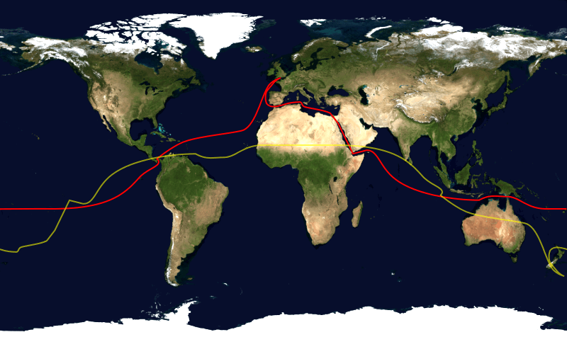
There are more ways to skin a cat, and there are more ways to sail around the world. Since each of those ways requires a different approach in terms of necessary skills, sailboat, equipment, provisions, time, and crew, the first step should be planning your route.

7 Best-Known Routes for Sailing Around the World (with Maps)
You don't need to be especially detailed, outlining every stop on a precisely defined route. I'm talking about a general idea of what you want from the journey because this will influence the items on the following list.
Are you looking to simply tick circumnavigation off your bucket list, wanting the most straightforward, fastest way? Is this more of a world traveler's dream, and you want to visit beautiful places along the way and don't mind making a few stops on the way, even if that extends the trip duration by months? Or do you perhaps have specific stops in mind?
Either way, you will want to know what your expected journey is. A quick look on a globe will instantly hint to many approaches. Various approaches will differ not only in the overall length, which impacts the time needed but also in the distance between the stops, impacting the provisioning system and how far from the warm equator you will be, which impacts the kind of clothing you will need.
The safest sailing route around the world uses the trade winds You want to stay as close to the equator as possible, but you also want to avoid the following 5 places if you can. We've listed the safest and fastest sailing routes for you. Also read: The Safest Sailing Routes Around the World (Which to Avoid)
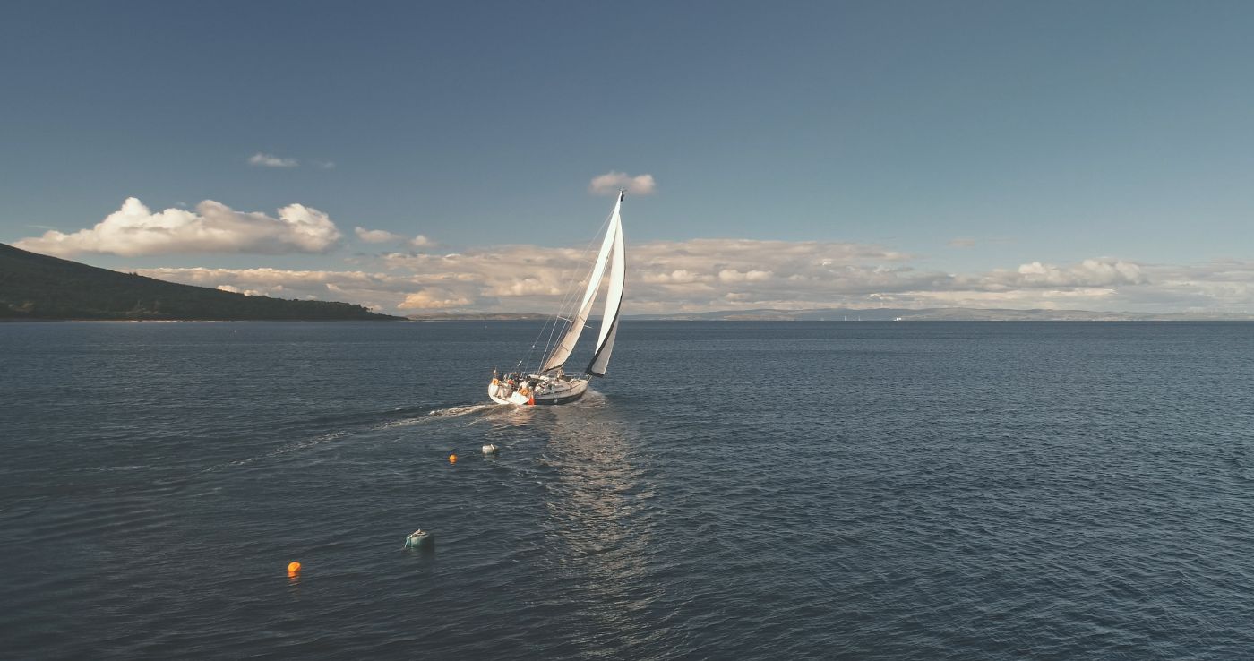
Let's get this out of the way first - you don't need a large boat to circumnavigate the world. Larger boats are comfier and faster, but technically not necessary. The smallest sailboat to circle the globe had around 21 feet. We have written many times about small boats that are great liveaboards, so it is possible. Your comfort level, partially dependent on how many people will go with you, is individual.
If you are in a money-saving mode, it pays off to get a smaller boat, but one in good condition, instead of a larger one requiring more maintenance.
But as mentioned before, since your route's character influences your needs greatly, if speed is what you are looking for, as well as long crossings without stops, requiring more spare parts and provisions, a bigger boat is what you will need.
Either way, it needs to be a boat with offshore capabilities. Not a weekend cruiser.
Many people think sailboats are super expensive We did the research, and it turns out you can get a capable bluewater sailboat for just $3,000 . However, it isn't for everyone. Here's the cheapest bluewater sailboat
The short answer is - prepare to typically pay around $500 - $1,000 per person per month when sailing with the sky being the limit, of course.
Here's a breakdown that will apply to you if you are a cost-efficient person:
Breakdown of cruising costs per month:
Roughly 25 percent of your budget will be for food . Eating out is not included.
Around 20 percent will be spent on maintenance (though this varies depending on the state you got your boat in). This means sail and rigging maintenance, yearly haul out and antifouling, electrical and winch malfunctions, engine spares, water filters, and so on.
Approximately 15 percent will be spent on insurance - unless you are against that whole concept.
About 7 percent will be spent on cruising fees , such as permits, visas, and check-in fees. Panama canal costs north of $1,000, and so does entering Ecuador. New Zealand, on the other hand, will set you back merely tens of dollars.
Around 6 percent will be needed for mooring fees , though only if you anchor whenever possible.
A similar amount will be needed for a basic satellite phone plan for communication and weather reports and various sim cards to connect to the internet, when possible.
Fuel varies, but 5 percent is not an unreasonable amount to expect to spend on it.
The rest will be spent on a range of expenses - various clothing, eating out, flashlight batteries, sunglasses you keep drowning, and all that jazz.
The percentages will vary from person to person, but they are not the most important part of the above breakdown - rather, it is the expense list since these are the things and items you will have to pay for, and thus you should know about them beforehand.
Just as before, the kind of trip you have in mind will determine many of the costs. Antifouling might not be needed if you are going at it non stop and are done within months. That $1,000 for the Panama canal won't be necessary if you venture around South America and the infamous Cape Horn. And venturing through Suez, Red Sea, and the Gulf of Aden will require extra security expenses.
And of course, if you are paying $1,000 monthly, the overall expenses will differ whether this is a three-year travel journey or you are doing a Vendée Globe style circumnavigation.
Sailboats are cheaper than you might think We've compared thousands of sailboat listing prices for four different budgets. There are a lot of costs involved with owning a sailboat. Learn everything there is to know about ownership costs with our comprehensive overview. Read all about sailboat ownership costs
Boring? Yes. Necessary? Also yes. Except for those of you who will make the trip non-stop without visiting any country, you may need your passport and sometimes valid visas.
Then there is your boat registration and port clearance. Boat insurance policy is a must in some places, where they won't let you in without third party liability or personal liability.
Sometimes you will need your MMSI number and proof you have AIS capability. Having a few copies of passport-sized photos of the crew helps too - as well as plenty of photocopies of all documents. You will save yourself some running around, trying to find a copy machine.
Here are the licenses you'll need for sailing the world You'll need lots of documents for some places, and none for others. William sailed the world for 8 years and made an overview of all documents you'll need and the documents you can leave at home. Read all about international sailing licenses
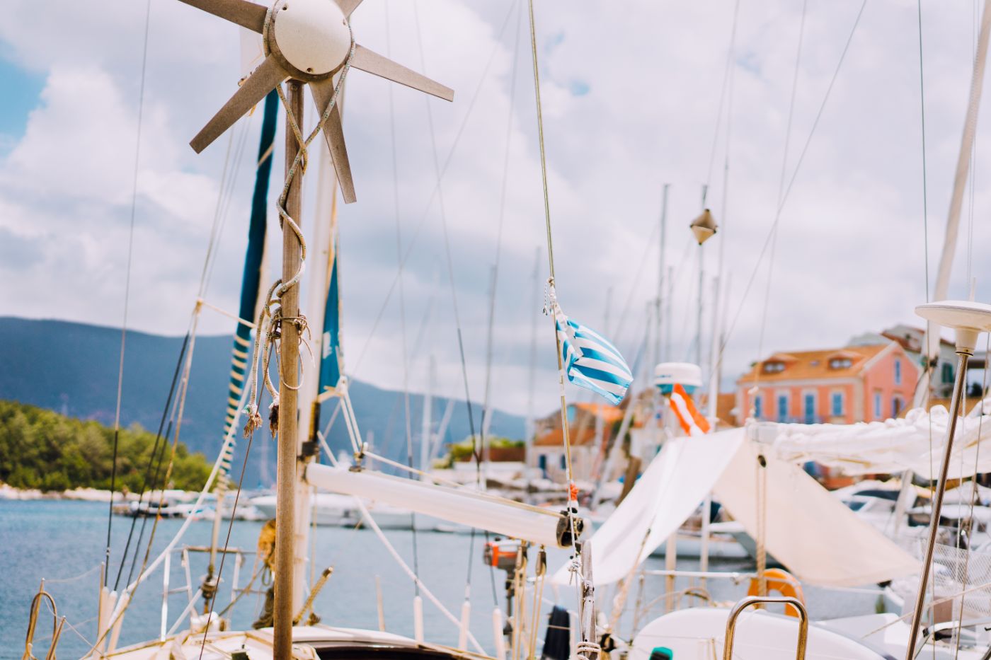
Your actual checklist will be a mile long, but here are several things worthy of extra mentioning. These items came from quite extensive research where numbers of circumnavigators, both racers, and cruisers, were asked to name items they found the most useful. Safe to say, they all named more or less the same set of things.
Now, unless you plan on staying so close to the shore most of the time that you might as well make the trip in a car, you will need plenty of water. Full tanks probably won't cut it. You will need to make your own, probably from seawater.
Electricity generator
The same applies to electricity. Whether you will choose a hydro generator, solar panels, or a wind turbine, you will quite probably need a way to generate some power.
Satellite Phone
Whether it is about safety concerns, or wanting to be able to stay in touch, this is a must. You shouldn't set sail without a reliable weather report. There are many options,, including satellite internet, thanks to which you will be able to be online wherever you are. If you are unsure where to start researching a solution for you, Iridium GO! is among popular choices.
And if Elon Musk's Starlink kicks off as promised, global satellite internet will be an affordable thing for anyone.
Good Bimini
If you are a holiday cruiser kind of person or if you usually sail in areas without much strong sunshine, this might not come to mind when compiling your checklist. But the ability to be in the shade while being on deck will prove crucial.
So make sure your bimini is solid, has a few good years ahead of it, and covers what it needs to, without the need for makeshift solutions consisting of hanging towels and clothes around you to protect you from the low, afternoon sun.
Downwind Sails
The value of good downwind sails that will propel you forward even in light winds is undeniable, though not always do they find themselves on a sailor's checklist. If you plan a long journey, you will appreciate them since conditions won't always be favorable.
Power-free Autopilot
Autopilots will save you lots of headaches when on long stretches, especially if you do things short-handed. But the classical ones use a lot of power. So look into solutions like Hydrovane, which will take a lot of work off your hands.
AIS Transponder
Not only is this a good thing to have for obvious reasons, but it is also mandatory in some areas and will save you money on certain insurance plans.
There are many sailboat cruising essentials There's lots more you'll need, and plenty you hadn't thought of if you're a first-time cruiser. We've listed them all for you. Read all about cruising essentials
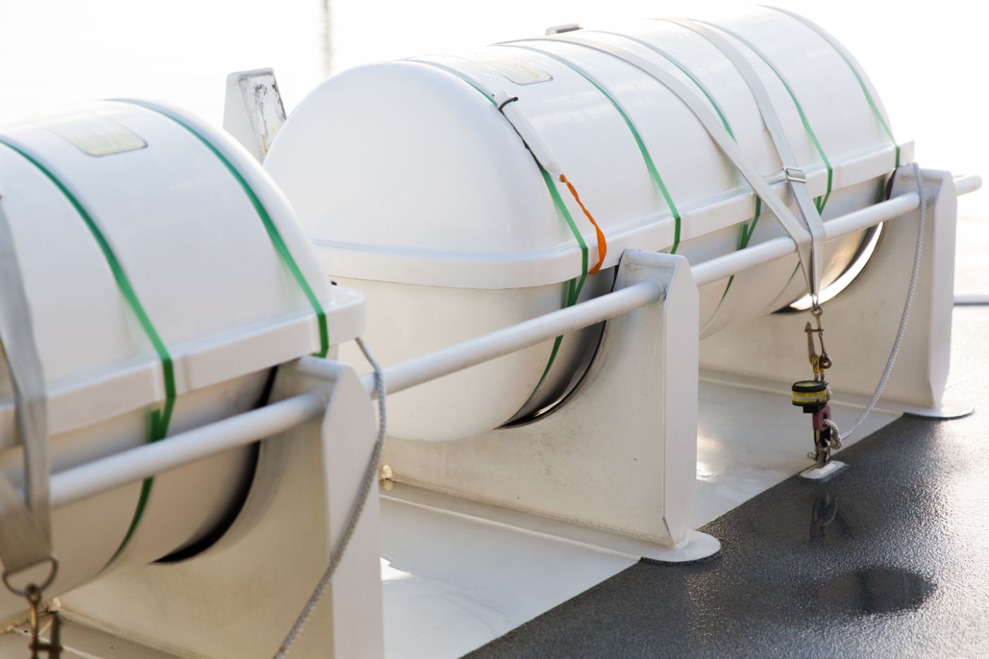
A liferaft, enough lifejackets, and harnesses. As for the liferaft, preferably one that isn't out of date - yes, that is a mishap way more common than you'd think. As for the lifejackets, preferably ones with a crotch strap and a sprayhood, as well as a light, reflective element, and a whistle. And as for the harnesses, preferably a three-point one. A grab bag with an EPIRB, basic survival items, and some provisions should be at the ready as well.
A well-stocked medical kit is a good idea too. Even something as simple as a plaster goes a long way when there is no place to buy it for thousands of miles around.
If you are unsure about what belongs in a solid safety kit checklist, consult, for instance, the ARC's safety equipment requirements - this event is meant for cruisers, not super experienced racers, so it lists everything you might need without supposing you will MacGyver your way out of any tricky engineering situation.
U.S. Coast Guart recommends this safety equipment We've created a full of the safety equipment required by the U.S. Coast Guard, which is a great starting point for beginning cruisers. Read all about safety equipment
If there is a screw on the boat, have the tool to unscrew it, no matter the shape. A power drill, spares, wires, lines, patches, glue, pliers, a knife, a hammer… go wild. These items aren't particularly costly, so make sure there is a toolbox on the boat with anything you can dream of putting in it.
Get a head-start by using our recommended tools You just need a couple of basic tools to be properly prepared. Over the years, we've recommended products that are well-priced but reliable. Check out our favorite tools
Offshore Sail Repair Kit
This should be in the above category, I suppose, but let that one belong to the boat, while this one tends to the sails. Of course, you should have some spare sails, but incremental wear and tear is an inevitable part of long term sailing, so be prepared to mend here and there.
Fishing Gear
For obvious reasons. I'm not saying you will find yourself stranded in the middle of the Pacific, with no food left, reliant only on what you fish out of the ocean, but if you want to save on food, have it as fresh as it comes and have a backup plan just in case, a good bit of line with some hooks and baits will come in handy.
To leave the tangible category, here's something many overlook and never need. But if it all hits the fan, you will wish you wouldn't have. In other words, it pays off to rehearse various emergency situations, using the equipment you would, including fully inflating your liferaft.
It may sound a bit boring, and yes, perhaps you won't need it (let's hope), but much is at stake when you do.
You can learn most for free from home There are lots of free or cheap online courses that will teach you the fundamentals. Check out our course recommendations
If there is a time when you want to take advantage of the ultra-organized, obsessive part of your brain, it is before you depart.
In other words, have a detailed preparation plan. Have a detailed journey plan with all the distances and entry prices and necessary documents in it. This should be done to such details as general grocery prices in various areas. Many sailors, after crossing the Atlantic, arrived in the Caribbean, cursing themselves for not stocking up on groceries back in the Azores because food in the Caribbean is so bloody expensive.
Make no mistake; this isn't really about money. If you don't mind paying extra, that's fine. But this is mostly about the mindset of a person that prepares well for all the little eventualities and has two back up plans for if XYZ happens.
The kind of a mindset that will have spare parts for everything, two copies of maps on paper, and the will to power through the logistics of it all.
The Vendée globe racers do it in under three months, the world cruisers who are in a hurry in a bit over a year, but most take two years and up, to take advantage of good seasons and to get the most out of every location they visit.
You can sail the world in around 3.5 years How long it will take you depends on your goals. We've compared three sailing speeds to see how long it will take you . Find out how long it will take you
I'm not a fan of articles telling you how sailing is tough and why it probably isn't for you since only those belonging to the big boys club can enter. If circling the world on a sailboat is what you want, then circling the world on a sailboat is what you will get.
Nor do I like articles that speak of all the miseries you will have to endure, articles whose authors low key boast about how they don't have any issues enduring said agonies. They make sailing seem like something unattainable for the everyday man, an exclusive activity for those with warrior blood in their veins, which is just unnecessarily elitist.
That being said, know what you are getting into. Know what it means to sleep on a boat for months, know the limits (and perks) regarding comfort, using the bathroom, showering, preparing and eating food…
Also, know the physical and mental demands of operating a sailboat for months and know of its dangers.
Be aware of how you feel about spending lots and lots of time either alone or in the company of whomever you want to sail with.
How to get there? A regatta in 50 degrees Fahrenheit, high winds, and bad weather is a great start. Getting aboard a sailboat as a crew member, ideally not an island hopper, but one aiming for longer stretches, is a great continuation. Reading blogs and watching vlogs from various sailors helps too, as it virtually introduces you to situations and ideas you might not have thought of.
If I was to decide on a single way to get into the mindset you need, it would be joining an ARC fleet for an Atlantic crossing. Not just for the sailing experience, but because their events are fantastically structured, and you will understand what a long journey means logistically.
It is very much possible to go around the world in a sailboat. Yes, it takes preparation and an adventurous mind, but in the end, it is nothing but a set of specific tangible and intangible parts that, if you have under control, you will likely succeed.
And since there are not many greater adventures available on Earth, what better thing to spend time on preparing for than this?
Fair winds.
Leave a comment
You may also like, the sailing seasons around the world (with map).
Knowing the sailing seasons around the world help you to plan your trip well. I've made a list of sailing conditions around the world, so you know where to go when.

The Cheapest, Smallest Boat to Sail Around the World

How Big Should a Sailboat Be to Sail Around the World?

How Long Does it Take to Sail Around the World?

Do You Need a License to Sail Around the World?
Own your first boat within a year on any budget.
A sailboat doesn't have to be expensive if you know what you're doing. If you want to learn how to make your sailing dream reality within a year, leave your email and I'll send you free updates . I don't like spam - I will only send helpful content.
Ready to Own Your First Boat?
Just tell us the best email address to send your tips to:
Why Are Great Circles the Shortest Flight Path?

Why do you fly over Greenland in an airplane flight?
Or why is it that when you see flight paths on a map they always take a curved route between 2 cities?
It’s because planes travel along the shortest route in a 3-dimensional space.
This route is called a geodesic or great circle route . They are common in navigation, sailing, and aviation.
But geodesics can be confusing when you’re looking at a 2-dimensional map as they follow quite the odd flight path. Let’s dig into this concept a bit deeper.
Great Circle Routes Explained
In a flight path from New York to Madrid, if I asked you which line is shorter, you’d say the straight one, right?

However, a straight line in a 2-dimensional map is not the same as a straight line on a 3-dimensional globe .
This is why flight paths travel along an arc between an origin and a destination.
Now here’s what the same flight paths look like on a sphere. Remember that the straight line in the Mercator map above followed the 40° latitude line.

This paints quite a different story, doesn’t it? It’s deceiving to the human eye.
The takeaway is this:
A route that looks longer on the map is because of the distortion created by map projections like the Mercator Projection . In navigation, pilots often use great circles (geodesic) as the shortest distance flight.
Great circles vs small circles
Now that you have a visual understanding of great circles. Here’s a definition of what a great circle is:
- A great circle is a circle on the globe such that the plane passing through the sphere’s center is equal to the circumference of the Earth.
- Alternatively, a great circle is where the radius is equal to that of the globe representing the shortest distance between two points on the surface of the earth.
In basic terms, imagine you’re cutting into an orange. You can cut them at any angle – north-south, east-west, diagonally. As long as you cut two identical portions, then the circle where the cut was made is a great circle.
For example, the equator is a great circle because it’s the maximum possible circle:

You could also cut it at the north and south poles. This longitudinal line also cuts two equal portions. Any meridian line is a great circle as well.

From New York to Madrid, here’s how the plane creates two equal segments.
A great circle generates two arcs with the shorter one being the shortest path. Here is the shortest path and how the plane is angled to create the shortest path.

How about when you follow along the 40° latitude line? Anywhere that it doesn’t cut two equal pieces is a small circle .
While a rhumb line track is at a constant azimuth, a geodesic line changes direction all the time.

This fundamental difference in navigation concepts can have a significant impact on long-distance sea voyages.
READ MORE : Rhumb Lines: Setting it Straight with Loxodromes
How Geodesics Work
Planes travel along the shortest route in 3-dimensional space. This route is called a geodesic or great circle .
While map projections distort these routes confusing passengers, the great circle path is the shortest path between two far locations.
This is why pilots fly polar routes saving time and distance . And this is why pilots often fly over Greenland.
Have any questions? Please let us know in the comments section below.

25 Map Types for Building Unbeatable Maps

Epic Web Maps – The Maps Hall of Fame

50 Map Projections Types: A Visual Guide

How Map Projections Work

Esri JavaScript API Examples: 15 High-Tech Webmaps and Webscenes

Ocean Currents Map: Visualize Our Oceans Movement

3 Wildfire Maps for Tracking Real-Time Forest Fires

10 Topographic Maps From Around the World
35 comments.
Buy a globe and figure it out.
I’m trying to figure out what flight path an LTA aircraft (Larger than Goodyear Blimp) would take from England to Idaho. It’s part of a novel I’m writing. Any suggestions?
You’re definitely on the right path and to use a great circle.
I am a layman. Please describe the route from Mumbai to New York and San Fransico to Tokyo through a diagram to show why airlines prefer polar routes?
A great circle connecting two points is the shortest distance but it requires frequent heading changes throughout the journey. A straight line (rhumb line) drawn on a Mercator projection map produces the constant compass bearing to follow for the same journey; which is easy to draw and much easier to follow. Over a short distance the difference between a great circle and a rhumb line route is negligible so the simple rhumb line route is used. However, over a very long journey the difference in distance will be quite significant so a great circle route is preferred.
In navigation latitude is the angle above (north) or below (south) of the equator. Longitude is the angle east or west of the prime meridian (ie the Greenwich Meridian). Both of these angular measurements are derived from the centre of the global earth mass. 0 degrees latitude, 0 degrees longitude is the intersection of the prime meridian and the equator (just south of Ghana West Africa).
When you try to draw a flat map to depict the surface of a globe there is a huge problem; imagine taking the peel off of an orange and trying to lay it out flat.
On the surface of global earth the horizontal distance measured between two meridians along the equator (0 degrees latitude) will be greater than the distance between the same two meridians measured along any other latitude because the circumference of each latitude gets smaller toward the poles so the meridians are closer together near the poles. However, the distance measured between two latitudes on the same longitude is the same distance on other longitudes because they will lie on a great circle.
For marine navigation the map solution generally accepted is the Mercator projection because of its unique property of representing any course of constant bearing as a straight segment that can easily be drawn on a flat map. Such a course, known as a rhumb line, is preferred in marine navigation because it is easier for a ship to sail in a constant compass direction to reach its destination even though it will be a bit further than a great circle route. For short distances the difference between the rhumb line and great circle route is negligible. For aviation the distance is more critical since it directly affects time, fuel and load. A simple solution is, where possible, create a sequence of short rhumb lines along the corresponding great circle route. In the modern era all of these positioning problems have been overcome by GPS satellite navigation.
These days we all take degrees latitude and degrees longitude for granted because they have been successfully used for over 2,000 years. Around that time there were early attempts to measure the circumference of the global earth. Early mariners setting off on long voyages either came ‘back’ or never returned; which for millenniums gave rise to the flat earth notion. The first circumnavigation of the earth was accomplished by the Magellan fleet sailing westward 500 years ago. I’ve personally used latitude and longitude to circumnavigate the earth 5 times.
I’ll finish with a reminder that latitude and longitude are both angular measurements derived from the centre of the global earth mass. If the earth were flat then for positioning on it there would be only one angle from the centre and a linear distance measurement from it… an idea that has never ever been tried and proven.
Taking all of the info from this page into consideration, how could it be used to strengthen flat earth theory? I was directed here because I wanted to learn what constitutes a “great circle” and I now understand. I seriously want to know how anyone could reach that conclusion.
High-altitude flying brings another problem to the fore. It is called “coffin corner” where if you fly slower you will stall, and if you fly faster you will also stall.
It actually makes sense if you go back to the comparison of cutting an orange. Again understanding how to navigate along a 3-dimensional globe while looking at a 2-dimensional picture is why it seems so confusing. And No Cari it doesn’t support the flat earth theory. Not even its own theory supports it. lol. The entire point of this is because of it’s a globe. If it were flat none of this would be necessary. Not to mention the Japanese would still be en route to Pearl Harbor if it were a flat earth. That’s an exaggeration but still, it would have been quite a long flight. One that those little planes would never have been capable of making. In fact, if the earth were flat many lives at Pearl Harbour as well as at both Hiroshima and Nagasaki would have been spared. It’s a shame that the earth is in fact round.
You have supported the theory of a flat earth. Thanks.
My wife just left Dallas for Tokyo. I looked on the flight plan and it goes up through Montana and Canada and over the edge of Alaska. I don’t see how this could be the shortest route to Tokyo from Dallas. It seems more like they are trying to avoid flying directly over the vastness of the Pacific Ocean in case there is a mechanical problem.
Having read all the above I’ve decided to go by boat.
Odd! I was told that because of centrifugal force, the Earth was compressed at the poles, thus making it wider at the equator. The great arc is a navigational compensation!
Meanwhile, the Egyptians, who started all this, still could not figure out the height of the pyramids even though they had Pythagoras. Not to mention that even today there is no certain way to measure the partial volume of a cylinder.
The Earth is flat and south polar centered. That’s it.
What about the direction of the route? Nobody can convince me that Madrid lies to the north of Newyork as they are saying now.
Maybe thats how they conclude it but its wrong, even if it works. the real reason is because of difference of rotational velocity of a shorter vs longer circumference. if you draw two lines from the center of a circle, each come out of the destinations. then draw two lines, one at altitude and the other at ground level. clearly the one at altitude is longer. it doesn’t matter if these lines are curved or not. what matters is the velocity the earth rotates at. the length of a circumference increases by 2 pi r. this means that at greater radius per starting location, the rotational velocity of a shorter radius vs a larger are varied. at a great altitude, though you are traveling at a perceived pace relative to the motor function, but you are multiplying that velocity by the increase in circumference relative to the ground’s. or vice versa, you can say the ground it traveling quicker as well since two point in the circumference have less distance to travel compared to the greater altitude. but what this really does is multiply the distance you travel at altitude relative to the ground. so one minute of flight at ground level vs one minute of flight at altitude results in greater distance. but its only if you fly against earth’s rotation. the earth is rotating at a constant speed, but the circumference between the greater height points travels at length over time just as the shorter one. but the shorter circumference then has less length to travel in that time, so its technically traveling slower. so as you increase height from the center of a circle, the increase in circumference, with earth’s rotation increase your velocity. if earth wasn’t rotating, then height wouldn’t matter and straight line would. 3 dimensions or 2… sure, you could look at it that way, but its over complicated…
Because the time it takes to fly to the higher altitude is not commensurate to the time lost by not climbing.
Let P = pressure, d = density, R = gas constant, T = temperature, h = height, g = gravitational acceleration.
By Ideal Gas Law PV = nRT -> d = n/V = P/RT
By the law of hydrostatic pressure
dP/dh = -d*g = P*g/RT
We know have a first-order separable differential equation. Solving this, we get:
Integral dP/P = Integral -g/RT dh log(P) – log(P0) = -g*h/RT -> P = P0*exp(-g*h/RT) d = P/RT = P0/RT*exp(-g*h/RT)
Therefore, as you go higher, the weight of the air column decreases reducing atmospheric pressure and density. However, the air also gets colder slightly increasing density. In the Stratosphere, temperatures increase with altitude instead of decrease. However, this layer of the atmosphere is above the troposphere where we live, so it has to be less dense. Thus, the weight of the hydrostatic pressure of the air column has a larger effect on atmospheric pressure and air density at least less than 10 km above sea level.
In the real world of long distance air navigation, great circle routes are *not* the shortest *flight* path, but they do make a good start on figuring out what will be the shortest flight path. The article fails to understand that aeroplanes travel in the air, which is moving, rather than fixed in relation to the earth. The origin and destination are fixed to the earth, if the sea and the air were likewise fixed, a great circle would yield the shortest path. A longer path with regard to the earth can yield flight path savings in the order of 30% to 50%, the classic example being North Atlantic flights in the forties, where savings of this order resulted from using Bellamy drift derived constant heading paths instead of great circle routing.
Aircraft need to travel the shortest route in the air, not in three dimensional space. Sometimes that will be the same thing, but not very often. For an air routing, you could use the barometric pressure at origin and destination plus the latitudes. Using these, you can calculate the drift for the entire flight due to pressure differences and Coriolis effect, the net geostophic winds. However, there may be jetstreams at less optimum altitudes that could provide considerable net improvement, even if more fuel is used per air mile (meaning movement through the body of air, not the 3D relationship with the earth), but lets not go there. Having derived a constant heading, it is flown, and neglecting political geography, with no concern for the position with respect to the position on earth below, other than the destination and not bumping into things.
To help with the lay understanding, imagine a rectangular table top, with a dot at each end. Over the top you have a much larger piece of perspex. You have a toy car which can travel at a speed equal to the distance between the dots over one hour. Over the course of an hour, the perspex moves half that distance to the left of the direct track, then half that distance to the right. If we attempt to stay on the “shortest” path from A to B, at the end of an hour, we will still be at A. If we calculate the net drift between A and B, which in this example means following a constant heading equal to the direct heading at the start of the journey, our path will be much longer than the direct path, a loop heading out to the left. However, after an hour, we will be at B. If we change the total distance moved by the perspex to half A-B, purely left and right, it will still take us one hour on the constant heading, but if we follow the direct path on the table top, we will get there, having taken considerably more than an hour to do so.
On shorter journeys in the real world, there are few wind reversals – there is also little difference between a rhumb line course and a great circle, so you may as well fly a rhumb line. Longer journeys are where this counts, and also where the great circle should be of use, but often is not, due to winds aloft.
The correct term is “Density altitude” which is a calculation of pressure altitude corrected for nonstandard temperature. As temperature and altitude increase, air density decreases. All aircraft have a flight “ceiling”, an altitude above which it cannot fly. As an airplane ascends, a point is eventually reached where there just isn’t enough air mass to generate enough lift to overcome the airplane’s weight. This is why (depending on the airplane) you might not be able to take-off from a high altitude airport on a particularly hot day. I have experienced this (pilot) myself several times.
If you depart from the North Pole with a plane along a meridian, directly from the rotation point (rotation axis) where speed is 0, to a destination at the equator where the rotation speed is around 1660 km / h , would the plane still reach its destination? From North Pole direct to Brazil(circular arc over meridian 60 W).
Thinner air does not give better engine performance. The reason flying high is more economical compared to flying at low altitude is because the TAS is higher due to density. Thus the amount of fuel burned per nm travel is lower.
You have such great figures. May I use one of them in a presentation to illustrate great circle routes?
Yes, you can. But please give credit by referencing to gisgeography.com
Chris, you are wrong. For air, D=PM/(RT), where D=mass density, P=pressure, M=molecular weight average, R=ideal gas constant, & T=absolute temperature. This is why you need to fill your tires with air in the winter. The temperature drop compresses the air, which means you have to add air to fill in the same amount of relative space.
There are many other atmospheric factors in play such as humidity, wind speed, and wind direction to consider as well.
…and yes, thinner colder air is better for fuel efficiency, but bad for lift. The higher you go, the harder it is to maintain altitude, so like everything else, there is a trade-off. Airplanes are designed to take advatange of the thickness of the air at a certain altitude. That altitude is not fixed relative to the ground, but depends on the weather. So on a hot day, they can fly higher. On a cold day, they.have to fly lower. But there is always an optimum “temperature altitude” for any given plane on any given day. You can’t just keep going up forever. You need pressure under the wings, or you’re flying a brick.
Airplanes need air pressure to fly, it doesn’t matter how dense the air is if there’s no pressure, and pressure and altitude have a consistent relationship. Does that make sense?
Actually, you’re all right, but you’ve each only got two-thirds of the puzzle. There is no direct relationship between temperature and density. There IS a relationship between PRESSURE and temperature and density.
In aviation, there is a concept called “termperature altitude.” So the actual relationship is between all three of them, but the focus is only on the two. The higher you go, the colder and thinner the air gets because the pressure is dropping. For every 1000 feet you go up, there is an expected drop in temperature and pressure, and this remains constant. So flying through colder air is like flying higher. The colder air makes the pressure go down while the density remains the same. The airplane acts as if the air is less dense. Got it?
I too, like Mr. Bir, noticed that there was something wrong with the explanation regarding the density of air. Yes, as air gets colder it gets denser, that’s why to start a cold gasoline engine you have to activate the ‘choke’ which in turn will supply the fuel-air mixture with an extra amount of fuel in order to compensate the leanness that otherwise would not start a combustion.
J Bir, unlike liquids the viscosity of gases inceases with increasing temperature. This can be explained using the kinetic theory of gases.
Mr Bir has it right on, as soon as I read it, I questioned it. But we appreciate your explanation of the great circle route. Good article.
Let me correct you. As the air gets colder, it gets denser, not thinner. However, as you increase in altitude, the air gets thinner and colder. Pilots will always want to fly higher as the low density of the air reduces drag and thus increases the efficiency of the fuel.
Every airline in the world has a business route. This route determines where the aircraft can and cannot fly. For example certain routes over the Atlantic are more costly to make but much faster, the final determination is down to the pilot, in regards to how much fuel he has on board, how delayed the aircraft is, in respect to flying faster than he normally would. This is a very significant thing when determining which transatlantic route to take, because there are at least a dozen of which only 3 of those routes are the fastest and most economical, the rest vary with flight cost. In respect to flying over Greenland, there was a very valid reason to do so especially during the winter and early spring months. As the air gets colder, it gets thinner, and the air thins it gets more and more difficult for an aircraft to stay in the sky. This meant under aviation rules, those aircraft with only 2 Jet Engines had to make the shortest distance between land masses, incase an engine stopped working. This way the pilot could make an emergency landing. Aircraft such as the 747 had no such problems, and could easily fly the quickest transatlantic routes. However over the decades Jet Engines have become increasingly reliable, so much so, that they too can now fly over the Arctic to whatever destination. There are very few airlines who actually use Arctic routes, because these routes are extremely expensive to use. An example of a flight from Helsinki (EHFK; HEL) to Barcelona (LEBL, BCN) does not use a Great Circle nor a Small circle, it uses a direct path from point A to B.
Small circles are not always used for short distances, infact they are seldom used in Europe. Instead most short distances are literally from A->B.
Why are small circles used in short distance trips and not the latter?
Leave a Reply Cancel reply
Your email address will not be published. Required fields are marked *
East Hampton graduate Cole Brauer is first American woman to solo circumnavigate the globe in a sailboat

Cole Brauer, arriving Thursday in A Coruña, Spain, became the first American woman to race nonstop around the world by herself. Credit: AP/James Tomlinson/Cole Brauer Ocean Racing
Racing around the world has long been an aspiration of Cole Brauer, who grew up on the East End of Long Island with the ocean so close.
“I just wanted to get out on the water," said Brauer, 29.
Thursday, she made history by becoming the first American woman to solo circumnavigate the world in a nonstop sailboat race.
"I'd always wanted to race around the world, because I wanted to be able to be offshore, without anybody around, just kind of like in that Puritan type of style, no building, no cars, no nothing, just really beautiful ocean weather," she told Newsday in an interview Saturday.
For her parents, it was far from easy to wait out the 130-day, near-30,000-mile voyage, her dad, East Hampton native David Brauer, confessed.
"It's been hell," Brauer, 59, now of Trevett, Maine, said Friday in a phone call from A Coruña, Spain. "A lot of sleepless nights."
On Thursday, her place in the books was sealed when she sailed her 40-foot sailboat into the harbor at A Coruña, on the northern Atlantic coast of Spain, finishing second among more than a dozen sailors competing in the Global Solo Challenge. She also became one in a field of fewer than 200 elite sailors — and just the 18th woman ever — to solo circumnavigate the globe nonstop, according to a register maintained by the International Association of Cape Horners.
Cole Brauer left A Coruña in October to begin her quest in the staggered-start field, sailing south along the west coast of Africa, then around the Cape of Good Hope and east to Australia. She traversed the Pacific, sailing around Cape Horn at the tip of South America and continuing across the Atlantic aboard her sailboat, named First Light.
Along the way, the 5-foot-2, 100-pound 2012 graduate of East Hampton High School got her ribs battered when she slammed into the cabin walls during a storm that generated 30-foot seas, and she had to self-administer an IV after becoming dangerously dehydrated.
She's has had to be able to handle any challenge that came her way. There really was no other way.
"You just know the boat, and you know when she's not happy, and you learn very quickly how to make her happy ... because I'm on the boat, and I have full control, I never felt like, 'Oh, I need to go to shore, oh, this and that is happening.' Things were breaking, but I had planned exactly what I needed to have for spares and tools, and even if I didn't, you just learn how to, you know, use a hammer for five different types of tools because you don't have the actual tool," she said in the interview.
After months at sea on an arduous journey, she and her teammates are resting — finally — and celebrating.
"The whole team is here. I finished two days ago, so we've mostly been popping bottles of champagne, and I've been eating like I've never eaten in my entire life," she said. "We're just enjoying a couple days as an entire team, just a big celebration after a long, long six months of our lives, and then we all go home."
Dawn Riley, executive director of the Oakcliff Sailing Center in Oyster Bay and the first woman to be a crew member in an America's Cup race, said, "It is incredible how she has made it around [the world] and made it look so easy to her hundreds of thousands of followers."
Brauer grew up on Springs Fireplace Road in East Hampton, off Accabonac Creek near Gardiners Island and Gardiners Bay.
Though David Brauer said Cole first learned sailing basics as a young teen on small Sunfish-type sailboats, it was her twin sister, Dalton, who was a member of the sailing club at East Hampton High School. It wasn't until Cole Brauer went to the University of Hawaii to train to be a doctor following a year studying photography at the Savannah College of Art and Design that she seriously became involved in sailing — setting the hook that would lead her to ocean racing.
"She was an artsy kid," East Hampton Union Free School District Superintendent Adam Fine said Friday of Cole. "She was a gifted photographer — and I still have a picture Cole gave me in my office . . . this beautiful, religious figure, draped in darkness and streaming light."
David Brauer said his daughters have always been strong-willed and confident, and noted Dalton also is a skilled sailor and sailing instructor.
Still, he said the toughest time for him and his wife, as parents, was fear of the unknown.
Brauer said at the last-minute prior to setting out on the Global Challenge, Cole learned she still needed more solo mileage to qualify for the race, and as a result had to sail First Light solo across the Atlantic from Newport, Rhode Island, to A Coruña just to qualify.
Then, there was the treacherous four months at sea solo.
He said being able to talk to Cole almost daily via a satellite phone was a blessing. But, he said: "While it takes a lot of angst out of the day, being able to see her, the scariest thing was when we'd be talking and there'd be a sound and she'd say, 'I have to go check something outside,' and then she'd pop out the cabin door and disappear. Most of the time on deck she'd be tethered to the boat. But with something like that, she'd just pop out, and I'd be sitting there, waiting, thinking: 'Where is she? Did she fall off the damn boat?'
"Trust me. That was hell."
The Brauers flew to Spain ahead of Cole's arrival Thursday and were on a boat that met her sailboat two miles outside the harbor — aptly, at dawn — then followed her as she sailed in on First Light.
David Brauer said his brother, who's a commercial airline pilot, named his own daughter Amelia Mayday Brauer after Amelia Earhart, and that he thought of the failed quest of the famed aviator as he followed Cole's circumnavigation to its successful end.
"I was trying to think of all the other women who have accomplished firsts," David Brauer said, "and now I think, 'Wow, my daughter is among them.' When we finally got to land? There were some tears, for sure. And a lot of joy ... It's all just so incredible."
The biggest news, politics and crime stories in Suffolk County, in your inbox every Friday at noon.
By clicking Sign up, you agree to our privacy policy .

Brauer celebrates as she became the first American woman to race nonstop around the world by herself when she arrived Thursday in A Coruña, Spain. Credit: AP/James Tomlinson/Cole Brauer Ocean Racing
Body parts case update ... Sam Ash closing 18 stores ... Adventureland preview ... Cricket controversy
Get more on these and other NewsdayTV stories
Most Popular
Latest videos.
- Skip to main content
- Keyboard shortcuts for audio player

Middle East crisis — explained
The conflict between Israel and Palestinians — and other groups in the Middle East — goes back decades. These stories provide context for current developments and the history that led up to them.
An aid ship is en route to Gaza, in a test of a sea corridor for the war-torn enclave

Open Arms members carry humanitarian aid for Gaza in a joint mission between NGOs Open Arms and World Central Kitchen at a port of Larnaca, Cyprus, March 9. Santi Palacios/Open Arms-World Central Kitchen/Handout via Reuters hide caption
Open Arms members carry humanitarian aid for Gaza in a joint mission between NGOs Open Arms and World Central Kitchen at a port of Larnaca, Cyprus, March 9.
AMMAN, Jordan — A barge loaded with food is on its way to Gaza from the Mediterranean island of Cyprus in a test of a possible maritime aid corridor meant to help avert what United Nations officials say is imminent famine after five months of war and Israeli restrictions on aid.
Since the start of the war in October, Israeli attacks in Gaza have destroyed most of its infrastructure , while Israel's restrictions on food and medicine entering by truck have left most of the enclave at risk of famine and vulnerable to disease, according to the U.N.

With aid headed to Gaza, risks remain to getting food to its starving population
Israel says it needs to ensure that weapons are not being smuggled into Gaza. But the European Union's foreign policy chief, Josep Borrell, told the U.N. Security Council on Tuesday that starvation is being used as a weapon of war.
Enter World Central Kitchen , a U.S.-based aid organization founded by celebrity humanitarian-chef José Andrés. The organization has partnered with Open Arms , a Spanish nongovernmental aid group that is using its ship of the same name. The United Arab Emirates provided funding for the food while Cyprus provided logistical help.
While WCK and other aid groups are scrambling to find alternative ways to deliver aid to Gaza because of Israeli restrictions, they have also had to rely on Israeli cooperation to pursue the alternate routes and devise a way to offload pallets of aid.
"The most difficult part, the diplomatic technicalities, already is kind of behind us," Andrés says. "The most difficult part ahead is as we speak, we are finalizing the construction of a temporary jetty."
Five months of intense Israeli bombing added to previous destruction and an Israeli blockade of Gaza since Hamas took control there in 2007 have devastated Gaza's infrastructure, including hospitals, water treatment plants, schools and universities.
Israel destroyed Gaza's airport during a Palestinian uprising that began in 2001 and since October has further damaged what remained of Gaza's fishing port.
Jordan has taken the lead in airdropping aid into Gaza, along with the United States and other partner countries. But the airdrops are extremely expensive, and with ongoing fighting, they are difficult to target and almost impossible to distribute on the ground.
WCK has been providing meals in Gaza since the start of the war, and once it builds the jetty, will unload the cargo onto smaller boats to take the aid ashore to be distributed to its network of 64 kitchens.
Israel approved and inspected the goods that will be going into Gaza. Andrés says they were not allowed to bring in machinery, equipment or the concrete blocks requested for the operation, but the aid organizations are improvising with what they have. Israel bars a large range of goods to Gaza, saying they could be used by Hamas, the Palestinian militant group that rules Gaza.
"We have crews working 24-7 and we are really trying to build this 60-meter [yard]-long jetty that will allow us then successfully, if things go well, to start bringing in humanitarian aid in bigger quantities," Andrés says.
Laura Lanuza, communications director for Open Arms, says it has taken three weeks to deal with regulations, restrictions and logistics after the boat arrived in Cyprus.

The Open Arms vessel, carrying almost 200 tons of food aid to Gaza, is seen docked in the Cypriot port of Larnaca on March 9. Iakovos Hatzistavrou/AFP via Getty Images hide caption
The Open Arms vessel, carrying almost 200 tons of food aid to Gaza, is seen docked in the Cypriot port of Larnaca on March 9.
"We had a huge challenge in front of us trying to make this happen," she says.
Lanuza says each box of food was individually scanned under supervision of Israel's Coordinator of Government Activities in the Territories at Larnaca port in Cyprus to ensure it did not have contraband before it was loaded onto the barge and then the entire shipment sealed.
"We have to be cautious and we have to follow all the protocols that we have in order to have a good end to this," she says, adding there is food waiting at the port in Cyprus for an immediate second trip if the first goes well.
The mission, which began Tuesday, is expected to take several days because of the slow speed necessitated by the heavily laden barge, and the logistics of building the floating jetty.
The organizers said they were not disclosing where on the coast the vessel was planning to land for security reasons.
The barge's cargo — roughly 200 tons of food , including lentils, rice and canned meat — is the equivalent of only about 10 trucks of aid.
The main land entry for aid to Gaza through Egypt has 30,000 trucks backed up waiting for entry, says Ahmed Naimat, a spokesman for Jordan's National Center for Security and Crisis Management.
He says some trucks of Jordanian aid have been waiting in a line for two months for approval to enter.
"Israel's military operations are intended to cut off life to Palestinians — especially for medical and food services," Naimat says.
Israel has blamed delays on U.N. agencies. The U.N. has said Israeli forces have not just delayed approval for truck convoys, but turned away key aid to northern Gaza and attacked its staff and facilities .
Jordan, which has a peace treaty with Israel, has accused the Israeli military of deliberately targeting its field hospitals in Gaza. Israel has said it was aiming at Hamas militants.

Humanitarian aid for Palestinians on the Gaza Strip is loaded onto a Jordanian Air Force aircraft in Amman on March 10, amid ongoing battles between Israel and the militant group Hamas. Ahmad Shouraa/AFP via Getty Images hide caption
Humanitarian aid for Palestinians on the Gaza Strip is loaded onto a Jordanian Air Force aircraft in Amman on March 10, amid ongoing battles between Israel and the militant group Hamas.
Jordan and other countries have continued airdrops into Gaza in a desperate effort to save at least some people from starvation despite the considerable risks. Last week, Gaza health authorities said five people were killed when a parachute on one of the pallets dropped by a Jordanian partner failed to open.
The United States insists it is pressing Israel to allow in more aid by land but has announced it plans to set up a floating dock to deliver aid by sea in bigger ships. The project is likely to take several weeks and still faces severe obstacles in widely distributing the aid.
The war has left most of Gaza's 2.3 million people homeless and the U.N. says a quarter of the population is malnourished. The U.N., quoting Gaza health officials, says at least 23 children have already starved to death.
Malnutrition is particularly acute in northern Gaza, which has been largely cut off by Israeli forces over the last five months and where UNICEF says 1 in 6 children under the age of 2 is acutely malnourished.
Last week, the United Kingdom's foreign secretary, David Cameron, told the House of Lords that the amount of aid allowed into Gaza last month was half of that received in January, adding that the patience of Israel's allies with the humanitarian crisis was "wearing thin."
World Central Kitchen plans to use its existing distribution network and to increase to about 100 the number of kitchens it is operating in Gaza to prepare and distribute meals. Andrés says so far the aid organization has provided more than 35 million meals there.
"It will be very easy to solve if we will be able to open other entry points around Israel that can double or triple the amount of trucks reaching Gaza every single day," Andrés says. "But for various reasons this is not happening and this is out of our control."
"The necessity and the urgency are so great that the worst thing we can do is not try new ways," he says.
- World Central Kitchen
- Israel-Hamas war
- Israel-Gaza war
- Palestinian aid
- humanitarian aid
- Jose Andres
Morning Rundown: Princess Kate seen in new video, a rowdy referendum on Trump, and new risks linked to intermittent fasting
First ship carrying aid arrives in Gaza as Israel faces backlash for blocking land routes
TEL AVIV — A private aid ship docked off the coast of Gaza early Friday, carrying the first nautical delivery for hungry Palestinians while tons of food and supplies sit on idling trucks in Egypt , waiting for permission to enter the besieged enclave.
The Open Arms, named after the Spanish charity that transported the supplies, towed a barge containing flour, rice and protein to the enclave, where five months of war have left around a quarter of its 2.3 million residents “one step away” from famine, according to the United Nations, which has noted that children have already died from malnutrition and dehydration.
The food was collected by World Central Kitchen, the charity founded by celebrity chef José Andrés, which operates a network of around 60 kitchens across the Gaza Strip. “Our goal is to establish a maritime highway of boats and barges stocked with millions of meals continuously headed towards Gaza,” Andrés and the NGO’s CEO, Erin Gore, said in a statement Tuesday, when the ship set sail on the roughly 200-mile voyage from the Larnaca port in Cyprus.
The nongovernmental organization said in a separate statement Friday that preparations were underway to move the goods onto a jetty built from destroyed rubble, although it was not immediately clear when that would happen.
The new nautical route — as well as recent aid airdrops into northern Gaza — comes amid increasing international frustration about the growing humanitarian crisis in the enclave and the inability to get enough aid in by road.
The U.S. and many of its international partners have been pushing to speed up the flow of humanitarian assistance into Gaza. But Israel has tightly controlled the entry of aid, which has been delivered by trucks through the country’s Kerem Shalom border crossing or the Rafah border crossing with Egypt .
Aid groups have said their efforts have been hampered because of the difficulty coordinating with the Israeli military, as well as ongoing fighting and the breakdown of public order, which have led to the looting of several convoys. As a result, only a small fraction of what is needed has entered the enclave, the agencies have said.

The Israel Defense Forces said the aid ship delivery was being carried out “in coordination with Israeli security and civilian authorities, in accordance with the directive of the government of Israel and at the request of the U.S. government.” It added that all the equipment on the ship underwent a comprehensive security check and was accompanied by Israeli officials.
Seperately, IDF spokesperson, Rear Adm. Daniel Hagari suggested to reporters Wednesday that more routes could open up and that Israel was “trying to flood the area” with aid.
His comments came hours after the U.N. agency for Palestinian refugees said in a statement Wednesday that at least one of its staff members was killed and 22 others were injured in an Israeli strike on one of its food distribution centers in southern Gaza. The IDF acknowledged the strike but said in a statement that it had killed Muhammad Abu Hasna, a Hamas commander who it said was taking aid and giving it to the militant group.

And on Thursday, the Palestinian Health Ministry in Gaza said a number of people were killed and dozens of others were injured while waiting for the expected arrival of aid.
NBC News could not independently verify this, but the IDF said it was assessing the incident. Reports that its forces attacked dozens of Gazans at an aid distribution point were “false,” it said in a statement.
These came after several incidents last month when people were killed as they tried to access aid.
Facing growing political pressure at home and abroad to do more to help Palestinians, even as the U.S. continues to supply Israel with military hardware , President Joe Biden announced last week that the U.S. military will construct a temporary port in Gaza to get more humanitarian aid into the territory by sea.
But that was criticized by aid groups, including Médecins Sans Frontières, or Doctors Without Borders, whose executive director, Avril Benoît, said last week that the U.S. “should insist on immediate humanitarian access using the roads and entry points that already exist.”
Ciaran Donnelly, the vice president of crisis response at the International Rescue Committee, said the port was a “distraction” and called on the Biden administration to find “alternative solutions in aid delivery.”
In Gaza's southernmost city of Rafah some residents, including Zohir Donna, questioned the wisdom of building a new port, when aid trucks were ready and waiting to cross the land border with Egypt nearby. Donna, who moved to the city from the Al-Shati refugee camp in northern Gaza after the start of the war, said the aid was “only five minutes from where we are.”
Rafah resident Mostafa Gamal Elian also said the “crossing should be open, and the aid should pass through it.”
The State Department did not immediately respond to a request for comment on the port, but Secretary of State Antony Blinken said Wednesday that the maritime corridor was not meant to be a substitute for other ways of getting aid into Gaza. “Overland routes remain the most critical way to get assistance in and then to people who need it,” he said.
In the meantime, World Central Kitchen said it had 500 more tons of aid ready to depart from Cyprus to Gaza, where health officials say more than 31,000 people have been killed since Oct. 7.
Israeli military officials said at least 245 soldiers have been killed since the ground invasion of Gaza began. Officials in the country said around 1,200 people were killed in the Oct. 7 attacks and around 240 others were taken hostage. Officials say 134 remain in Gaza after dozens were freed in exchange for Palestinian prisoners in late November, although a number of them are dead.
Chantal Da Silva is a breaking news editor for NBC News Digital based in London.
Greece's Crete and Gavdos islands see surge in migrant boats from Libya

The Reuters Daily Briefing newsletter provides all the news you need to start your day. Sign up here.
Reporting by Karolina Tagaris; Editing by Edward McAllister and Lucy Marks
Our Standards: The Thomson Reuters Trust Principles. , opens new tab

Indonesia fishing village grapples with piles of trash brought in by tides
Solikah, an Indonesian housewife living in the fishing village of Teluk, was in tears as she pointed to piles of trash strewn on a beach close to her home of 40 years.

- Bahasa Indonesia
- Slovenščina
- Science & Tech
- Russian Kitchen
Check out Moscow’s NEW electric river trams (PHOTOS)
Water transportation has become another sector for the eco-friendly improvements the Moscow government is implementing. And it means business. On July 15, 2021, on the dock of Moscow’s ‘Zaryadye’ park, mayor Sergey Sobyanin was shown the first model of the upcoming river cruise boat.

The model of the electrical boat with panoramic windows measures 22 meters in length. The river tram - as Muscovites call them - has a passenger capacity of 42, including two disabled seats. The trams will also get cutting edge info panels, USB docking stations, Wi-Fi, spaces for scooters and bicycles, as well as chairs and desks for working on the go. The boats will be available all year round, according to ‘Mosgortrans’, the regional transport agency.

Passengers will be able to pay with their ‘Troika’ public transport card, credit cards or bank cards.
The main clientele targeted are people living in Moscow’s river districts - the upcoming trams will shorten their travel time in comparison to buses and other transportation by five times, Mosgortrans stated.

As the river trams are being rolled out, Moscow docks will also see mini-stations, some of which will also be outfitted with charging docks for speed-charging the boats.

Moscow is set to announce the start of the tender for construction and supply in September 2021. The first trams are scheduled to launch in June 2022 on two routes - from Kievskaya Station, through Moscow City, into Fili; and from ZIL to Pechatniki.

“Two full-scale routes will be created in 2022-2023, serviced by 20 river trams and a number of river stations. We’ll continue to develop them further if they prove to be popular with the citizens,” the Moscow mayor said .
If using any of Russia Beyond's content, partly or in full, always provide an active hyperlink to the original material.
to our newsletter!
Get the week's best stories straight to your inbox
- Face it: Moscow Metro to introduce FACIAL payment technology
- What does Moscow smell like?
- Riding Moscow’s train of tomorrow (PHOTOS)
This website uses cookies. Click here to find out more.
- International edition
- Australia edition
- Europe edition

Libya coastguard accused of hampering attempt to save more than 170 people
Médecins Sans Frontières says ‘dangerous manoeuvres’ by coastguard put refugees at even greater risk
An NGO performing search and rescue missions in the Mediterranean has accused the Libyan coastguard of hampering an attempt to save more than 170 people making the perilous journey across the sea to Europe.
In a statement, Médecins Sans Frontières (MSF) said its ship had come to the rescue of two boats in international waters on Saturday: a small fibreglass boat carrying 28 people and a double-deck wooden vessel with 143 people onboard, which appeared to be in distress.
The organisation said that as it approached the larger boat, the Libyan coastguard (LCG) also came near and “performed dangerous manoeuvres” that put the people onboard, mostly Syrian refugees, at even greater risk.
In a video taken by crew on a support aircraft operated by the maritime rescue NGOSea-Watch, a patrol vessel moves into position between two rigid dinghies operated by MSF, one of which has already started taking people onboard. The positioning makes it impossible for the second dinghy to move towards the vessel in distress.
Speaking in a video posted on X, an MSF official said the Libyan patrol vessel had “started to perform dangerous manoeuvres, blocking the RIBs [rigid inflatable boats]”.

A man on the aircraft footage is heard saying: “They are trying to intimidate the second RIB.” A woman’s voice on the plane is heard saying: “What they are doing is, like, really, really, really dangerous.”
Juan Matías Gil, the head of the MSF’s search and rescue mission in Rome, said the Libyan coastguard had attempted to tow away one of the dinghies. “We were never going to allow this. We [the ship Geo Barents] are running under the Norwegian flag so the boat is Norwegian territory in international water. We don’t know where we would have ended up if they had managed to board our boat,” he said.
Gil said the interference with its mission lasted “for around two hours” despite communicating in English and Arabic with the Libyan coastguard, which under international law is obliged to rescue anyone in distress. “It was only after tense negotiations and calls to the Norwegian and the Italian and Libyan authorities did they finally leave but not before making further threats towards us,” MSF said.
The people onboard the ships were “mostly from Syria” and included a number of children under 13 and a number of unaccompanied minors, Gil added.
The incident came after survivors said as many as 60 people had died last week in the Mediterranean after setting out from Zawiya on the Libyan coast. The 25 survivors said their dinghy’s engine had broken down after three days, leaving the group adrift for days before being rescued by another humanitarian group, SOS Méditerranée.
Improved weather has prompted an increase in the number of people being smuggled across the Mediterranean in dangerously ill-suited vessels.
Later on Saturday, with the assistance of the maritime rescue coordination centre in Libya and the Italian authorities, MSF recused 75 people from an overcrowded fibreglass boat that had capsized, 45 of whom had fallen into the water.
According to the latest data from Frontex, the EU border agency, 4,315 people made the crossing from north Africa to the EU across the Mediterranean in January and February, with an increase in numbers expected in the coming weeks.
The International Organization for Migration said last week the Mediterranean continued to be the most dangerous route for migrants and refugees with more than 3,000 deaths and disappearances in 2023 and 300 so far this year.
The EU, which provides financial support to the Libyan coastguard for training and for vessels, said all authorities had acted in compliance with international law.
A spokesperson for the European Commission said: “We are not able to control the actions by individuals. When it comes to search and rescue it is clear that search and rescue is an international obligation for everyone and international maritime law is very clear. All actions that put people’s lives at risk must be avoided at all times.”
Libyan representatives in Brussels have been contacted for comment.
- Middle East and north Africa
- Médecins Sans Frontières

European Commission accused of ‘bankrolling dictators’ by MEPs after Tunisia deal

Watchdog urges EU rescue rules change after migrant boat disaster off Greece

Calais people-smuggling gang broken up with 19 arrests, says Europol

Number of people arriving by boat in Canaries from west Africa jumps 1,000%

People smugglers recruiting skippers from central Asia on Turkey to Italy route

Albanian court to rule on migration deal with Italian government

Greece found to have violated Syrian refugee’s right to life by firing on vessel

Migration to Europe will increase in 2024, thinktank says
Most viewed.
IMAGES
VIDEO
COMMENTS
For someone doing a typical circumnavigation route, sailing east to west, you'll be sailing downwind a lot. Some monohull owners have complained to us about how uncomfortable their boat is sailing dead downwind. Catamarans, however, typically perform best downwind. We have a very smooth ride when we are traveling with the wind and waves.
Route planning is among the most crucial bits of preparation, especially when it comes to circumnavigation. This article will give you seven of the most commonly used routes for sailing around the world. Some routes have been sailed many times by many people, others are obscure or even dangerous.
Most cruisers choose warmer climates, sailing down wind, avoiding areas/seasons of storms and hurricanes (called "cyclones" in the southern hemisphere) and using current boosts when possible. ... Our World Circumnavigation route as captured by the YellowBrick Tracking system Fig. 2. Trade winds blow relatively consistently throughout the oceans
The fastest sailing route around the world is the sail south from the Atlantic towards the Southern Ocean (Antarctica) and circumnavigate the world around Cape of Good Hope and Cape Horn. Sail back up north to the Atlantic starting point to complete the circumnavigation.
A basic description would be to follow a route that forms a great circle. The passage must be at least 21,600 nautical miles for racing, and you must cross the equator, starting and finishing in the same port. A cruising circumnavigation will often take a route that covers a much greater distance, with multiple diversions to visit places of ...
The Basics of Sailing Routes Around the World. First, some lingo. Sailors refer to a sail around the world route as a "circumnavigation." Taking a boat around the world requires some gumption. So why do it at all? For some, it is the goal of having done it. For others, it's a fun way to combine their passions of sailing and travel.
Southern Ocean Circumnavigation Offshore Sailing Routes. If a world cruise through the tropics sounds a little too tame, then a circumnavigation by way of the Southern Ocean (called 'the south' by Southern Ocean veterans) might be for you. This voyage is definitely only recommended for highly experienced sailors on seaworthy and proven vessels.
Most boats travel to the west since this means that they are able to utilize the trade winds going downwind, something that is much more comfortable. Although this is more enjoyable, the speed records for going around the world are set by going east into the wind. Southern Route Going West, 2.5 Year Circumnavigation Example
Circumnavigation, in its simplest definition, refers to the act of traveling around the Earth's surface, typically by water. It entails sailing or navigating a vessel across the world's oceans, crossing various meridians and longitudes until the journey eventually returns to the starting point.
You must adore the sea. The owner of _Mondango 3_. "Sailing long distances is not for everybody," says the owner of the 56 metre Alloy Mondango 3. "If one tends to motion sickness, definitely not. And even if not, one has to be happy with the quiet and tranquillity of being on the sea for days without the sight of land.".
World Cruising Routes is the go-to guidebook for long-distance navigators, cruisers, and sailors. It contains over 1,000 routes to destinations all over the globe rich with essential weather information, waypoints, and advice for safe passage making. "Some routes start as a dream and end as a nightmare.". The first sentence in World ...
The route of the Magellan expedition has great history and is the first to be sailed around the world over 500 years ago. The route is west-about, around the bottom of the world and into the south pacific islands, but not via Cape Horn. Magellan chose to sail through the aptly named Magellan Straight instead of rounding the horn.
The route of a typical modern sailing circumnavigation, via the Suez Canal and the Panama Canal is shown in red; its antipodes are shown in yellow. The map on the right shows, in red, a typical, non-competitive, route for a sailing circumnavigation of the world by the trade winds and the Suez and Panama canals; overlaid in yellow are the points ...
Let's move on now and see the best sailing routes around the world! How to Safely Plan Circumnavigation. The difference between success and failure often comes down to route selection. If you pick the proper route and time it correctly, you will experience smooth sailing for the entire trip. And, you will have just the maintenance to worry about.
The plan was simple, on paper at least: to circumnavigate solo, unsponsored, unassisted and nonstop via the five great capes—Cape Agulhas (Africa), Cape Leeuwin (Australia), South East Cape (Tasmania), South West Cape (New Zealand) and Cape Horn (Chile). On the day of departure, I remember being so exhausted from all the last-minute ...
While St Lucia marked the end of the 2018-19 rally, Grenada signalled the fleet's return to the Caribbean. A full circumnavigation for most, 438 days sailing for those who'd completed it in a ...
As well as sailing adventures and new experiences, we organise all kinds of events en route - from learning to cook with rum in Antigua to a dingy safari in Fiji and canoe racing in Tahiti, making some great memories. Safety and reassurance all the way There is great reassurance in sailing around the world with a fleet.
5. Beneteau 57. feelthebreezefamily. This is possibly one of the best, high-end options on the market currently! The Beneteau 57 is designed to be as stylish and reliable as possible. It would be fair to categorise it as a luxury cruiser that's for sure! The hull is designed to be as fast and as sleek as possible.
The safest sailing route around the world uses the trade winds. ... Let's get this out of the way first - you don't need a large boat to circumnavigate the world. Larger boats are comfier and faster, but technically not necessary. The smallest sailboat to circle the globe had around 21 feet. We have written many times about small boats that are ...
Airplanes travel along the true shortest route in a 3-dimensional space. This curved route is called a geodesic or great circle route. ... The first circumnavigation of the earth was accomplished by the Magellan fleet sailing westward 500 years ago. I've personally used latitude and longitude to circumnavigate the earth 5 times.
Bauer became the first American woman to accomplish the feat in a sailboat during the 130-day, near-30,000-mile voyage. ... than 200 elite sailors — and just the 18th woman ever — to solo ...
Great Circle Map displays the shortest route between airports and calculates the distance. It draws geodesic flight paths on top of Google maps, so you can create your own route map. Great Circle Map. Enter two or more airports to draw a route between them on the map and calculate the distance. ...
How to take a river ride. Taking a ride along the Moscow River has become even easier. The sudasuda.ru boat ticket engine offers residents and guests of Moscow to choose from river routes, using the nearest berths, departure time, price and other parameters, for children under seven years old most travel routes are free of charge. Passengers buy tickets on the website and receive them by email ...
A humanitarian ship is piloting a new sea route to bring food to Gaza to help avert famine after five months of war and Israeli restrictions on aid. ... will unload the cargo onto smaller boats to ...
The new nautical route — as well as recent aid airdrops into northern Gaza — comes amid increasing international frustration about the growing humanitarian crisis in the enclave and the ...
The Greek islands of Crete and Gavdos have seen a steep rise in migrant boats landing on their shores from Libya this year, U.N. data shows, piling pressure on ill-equipped authorities and raising ...
On July 15, 2021, on the dock of Moscow's 'Zaryadye' park, mayor Sergey Sobyanin was shown the first model of the upcoming river cruise boat. The model of the electrical boat with panoramic ...
The International Organization for Migration said last week the Mediterranean continued to be the most dangerous route for migrants and refugees with more than 3,000 deaths and disappearances in ...