• All UK Webcams
  • All Canada Webcams
  • All of Italy Webcams
  • Sign in / Join

Live Beach Cam home

British Virgin Islands

Cayman islands, czech republic, dominican republic, el salvador, french polynesia, netherlands, new zealand, philippines, puerto rico, south africa, switzerland, turks and caicos.

  • United Kingdom

United States

U.s. virgin islands, amusement parks, artificial intelligence, barbershops, cruise ships, ports & harbors, resorts & hotels, myrtle beach, railways & trains, ski resorts, street cameras, connecticut, massachusetts, mississippi, new hampshire, north carolina, north dakota, pennsylvania, rhode island, south carolina, south dakota, washington dc, west virginia.

  • Harbor Cams
  • Live Webcams
  • Live Stream

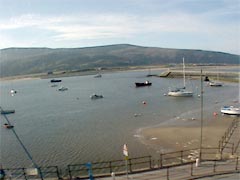
Barmouth Webcam, The Quay

Barmouth Webcam, The Quay

Live Barmouth Webcam

Watch this live HD webcam in Barmouth, Wales, United Kingdom from Merioneth Yacht Club . The Welsh town of Barmouth has one of the best set ups of any holiday resort in the UK. It has some of the best beaches in Britain, and sits on an estuary with exceptional views of the Snowdonia National Park. Keep an eye on the waves and tide times !

Things To Do: Barmouth Beach, Barmouth Bridge, Panorama Walk, Barmouth Harbour, Old Barmouth, Taith Ardudwy Way, Barmouth Slabs, Barmouth Heritage Trail. View all of the activities, main attractions, and things to do on TripAdvisor .

Weather in Barmouth

In addition to the fun, keep an eye on the current weather conditions in Barmouth. Furthermore, take a look at the 7-day forecast above, which includes precipitation and the temperature highs and lows. Also, Below is the weather radar with interactive map, allowing you to zoom and pan to get unmatched weather details!

Hotels in Barmouth

Find nice hotels to stay at when on vacation in Barmouth. Some of the best in the area are: The Tilman, Bae Abermaw, Tal Y Don Hotel, Lawrenny Lodge, Hendre Coed Isaf, Barmouth Bay Holiday Park, Endeavour Guest House, Endeavour Guest House, Min-y-mor Hotel, Ty’r Graig Castle. View all of the nice hotels to stay at in Barmouth on TripAdvisor .

Restaurants Barmouth

Enjoy the best restaurants in Barmouth. The most popular place to eat amongst locals and tourists are: Celtic Cabin, Bistro Bermo, The Bank Restaurant, The Bay Restaurant, The Tilman, Myrddins Brewery & Distillery, Foxglove, The Captain’s Table, Norbar, The Last Inn. View all the restaurants in the area on TripAdvisor .

Live beach webcams, weather conditions and surf report for your favorite beaches, vacation destinations and tourist attractions in the UK.

L ive Beach Cam brings you webcams from around the world. Keep up with the   weather  and  maps  from the best beaches around the world. Planning a vacation? This is the place you need to be. Furthermore you get to see these incredible beaches and landmarks around the world.

In addition to the best cams and webcams in United Kingdom, Live Beach Cam brings you sites from all around the world. Find out weather conditions, forecast and updates from the top beaches in the world. Check out drone camera video for the top tourist attractions around the world. Also, look at deck and pier webcams from the top beaches and vacation destinations in the world. Find  hotels  in the area prior to beginning your adventure.

Check out beach waves, surf conditions, tides, and storm news by looking at the maps of the beaches. Also, live beach cam has the best beach video from around the world.

Why Live Beach?

Do you love taking vacations and sight seeing throughout the world? Well this is the place for you. Furthermore, we will have live Streams and live cams of beaches, trains, mountains, volcanoes and theme parks. Also, We also have the best boardwalks, harbor cams, and other popular tourist attractions around the world. Make sure you check the weather forecast before planning your expedition.

Also, Live Beach Cam features the top web cams from around the world to bring you streams of the day to day happenings of the most amazing places in the world. Don’t miss day to day, hour to hour, minute to minute coverage of the most popular places on the planet.

RELATED ARTICLES MORE FROM AUTHOR
Mondovi, Italy | Live Video

Mondovi, Italy | Live Video

Freedom Square Tbilisi, Georgia - Live Hd Webcam Video

Freedom Square Tbilisi, Georgia – Live HD Webcam Video

Maiolati Spontini Webcam

Maiolati Spontini Webcam

Verbania Live Cam

Verbania Live Cam

Varazze Live Webcam

Varazze Live Webcam

Molini Di Triora Video

Molini di Triora Video

Port Of Pisa

Port of Pisa | Live Video

Milan Italy

Milan Italy | Live Video

Gallipoli Italy

Gallipoli Italy

Marina Di Alassio

Marina di Alassio

Limone Piemonte

Limone Piemonte

Chiavari, Italy Video

Chiavari, Italy Video

United kingdom webcams.

Watchet Marina Live Stream Cam New In United Kingdom

Watchet Marina Live Cam – England, United Kingdom

Strumble Head Lighthouse Live Cam New In United Kingdom

Strumble Head Lighthouse – Wales, United Kingdom

Woolacombe Webcam | Beach

Woolacombe Webcam | Beach

New Morecambe Bay Live Stream Cam United Kingdom

Morecambe Bay Live Stream Cam United Kingdom

Clonard Webcam Monastery, Belfast

Clonard Webcam Monastery, Belfast

Heathrow Airport Traffic Cam

Heathrow Airport Traffic Cam

West Kirby Beach Wirral

West Kirby Beach Wirral

Newquay Webcam, Porth Beach New In England, Uk

Newquay Webcam, Porth Beach England, UK

Robin Hood's Bay Webcam

Robin Hood’s Bay Webcam – Whitby, England, UK

Porthleven Webcam | Harbour

Porthleven Webcam | Harbour | Helston, Cornwall

Lyme Regis Webcam | Uk | New

Lyme Regis Webcam | UK | Live Harbour Video

Webcam Poole Harbour

Webcam Poole Harbour | Dorset, England, UK

Town Quay Live Webcam New In Southampton, Uk

Town Quay Live Webcam new in Southampton, UK

New Ferry Cam Southampton Live Stream Cam Uk

Ferry Cam Southampton Live Video | England, UK

Ammanford carmarthenshire Wales

Ammanford Carmarthenshire Wales

Ryde Esplanade Railway Station

Ryde Esplanade Railway Station | Isle of Wight | England

London Traffic Cam New

London Traffic Cam new

Grosmont Station Webcam, Whitby

Grosmont Station Webcam, Whitby

Wells Next Sea Webcam

Wells Next Sea Webcam – Port of Wells Live HD Cam...

Wembley Stadium Webcam | London, Uk

Wembley Stadium Webcam | London, UK

BARMOUTH RESORT IMPROVEMENT GROUP

  • Palm Tree Project
  • Bench Project
  • Dolphin Project
  • Station Project
  • Welcome Sign Project
  • Tear Drop Project
  • Get in Touch

Privacy Policy   |   Website Terms Of Use

BRIG Website - All rights reserved © Made with Love by Palm Web Designs

Supporters Of

JUST A FEW LINKS SO YOU CAN SEE WHAT IS HAPPENING IN BARMOUTH RIGHT NOW

Web cam and weather station links, meirioneth yacht club web cam - barmouth point, click on the image above for web cam, press f5 to refresh, meirioneth yacht club web cam - barmouth bridge, barmouth weather station donated by brig, click on the image above town council weather station link.

SpotCameras

  • Europe 6638
  • Austria 628
  • Germany 1598
  • Northern Ireland
  • Poland 2727
  • North America 432
  • British Columbia
  • New Brunswick
  • Newfoundland And Labrador
  • Northwest Territories
  • Nova Scotia
  • Prince Edward Island
  • Saskatchewan
  • Connecticut
  • District of Columbia
  • Massachusetts
  • Mississippi
  • New Hampshire
  • North Carolina
  • North Dakota
  • Pennsylvania
  • Rhode Island
  • South Carolina
  • South Dakota
  • West Virginia
  • South America 483
  • Australia & Oceania 744
  • Random camera ?
  • Animals 310
  • Ski resorts 483

Streaming AirMAX.pl

Views 11,890
Region Great Britain / Wales
Temperature 14.0°C (57.2°F)
Time 2024-09-23 14:20:00 (BST)
Coordinates 52°43'12.4'' N / -4°3'2.4'' W
Source http://merionethyachtclub.co.uk/
Refresh Refresh over 5 seconds
  • Nearby cams
  • Wikipedia articles

merioneth yacht club webcam

  • HOT cameras

merioneth yacht club webcam

Wales Web camera

Can you guess where this camera is from?

quiz kamera

  • Switzerland
  • Current weather

merioneth yacht club webcam

Advertisement

  • United Kingdom

Barmouth Harbour - Gwynedd Live cam

View of the barmouth harbour and bridge.

29 online - 332.039 hits

  • Rate this webcam
  • 4.8 / 5 - 216 Rating
  • NEARBY WEBCAMS

Live Cam Bala - Gwynedd

merioneth yacht club webcam

Weather & Webcams

  •   MHYC Channel Cam
  •   Fairport Harbor Lakefront Beach Camera
  • Graphical Forecast
  • Nearshore Marine Forecast
  • Complete Forecast via Accuweather.com
  • Weather Underground
  • Lake Erie Marine Weather
  • Fairport Harbor Lighthouse Observations
  • Observations at Cleveland Crib
  • Observations at Geneva State Park
  • Observations at South Bass Island
  • Put-In-Bay Webcams
  • Bahasa Indonesia
  • Slovenščina
  • Science & Tech
  • Russian Kitchen

Khanty-Mansiysk: Why you simply must visit this northern land of mammoths

merioneth yacht club webcam

“I have been to Yugra many times. I was sworn in as a Siberian in a cedar forest,” producer Andrey Suleikov writes in the preface to a collection of legends called Yugra. It’s My Land . “I tasted lingonberries in the cold and could not tell whether the berries were coated in sugar or ice. I also enjoyed outdoor hot springs while taking a traditional Siberian bath." 

Fuel pumping stations

Fuel pumping stations

Sounds more like time travel than a present-day tourist trip, doesn’t it? But that is what Yugra is like: a fusion between prehistoric things like mammoths and modernity, which has brought oil, gas and new buildings. Even the region’s official name (which is quite long: the Khanty-Mansi Autonomous Area – Yugra) combines the present with the past.

Tying a ribbon is a national tradition

Tying a ribbon is a national tradition

There is a beautiful legend about Yugra’s origins. In one very bright, warm and sunny city, twins of unprecedented beauty were born: a brother named Yug and a sister named Ra. At first, they grew up like ordinary small children, but with age they began to argue and fight, so much so that when they did flames flared up around them. The townspeople were afraid that they would burn everything down, so they exiled Yug and Ra to a remote northern land covered with ice and snow. The brother and sister illuminated this land with their light and made it warm so that people could come here to live. Yug and Ra stopped fighting and began living together in harmony. Since then, this northern land has been called Yugra.

When you look at the map, it may seem that Khanty-Mansiysk is located almost in the middle of Russia. However, the climate here is similar to regions of the Far North. In winter, the temperature here drops to below -40 degrees Celsius.

We asked local residents and people who know this region well to tell us more about it and to share some tips for tourists who come to visit.

Why should a foreigner visit Khanty-Mansiysk?

“If you want to feel the coldness and colors of Russian winter, then you should definitely stop by in our small cozy town,” says a local tattoo artist, Semyon Chepurnoy.

A Khanty man in a traditional dress

A Khanty man in a traditional dress

Yevgeny Zinovyev, a journalist and the former editor-in-chief of a local media outlet, says that Khanty-Mansiysk provides the opportunity to experience a real and not touristy part of Russia. “In winter, there are frosts, snowdrifts and wind. In summer, heat, midges and bears. At any time of the year, you can experience the everyday life and customs of the indigenous peoples: the Khanty and Mansi. And of course, in Khanty-Mansiysk you can get to know the backbone of modern Russia – its oil and gas sector."

“We have unique scenery here. Khanty-Mansiysk is located on seven hills and is surrounded by the taiga. There are a lot of fish in the rivers, and a lot of mushrooms, berries and pine nuts in the forests surrounding the city,” says local insurance company employee Sergey Yankovich.

View of the city and the Irtysh River

View of the city and the Irtysh River

The harsh climate of the region influences how local residents relate to visitors. “Residents of the city are very good-natured and welcoming and are always ready to offer help in any situation, even to a stranger, because in the north, there is an unspoken rule: If you see that a person is in distress, be sure to help them, because tomorrow, it may be you in their place. The harsh climate and surrounding scenery leave no room for error, especially in winter,” Sergey says.

Things to see/do/taste in Khanty-Mansiysk

Mammoths at the Archeopark

Mammoths at the Archeopark

According to Irina Pudova, a local resident and the author of a collection of legends called Yugra: It’s My land , the first thing to do in Khanty-Mansiysk is to see the local mammoths. Seven life-size bronze prehistoric animals "roam" the area near Samarovsky Hill on the grounds of the Archeopark complex. Here you will also find a prehistoric bison, a pack of wolves, a cave bear, two woolly rhinos and prehistoric people themselves.

Sculptures of bisons at the Archeopark cultural and tourist complex

Sculptures of bisons at the Archeopark cultural and tourist complex

“Then you could get something to eat,” Irina advises. “The thing to do is to go to any local restaurant of Siberian cuisine and ask for muksun. It is a valuable freshwater fish of the salmon family, which is highly prized by locals and tourists alike.”

Khanty-Mansiysk is a relatively new city and only received this status in 1950. Soo oil was discovered in the region, prompting a dramatic push in its development. Prior to that, there were just Siberian settlements built by Russia in the late 16th century. Irina is impressed that a modern city was built in such harsh conditions.

The Church of the Protection of the Holy Virgin

The Church of the Protection of the Holy Virgin

“Cultural objects, squares, houses - all this is unique. And everything is new, there is nothing very ancient here. Except for mammoths!” she says.

In addition to the Archeopark mentioned above, Yevgeny Zinovyev’s list of favorite places in the city includes the Museum of Geology, Oil and Gas, along with the Museum of Nature and Man and the centuries-old cedars in the Samarovsky Chugas natural park. He recommends checking out the views from the observation deck near the Monument to the Explorers of the Yugra Land and paying a visit to a local bathhouse.

'Red Dragon' bridge over the Irtysh River

'Red Dragon' bridge over the Irtysh River

Yevgeny also provided us a checklist of culinary delights that anyone visiting Khanty-Mansiysk should be sure to try:

  • Muksun (in any form but best of all frozen and sliced as Stroganina).
  • Wild berries (cranberry, cowberry, cloudberry).
  • Venison (in any form but best of all stewed and sprinkled with frozen berries and pine nuts).

Sergey Yankovich recommends visiting the open-air ethnographic museum Torum Maa, which means "Sacred Land" in Mansi. “There you can get acquainted with the history of the city and the district, as well as with the life of the indigenous peoples of the Khanty and Mansi, who belong to the Finno-Ugric group,” Sergey says.

Torum Maa ethnic center

Torum Maa ethnic center

In addition, he advises anyone who comes to Khanty-Mansiysk to visit the spot where the Ob and Irtysh rivers meet, pay a visit to Misne Hotel’s restaurant and taste traditional dishes there, as well as dishes prepared by local fishermen and hunters while in the taiga.

According to Semyon Chepurnoy, the Valley of Streams natural park is another must for any visitor. It is one of local residents’ favorite recreation areas, where you can stroll along a dedicated footpath offering stunning views of the city. Semyon also advises trying pancakes at the GoodFood chain of cafes.

What are the best souvenirs?

“We all love something mystical and supernatural. There is a strong culture of shamanism here, so I think it’s cool to take with you some local amulets charged by a shaman—a bear claw or a pendant made of beads and deerskin,” says Irina Pudova.

A Khanty woman in the traditional dress selling souvenirs

A Khanty woman in the traditional dress selling souvenirs

Sergey Yankovich advises that authentic souvenirs can be found at the Crafts Center on Roznina Street. “There you can also see and even try on the national costumes of the Khanty and Mansi and try to solve traditional puzzles that representatives of the indigenous peoples made for their children.”

According to Yevgeny Zinovyev, the best souvenirs are Khanty and Mansi amulets, clothes, jewelry, as well as traditional local treats such as muksun, wild berries, pine nuts and venison.

Cowberry bush

Cowberry bush

For his part, Semyon Chepurnoy recommends bringing away memories and photographs as well as a little bit of Siberian Frost ❄.

If using any of Russia Beyond's content, partly or in full, always provide an active hyperlink to the original material.

to our newsletter!

Get the week's best stories straight to your inbox

  • 10 main stops on the Trans-Siberian Railway
  • Naryan-Mar: Why you should visit this remote Arctic city
  • An expat’s confession: Why I miss the city by the Amur – Khabarovsk

merioneth yacht club webcam

This website uses cookies. Click here to find out more.

Russian cities and regions guide main page

  • Visit Our Blog about Russia to know more about Russian sights, history
  • Check out our Russian cities and regions guides
  • Follow us on Twitter and Facebook to better understand Russia
  • Info about getting Russian visa , the main airports , how to rent an apartment
  • Our Expert answers your questions about Russia, some tips about sending flowers

Russia panorama

Russian regions

  • Chelyabinsk oblast
  • Khanty-Mansi okrug
  • Nefteyugansk
  • Nizhnevartovsk
  • Kurgan oblast
  • Sverdlovsk oblast
  • Tyumen oblast
  • Yamalo-Nenets okrug
  • Map of Russia
  • All cities and regions
  • Blog about Russia
  • News from Russia
  • How to get a visa
  • Flights to Russia
  • Russian hotels
  • Renting apartments
  • Russian currency
  • FIFA World Cup 2018
  • Submit an article
  • Flowers to Russia
  • Ask our Expert

Khanty-Mansi Autonomous Okrug - Yugra, Russia

The capital city of Khanty-Mansi okrug: Khanty-Mansiysk .

Khanty-Mansi Autonomous Okrug - Yugra - Overview

Khanty-Mansi Autonomous Okrug - Yugra is a federal subject of Russia, part of the Urals Federal District. Khanty-Mansiysk is the capital city of the region.

The population of Khanty-Mansi Autonomous Okrug - Yugra is about 1,702,200 (2022), the area - 534,801 sq. km.

Khanty-Mansi okrug flag

Khanty-mansi okrug coat of arms.

Khanty-Mansi okrug coat of arms

Khanty-Mansi okrug map, Russia

Khanty-mansi okrug latest news and posts from our blog:.

21 March, 2020 / Nizhnevartovsk - the view from above .

8 November, 2017 / Surgut - the view from above .

4 March, 2017 / Khanty-Mansiysk - the view from above .

12 February, 2016 / Khanty-Mansi Autonomous Okrug from above .

21 May, 2013 / The most powerful thermoelectric power station in Russia .

More posts..

History of Khanty-Mansi Autonomous Okrug - Yugra

Yugra is the historical homeland of the Ob-Ugric peoples: Khanty, Mansi, Nenets, and Selkup. They were engaged in hunting, fishing, cattle breeding. After the Turkic peoples pushed them from south to north, these peoples had to apply their skills in more severe conditions. It is at this new location Ugrians began to domesticate deer.

In the first half of the second millennium AD, the main features of the material and spiritual culture of Khanty, Mansi and forest Nenets were formed. It is believed that since then they have not undergone major changes. Since the second half of the 13th century, a new factor in the development of the region was its entry into the Golden Horde.

At the end of the 14th century, the collapse of the Golden Horde led to the emergence of a separate Tyumen Khanate. In 1495, the Siberian Khanate appeared. At that time the basic principles of political, administrative and socio-economic organization of this territory were developed. The region was called Ugra or Yugra.

More historical facts…

The region became part of Russia in the end of the 16th century. From the middle of the 18th century, this region became a place of exile for criminals. December 10, 1930, Ostyako-Vogul national okrug was formed with the center in the settlement of Samarovo. Construction of a new center began 5 km away from it. In February 1932, the new center of the region was named Ostyako-Vogulsk.

In 1934, the first steps to find oil and natural gas in the region were taken. October 23, 1940, Ostyko-Vogul national okrug was renamed Khanty-Mansi national okrug and Ostyko-Vogulsk was renamed Khanty-Mansiysk. August 14, 1944, the region became part of Tyumen Oblast. On January 27, 1950, Khanty-Mansiysk became a city.

On September 21, 1953, in Berezovo, the first natural gas in Western Siberia was produced. On June 23, 1960, the first oil in Western Siberia was discovered near Shaim. This was followed by the discovery of many other oil and natural gas fields. Along with the industrial exploitation of oil and gas fields, the timber industry developed rapidly.

By the end of the 20th century, under the influence of demographic and socio-economic developments the Khanty-Mansi region in fact lost its national basis. On July 25, 2003, Khanty-Mansi Autonomous Okrug was renamed Khanty-Mansi Autonomous Okrug - Yugra.

Khanty-Mansi Autonomous Okrug - Yugra views

Rest on the lake in Yugra

Rest on the lake in Yugra

Author: O.Frolov

Golden autumn in the Khanty-Mansy region

Golden autumn in the Khanty-Mansy region

Author: Leonid Karpushin

Beautiful nature of Yugra

Beautiful nature of Yugra

Khanty-Mansi Autonomous Okrug - Yugra - Features

The name of the region is associated with the self-names of the two main groups of northern peoples - Khanty and Mansi. In the Middle Ages, the word “Yugra” was used to refer to peoples and lands beyond the Northern Urals.

This region, located in the middle of Russia, occupies the central part of the West Siberian Plain. Its territory stretches from west to east for almost 1,400 km, from north to south for 900 km. The area of the region is comparable to France or Ukraine.

The climate is temperate continental characterized by rapid change of weather especially in spring and autumn. Winters are long, snowy and cold with frosts below minus 30 degrees Celsius. Summers are short and warm. From the west this region is protected by the Ural mountains, from the north it is open to cold arctic air.

The highest points of the region are Mount Narodnaya (1,895 m) in the Polar Urals and Mount Pedy (1,010 m) in the Northern Urals. Two major rivers flow in Khanty-Mansi autonomous okrug: the Ob (3,650 km) and its tributary the Irtysh (3,580 km). About 30% of the territory is covered by swamps. There are more than 300,000 lakes surrounded by marshes and forests.

The largest cities of Khanty-Mansi Autonomous Okrug - Yugra are Surgut (396,000), Nizhnevartovsk (280,800), Nefteyugansk (128,700), Khanty-Mansiysk (106,000), Kogalym (69,200), Nyagan (58,500). Today, only about 32,000 people are representatives of indigenous peoples: Khanty, Mansi and Nenets. Half of them live in the traditional way.

This region is very rich in oil and natural gas. The largest oil and natural gas fields are Samotlorskoye, Fedorovskoye, Mamontovskoye, Priobskoye. There are also deposits of gold, coal, iron ore, copper, zinc, lead and other mineral resources.

The climate is not favorable for agriculture. Most of the agricultural products and foodstuffs is brought from other Russian regions. Waterways and railways are the main shipping ways. The total length of the pipeline network is 107,000 km.

About 60% of Russian oil is produced in Khanty-Mansi Autonomous Okrug - Yugra. In total, more than 10 billion tons of oil were produced here. The total number of oil and natural gas fields discovered is 475. In the coming decades, the Khanty-Mansi region will remain the main resource base of hydrocarbons in Russia.

Tourism in Khanty-Mansi Autonomous Okrug - Yugra

Yugra has unique natural, cultural and historical resources for the development of recreation and tourism. On the territory of the region there are historical and cultural monuments, as well as modern infrastructure for lovers of cultural, educational, recreational tourism, and outdoor activities. International events (sports competitions, festivals and forums) help to open this place to foreigners as an amazing corner of the globe.

Khanty-Mansi Autonomous Okrug - Yugra has a number of wonderful natural sites worthy of attention: two nature reserves (“Malaya Sosva” and “Yugansky”), four nature parks (“Samarovsky Chugas”, “Siberian ridges”, “Numto”, “Kondinskie lakes”), ten monuments of nature, archeological complexes (“Barsova Mountain”, “Saygatino”, Sherkaly settlement).

Holidays of the northern peoples are also popular among tourists: Reindeer Herder’s Day, Day of indigenous Peoples of the North “Crow day”, Fisherman’s Day, Bear holiday and others.

Active and extreme types of tourism (skiing, snowboarding, kiting) are gaining in popularity. There are seven ski resorts in the region. In summer, travelers can go rafting on mountain rivers of Siberia. Tourists can also go on a special oil tour that includes a visit to the oil-producing companies. They learn about the oil industry and the history of oil exploration in Siberia.

Khanty-Mansi Autonomous Okrug - Yugra is a region of endless charm of the beautiful nature and modern tourist facilities. True lovers of northern landscapes and local cultures will be able to fully enjoy the incomparable scenery and generous hospitality in Ugra.

Khanty-Mansi okrug of Russia photos

Khanty-mansi autonomous okrug scenery.

Road through autumn forest in Khanty-Mansi Autonomous Okrug

Road through autumn forest in Khanty-Mansi Autonomous Okrug

Deep winter snow is not a problem in Khanty-Mansi Autonomous Okrug

Deep winter snow is not a problem in Khanty-Mansi Autonomous Okrug

Author: Chernenko

Yugra scenery

Yugra scenery

Author: Sergej Fedotov

Pictures of Khanty-Mansi Autonomous Okrug - Yugra

Winter in Khanty-Mansi Autonomous Okrug

Winter in Khanty-Mansi Autonomous Okrug

Orthodox church in Khanty-Mansi Autonomous Okrug

Orthodox church in Khanty-Mansi Autonomous Okrug

Author: Alexey Borodko

Church in Khanty-Mansi Autonomous Okrug

Church in Khanty-Mansi Autonomous Okrug

Author: Peter Sobolev

  • Currently 2.80/5

Rating: 2.8 /5 (189 votes cast)

For information on where to stay and great places to eat in Barmouth..... Click Here!

Rowing Section Covid Policy

merioneth yacht club webcam

Barmouth Harbour

merioneth yacht club webcam

Barmouth Harbour is operated and managed by Gwynedd County Council. We have a harbour master who is the primary point of contact for all harbour issues and mooring enquiries.

Barmouth has two launch slips on the quayside in close proximity to the Harbour Masters Office and launching is limited to these designated zones. Launching at Barmouth is tide dependent and is limited to 2-3 hours either side of high tide, note that there is a 4 Knot speed restriction with the harbour.

When launching, ensure that you have contacted the harbour master and that your car and trailer are removed from the slipway to keep the access clear. Also beware of soft sand and mud when launching and retrieving. 

Swimming is not allowed in the Harbour and it is worth noting that boats regularly enter the water from the beach by the Bath House. 

The Harbour Master and his team can be contacted at the harbour office and by phone or email.

Harbour Master's Office, The Quay, Barmouth, Gwynedd, LL42 1HB.      

Harbour Master Office

01341 280671

Additional Resources for Barmouth Harbour Users

Harbour%20Guide_edited.jpg

Logo for Meredith Yacht Club Lake Winnepesauke NH

We are working on setting up a webcam at the Meredith Yacht Club, but in the meantime, here are current views over Meredith Bay from Weirs Beach.

(Refresh the browser to update the image below — The WeirsCAM is active from sunrise to sunset daily. The image is updated every 5 minutes.)

https://www.winnipesaukee.com/index.php?pageid=weirscam

WeirsCam

  • Places - European, Western and Northern Russia

KHANTY-MANSI AUTONOMOUS OKRUG: RUSSIA’S MAIN OIL-PRODUCING REGION

Khanty-mansi autonomous okrug.

Khanty-Mansi Autonomous Okrug is usually called Yugra or Ugra for short. It is named after two indigenous groups native to the region — the Khanty and the Mansi, known collectively as Ob-Ugric people. It covers 534,800 square kilometers (206,500 square miles), is home to about 1.53 million people and has a population density of 2.9 people per square kilometer. About 91.5 percent of the population live in urban areas. Khanty-Mansiysk is the capital, with about 80,000 people. The largest cities are Surgut, Nizhnevartovsk, and Nefteyugansk.

As of the early 2010s, about 51 percent of the oil produced in Russia and 7.3 percent of the world’s supply came from Khanty–Mansi Autonomous Okrug, making the region very important economically. More than 10 billion tons of oil has been was recovered from the okrug’s fields so far . The okrug contains around 70 percent of Russia’s developed oil fields, about 450 in total, including Samotlor, which is the largest oil field in Russia and the sixth largest in the world. Gas was first found in the region in 1953 and oil began to be produced in 1960.

As far as tourism is concerned this autonomous okrug combines unique historical, cultural and natural resources, the most important of which is the way of life of its indigenous peoples. If you visit a nomad camp, you can ride on a reindeer sleigh, live in a chum tent, learn to harness a deer, ride a sled and taste stroganina (slices of frozen meat) and patanka (thinly sliced frozen fish). In the Sub-Arctic Ural Mountains, it is popular to climb Mount Narodnaya — the highest peak of the Urals — and go fishing.

The winter in Khanty-Mansiysk is cold. Snow lies on the ground about 200 days of the year and temperature of -50 degrees, C are not unusual. The summer are short but sometimes can get surprisingly hot, with temperature over 30 degree heat. The best time to visit is May or or September, when it is not yet cold and the annoying mosquitos, no-see-ums and midges are not out in full force.

Getting There: By Plane: The flight Moscow or St. Petersburg to Khanty-Mansiysk is about three hours. To Surgut, three and a half. To Nizhnevartovsk, four hours. The cost of an adult round-trip economy class ticket is from 8,000 to 12,000 rubles, depending on the airline. The airport of Nizhnevartovsk. Website: /nvavia.ru. Phone +7 (3466) 49-21-75. By Train: you can reach Surgut, Nizhnevartovsk, Yugorsk, Nyagan and Kogalym. Trains do not reach Khanty-Mansiysk. The nearest station to it, Demyanka, is located 240 kilometers away. From it to the capital of Ugra there are minibuses. A round-trip ticket for a berth in a compartment from Moscow to Surgut is 14,000 rubles. The trip takes two days.

By Car: Two roads lead to Yugra. The main one is the Federal highway R404 Tyumen-Khanty-Mansiysk. This is convenient if you are going to the eastern part of the okrug. If you need to go to the western part or to the capital, it is better to go by the Northern route — through Perm, Serov, Ivdel and Yugorsk. The road quality on both routes is pretty good, but there is much less traffic on the northern one. If you are traveling in Ugra by car, do not forget to refueling. The distances gas stations can reach 200 kilometers or more. It is a good idea to have a canister of fuel in the trunk just in case. Regional Transport By Bus: From Khanty-Mansiysk to Surgut is 300 kilometers, Bus tickets range from 1100 to 1400 rubles. From Surgut to Nizhnevartovsk — 220 kilometers — bu bus costs about 1000 rubles. From Surgut to Kogalym — 80 kilometers — is about 500 rubles. The bus station in Nizhnevartovsk. Website: www.nvav.ru. Phone: 8 (3466) 45-72-97.

Accommodation in the Region: In all major cities there are a lot of hotels. The level of service is high everywhere, but the prices are also high: starting from 5,000-6,000 rubles for a standard price double room. It is much cheaper to rent apartments, at 1,500 to 2,500 rubles.

Khanty and Mansi

The Khanty (pronounced HANT-ee) are a group of Finno-Ugric-speaking, semi-nomadic reindeer herders. Also known as Ostyaks, Asiakh, and Hante they are related to the Mansi, another group of Finno-Ugric-speaking reindeer herders. Only about 60 percent of Khanty speak their native language and a much smaller percentage live in the forest. In the Khanty-Mansiisk District they are fa r outnumbered by other ethnic groups. [Source: John Ross, Smithsonian; Alexander Milovsky, Natural History, December, 1993]

There are about 23,000 Khanty. They live primarily in Khanty-Mansi Autonomous Okrug , a region along the northern tributaries of the Ob River in northwestern Siberia about 1,100 miles northwest of Moscow and 200 mile south of the Arctic Circle. Their cousins, the Mansi, also live there. The region has been damaged by oil and natural gas exploration and production.

The Mansi, known in the old days as the Voguls, are close relatives of the Khanty and live primarily in Khanty-Mansi Autonomous Okrug.. There are around 8,000 or so Mansi. The Mansi have traditionally survived by fishing, hunting and gathering, The hunting methods they employed and the animals they went after was determined by what was available. Often they relied chiefly on fishing and dried enough fish during the summer to last through the winter. They hunted elk, bears, wild reindeer with spears, bows and arrows and traps until the 19th century when the began using firearms. Elk were caught with a system of traps and triggered bows.

Many Mansi still hunt. They use dogs and firearms and go chiefly after muskrats and squirrels. Sable are hunted with nets and guns by a pair of hunters: one who flushes the sable from its den into the net and the other who shoots the animal. Their traditional religion is often aimed at securing a successful hunt.

KHANTY factsanddetails.com ;

Oil and Natural Gas in Khanty-Mansi Autonomous Okrug

Oil was prospected in the West Siberia from the beginning of the 20th century. Local people reported finding discharges on the surface from time to time. The first Soviet prospectors arrived to Ugra in 1935. They confirmed the presence of natural oil seeps on the Ugan river in the Surgut area. Over 2.5 tons of equipment were delivered to the drilling pad by air. Other supplies were hauled by horses, since the nearest railroad ran about 1,000 km away from the prospecting site. The place was very remote and was only accessible during the winter. The early workers lived in a camp under extremely cold conditions. [Source: Technologies Department of Ugra]

In 1953, natural gas was found for the first time in Western Siberia, in Berezovo, about 300 kilometers northwest of Khanty-Mansiysk. in Berezovo. In 1960 the first oil was found in the vicinity of Shaim. Soon after oil fields were discovered in Megion, West Surgut, Pokur, Vatinsky, Mamontovo, Salym, Pravdino and other places. The biggest discovery was in 1965, when the first oil gushed out from the marshland at Samotlor. One of the largest oil fields in the world, it has already produced 2.67 billion tons of oil.

Oil quality in the region is quite high. Some is light, some is black, but most of it is brown. Its characteristics and composition can differ significantly even within the same field. In 2013 255.1 million tons of oil were produced in Khanty-Mansi Autonomous Okrug and eight new fields were brought into development. Total gas production in Ugra was 33,0 billion cubic meters in 2013. This was mostly associated petroleum gas.

Owing to its explored and proven raw hydrocarbons resources, production capabilities, industrial infrastructure and oil fields commercial viability Yugra will remain Russia’s main strategic raw hydrocarbons resource base for the next several decades. Over 475 oil and gas fields have been discovered in the territory of the Khanty-Mansiysk Autonomous Okrug. Total length of the region's pipelines network is 107,000 kilometers.

Ob River (flowing northeast of Novosibirsk and Tomsk) is the forth longest river in the world if you include its major tributary the Irtysh River and the seventh longest without it. The westernmost of three great rivers of Asiatic Russia, the Ob is 3,650 kilometers (2,270 miles) long and is an important commercial waterway that transports goods back and forth between the Trans-Siberian Railway and the resource rich regions of northern Siberia. Since it is frozen over half the year activity on the river is concentrated mostly in the summer months. The Ob-Irtysh is over 5570 kilometers (3461 miles) long

The Ob and the Irtysh River begin in the Altay Mountains, a range located near where Russia, China, Kazakhstan and Mongolia all come together, and flow northward. Although the Ob and the Irtysh begin at points within a couple of hundred miles of one another the two rivers don't join until the Irytysh has traveled over 1,600 kilometers (1000 miles). Once the two rivers have dropped down out of the highlands the meander lazily through open steppes, then rich farmland, and meet in flat, swampy plains, where the width of river ranges between a half a kilometer and a kilometer and a half. The Ob then passes through fir and spruce forests of West Siberia, then through Arctic tundra before finally emptying into the Kara Sea, an arm of the Arctic Ocean. The Ob is one of the great Asiatic Russian rivers (the Yenisei and the Lena are the other two). According to the Guinness Book of World Records, it has the longest estuary (550 miles long and up to 50 miles wide) and is widest river that freezes solid. The mouth of the river on the Arctic Ocean is ice free only a couple of months a year. Huge flood sometimes form in the spring when high waters fed by melting snow and ice meet still frozen section of the river.

The main city on the Ob is Novosibirsk. Parts of the Ob are very polluted and nearly void of life. At the mouth of the river so much land has been degraded by gas exploration that huge chunks of permafrost land have literally melted into the sea. [Source: Robert Paul Jordan, National Geographic, February 1978, ♬]

Traveling on the Ob and Irtysh Rivers

There is a regualr ferry the Ob and Irtysh Rivers that travels between Omsk – Tobolsk – Khanty-Mansiysk – Berezovo and Salekhard (Yamal Nenets Autonomous Region). Omsk and Tobolsk both have train stations on the Trans-Siberian Railway. Khanti-Mansiysk is accessible by bus from Tyumen, which has a train station. After Khanti-Mansiysk you are beyond the road network. As well as the major stops listed on the route above, the boat also stops at plenty of isolated indigenous villages in between them. Salekhard is the only city in the world located exactly on the Arctic Circle.

The name of the ferry is the Rodina. It travels three times a month in June and September and four times a month in July and August. Going from Salekhard to Omsk: Day 1): departs Salekhard at 5:00pm; Dat 2) stops at Berezovo for 30 minutes ay 7:30pm; Day 3) stops at Oktobraskaya Market for one hour. Day 4) stops at Khanty-Mansiysk for two hours at 8:00am; Day 6) one hour stop in Tobolsk at 7:30. Day 9) arrive in Omsk at 3:00pm. Traveling the other direction, with the current, takes one third less time.

On the Salekhard - Tobolsk - Omsk trip on person posted on Lonely Planet’s Thorn Tree forum in 2013: “I'll start by saying that this boat is amazingly good value for money. Here some example prices. The first is for beds in the common area, similar to platzkart on the train, the second is for a bed in a private 4-, 6-, or 8 bed cabin and the third is for a bed in a private 2 bed cabin. 1) Salekhard - Omsk (8 days): 1162 / 1437 / 3926 roubles; 2) Salekhard - Tobolsk (5 days): 774 / 969 / 2632 roubles; 3) Tobolsk - Khanty-Mansiysk (2 days): 429 / 526 / 1394 roubles. Children go half price!

“Tickets can be bought in advance at the airport in Salekhard or on the boat itself an hour before departure (it's apparently never full). Most people get off at one of the stops in the first 24 hours when going south from Salekhard, leaving only one or two people in most of the cabins for most of the route. The beds are comfortable , both longer and wider than on trains. Everything is cleaned several times a day, there's a shower, laundry, restaurant with simple but tasty meals and alcohol. Breakfast about 70 roubles, lunch and dinner 150 - 300, beer 50 - 80, wine, vodka and so on also available. Theres also a small room where films are shown starting in the afternoon and a shop selling all sorts of useful stuff such as toiletries, mugs, books.

“You can walk around on deck as much as you want or sit and read a book on the benches up there. The scenery is more or less the same all the way - endless taiga forest with absolutely no sign of civilisation. There are a few villages such as Pitlyar for which the boat is their only access to the outside world and a couple of towns where you can get off the boat and walk around - Beryozovo 24 hours after Salekhard and Khanty-Manskiysk 3 days from Salekhard. From Khanty Mansiysk there are regular buses to Tyumen on the Trans Siberian which take 8 hours. At Tobolsk the boat stops next to the stunning kremlin, the only one in Siberia.

“Anyone can freely sail the whole route between Omsk and Pitlyar, a small village of 500 and the last stop before Salekhard. Salekhard and areas north are closed to outsiders, Russian or otherwise, unless they get a temporary permit. See the Yamal Peninsula link in my signature line for how to get this permit. Permit in hand, you can continue the journey north from Salekhard a further two days to Antipayuta, well beyond the Arctic Circle, with a similar level of comfort and price.

“It sails the whole route from June to September and once in October from Khanty-Mansiysk to Omsk. Check www.irsc.ru for timetables and fares. Only about half the boats from Salekhard go as far as Omsk, the rest stopping in Tobolsk. Eg in July and August, the most frequent sailing months, 6 boats go from Salekhard - Tobolsk each month but only 3 continue to Omsk. Check the timetable carefully when planning if you want to sail all the way to Omsk!”

Khanty-Mansiysk City

Khanty-Mansiysk is the capital of the Khanty-Mansiysk Autonomous Okrug and home to about 80,000 people. Despite its remote location and relatively small size, it has a Norman Foster skyscraper, world-leading medical center that is free and has hosted international film festivals, major sports events and political summits. How is this possible?: Oil wealth and close ties between local politicians and Russian President Vladimir Putin doesn’t hurt.

Khanty Mansiysk has showy headquarters for Russia’s main oil companies: Rosneft, Lukoil and Gazprom-Neft. Not far away enormous drilling towers rise and gas flares burn above the birch forests and pipelines cut through the landscape. Around 90 percent of the city’s economic revenues are tied directly to the oil and gas industries.

The city is located in a picturesque area of the West Siberian lowland, where steep hills overgrown with age-old dwarf pine, rise up from the right bank of the mighty Irtysh River. Two of the largest rivers of Siberia — the Irtysh and the Ob — merge twenty kilometers from the city. Not far from town the “Coniferous Urman” ski complex with a cable car. The cedar forest of the Samarovsky Chugas Park has trails for cross-country skiing and hiking. For children there is a water park and a small zoo in the village of Shapsha 20 kilometers from the city. In the summer, there are boat tours to the confluence of the Ob and Irtysh, where you can see the floating chapel-lighthouse.

Places of interest to tourists the gold domes of the Church of Christ’s Resurrection; the gallery of the artist Gennady Raishev; the Geology, Oil and Gas Museum, which traces the history of Western Siberian oil and gas development; and the open-air Archeopark, which has bronze sculptures of Pleistocene animals like mammoths and woolly rhinosl a sporting venue that hosts international ice and skiing events. A new triple concert hall dominates the center of the town. Servicing villages that cannot be reached by road, is an ultra-modern hospital ship that cruises Ob and Irtish rivers treating the sick on board. Complex operations are supervised by surgeons from the central hospital in Khanty-Mansiysk using TV monitors that relay pictures by satellite.

Accommodation: There are several hotels of different levels in Khanty-Mansiysk. The best service and, accordingly, the highest prices at the Ugra valley Valley Complex. At the Tarey business hotel prices start from 4800 rubles per night; at the Olympics Hotel, from 3000 rubles per night. If you want to save money, it is better to rent an apartment: a one-bedroom can be found in the area of 1500 rubles per day.

History of Khanty-Mansiysk City

The first written mention of the town of the Khanty Prince Samara, where the modern city of Khanty-Mansiysk is located, dates back to 1582. In 1637, a settlement of Russian coachmen was formed in the place of this town. It was named after the Prince Samara — Samarovsky Yam.

By the beginning of the 19th century, Samarovsky Yam turned into a large village of Samarovo and became the center of crafts and trade thanks to the favourable location on the river trade routes. In 1931, a few kilometers from the village of Samarovo, a workers settlement Ostyako-Vogulsk was built, which became the district center of the Ostyako-Vogulsk national district. The settlement began to be built up with new industrial enterprises, administrative buildings, apartment houses, public and cultural institutions. By the end of 1950s, pebble roads were laid in the settlement.

In 1940, Ostyako-Vogulsk was renamed Khanty-Mansiysk, and the district was renamed Khanty-Mansiysk, since at that time Ostyak tribes began to be called Khanty, and Voguls tribes — Mansi. In 1950, Khanty-Mansiysk received the status of a city, including Samarovo village. Since 1977, Khanty-Mansiysk has become the administrative center of the Khanty-Mansiysk Autonomous Okrug formed from the national district.

Sights in Khanty-Mansiysk

Torum Maa Open Air Museum (Ulitsa Sobyanina, 20, Khanty-Mansiysk) is located on one of the seven holy hills, in the Samarovsky Churas Nature Park, and features authentically reconstructed buildings and dwelling of indigenous peoples of the North, including a Mansi winter camp and traditional Khanty residential and household structures dating to the early-mid-19th century. You can learn more about hunting culture of the Khanty and Mansi on a special hiking trail.

At the museum you can find a 15th-17th century smithy, reconstructed using materials from archaeological excavations of Emder city; displays of idols and protectors of this land. The museum is especially active during traditional holidays of the Ob river Ugric people when Khanty and Mansi come from all over to celebrate. The most popular of these are: Tylasch pori (the Rite of Offering to the Moon), which takes place in February or March when the moon is waxing; Crow Day, which symbolizes the beginning of spring and is celebrated in April; the International Day of the World’s Indigenous Peoples, which is celebrated globally on August 9; and the main holiday for the museum staff and visitors — the anniversary of the Torum Maa Museum on October 30.

Archeopark Cultural and Tourist Complex (in Khanty-Mansiysk) covers 3.5 hectares near a rock outcropping and includes a geological monument, the Samarov Villiage Archaeological Monument (dating from the 11th-18th centuries), and a the Sculpture Park with giant bronze sculptures of mammoths and other Pleistocene-era animals and Paleolithic humans.

The park was set up where the bones of mammoths and other pre-historic animals have been found. The first large bones and tusks were found in the 19th century, when the northern region came to be called the “elephant homeland.” For local inhabitants, the archaeological findings along the river banks were not so uncommon. The bones had been in demand as a decorative material and therapeutic powder.

All the sculptures were created in cooperation with paleontologists, who made sure that the ancient inhabitants of this area look as authentic as possible. Some of the sculptures, for instance, rhinoceroses, were made in life size, while others are two to three times larger. The height of the largest sculpture in the Mammoth composition is eight meters. The sculptures are lit up at night. The little mammoth is named KoJourka. The sculpture probably has the world's only sign that prohibits mammoth climbing.

Sights Near Khanty-Mansiysk City

Floating Chapel-Beacon in Honor of Saint Nicholas (20 kilometers Khanty-Mansiysk) opened in 2013 near the confluence of two mighty Siberian rivers — the Ob and Irtysh. Blessed by Bishop Pavel of Khanty-Mansiysk and Surgut and consecrated by Kirill, Patriarch of Moscow and all Rus, it is Russia's first floating chapel-lighthouse. The chapel is eight meters high, it weighs 10 tons and is fixed on a pontoon. Below the cross crowning the chapel there is a beacon light. There are eight illuminated alcoves with icons. The chapel is not intended to hold a service inside. Only maintenance personnel looking after the power supply can moor to it.

Originally the idea of building the chapel was suggested by S. Sandulov, president of the local branch of the Association of Ports and River Transport Owners. For river transport workers the Ob-Irtysh confluence is a special place. And for the local people — Khanty and Mansi — this is a sacred area. However, for a long time there was no monument or sign to mark the place. At the confluence of the Ob and Irtysh people have traditionally made a wish by throwing a coin into the water. The water here is considered to be sacred and many tourists wash themselves with the water of the two rivers.

Silava Ethnographic Center (near Uray, 250 kilometers east of Khanty-Mansiysk) and the Ela Hoth community of indigenous peoples "was founded in 2008 to preserve features of the traditional culture and way of life on the site of the former village of New Silava. Visitors can participate in Mansi ceremonies and celebrations and Mansi cooking and engage in recreational activities such as skiing, sledding, tubing, ice sliding and riding a snowmobile "Buran" in the winter; and pick mushrooms, berries, medicinal plants and go boating in the summer. The center may difficult to get to.

Swimming is possible in the cold Konda River. You can also go hiking on eco-trails and participate in various types of fishing and children's entertainment programs. The community has assembled a small museum of household items and fishing items. You can see how fishing camps were set up and a functioning bread oven and a machine for weaving mats and try grinding flour at the mill and baking bread.

Priobskoye Field

The Priobskoye field (65 kilometers east of Khanty-Mansiysk, and 100 kilometers west of Nefteyugansk) is an oil field that occupies an area of 5,466 square kilometers (2,110 square miles. It is located along both banks of the Ob River, and is serviced by the town of

The field was discovered in 1982. The northern three-quarters of the field was controlled by YUKOS via unit Yuganskneftegaz, and began oil production in 2000. In 2004, Yuganskneftegaz was bought by Rosneft, which is now the operating company of that portion of the field. The southern quarter of the field was controlled by Sibir energy, which began a joint venture with Sibneft to develop the field, with volume production beginning in 2003. Sibneft subsequently acquired complete control of the field via a corporate maneuver to dilute Sibir's holding. Sibneft is now majority controlled by Gazprom and renamed Gazprom Neft.

In 2007, the field was producing 675,000 barrels per day: 550,000 barrels per day in the northern Rosneft area and 125,000 barrels per day in the southern Gazprom Neft area. For 2008, Rosneft reported a growth of production to 680,000 barrels per day, while Gazpromneft's share grew slightly. In 2009, Gazprom Neft produced 160,000 barrels per day in its share of the field. In September 2019, Russia’s finance ministry approved tax breaks for developing the Priobskoye oilfield, Russia’s largest, to oil giants Rosneft and Gazprom Neft, Alexei Sazano.

Surgut (300 kilometers east of Khanty-Mansiysk by road) located on the Ob River and is one of the few cities in Russia that has a larger population than the capital of its federal subject. It is home to about 375,000 people compared to 80,000 in Khanty-Mansiysk. Surgut is home to the largest port on the Ob River, the largest road-railway junction in northwest Siberia. Two of the world's most powerful power plants — the SDPP-1 (State District Power Plant 1) and SDPP-2 (State District Power Plant 2), which produce over 7,200 megawatts — are also there supply most of the region with relatively cheap electricity.

Surgut's economy is tied to oil production (the city is known as "The Oil Capital of Russia") and the processing of natural gas. The most important enterprises are the oil firm Surgutneftegaz and Surgutgazprom (a unit of Gazprom). The Surgut-2 Power Station providing Energy for the city is the largest gas-fired power station in the world. In addition, there are factories: gas processing, stabilization of condensate, motor fuel. Enterprises food (meat processing, dairy, etc.) industry, timber industry. Manufacture of building materials (production of reinforced concrete structures, etc.).

The city is served by the Surgut International Airport, which offers flights to Moscow, St. Petersburg, Dubai, Irkutsk, and a number of other cities. Through Surgut are trains to the east (in Novy Urengoy, Nizhnevartovsk), to the south-west (in Tyumen, Moscow, Novosibirsk, Ufa, Chelyabinsk, Yekaterinburg). Road P-404 connects Surgut with Tyumen. Places to stay in Surgut include the Ob, Den, Ark, and Center hotels

Old Surgut is a historical and ethnographic complex with 14 restored copies of wooden houses that once stood in the city. Among them “house of nature”, “House of local historian”, “house of Cossacks”, “House of indigenous peoples of the North” and others. Every winter, the center hosts a festival of ice sculptures.

Barsova Mountain Tract (west of Surgut) is located he state natural and archaeological park. Barosova Gora stretches for eight kilometers along the right Bank of the Ob river. Along the tract there are remains of ancient buildings, sanctuaries, burial grounds, some dating back to the Stone Age. In total, there are more than 400 archaeological sites on Barsova Mountain. It is better to visit this place in the summer or early autumn. The standard tour lasts about three hours.

Nefteyugansk

Nefteyugansk(30 kilometers west of Surgut) is located to south of the Ob River and is home to about 125,000, people. It was founded on October 16, 1967, after an oil field had been discovered on a small forest clearing in the middle of the taiga marshland in 1961. The main and the only big enterprise in the city, Yuganskneftegaz, was founded in February 1966. The name 'Yugansk' comes from the indigenous Khanty name of a small river near the city, neft' means oil in Russian, and gaz is natural gas.

The economy of the city remains petroleum-based, and was a major center for the Russian oil enterprise YUKOS, which owned Yuganskneftegaz. In fact, the "Yu" in "YUKOS" comes from the "yu" in "Nefteyugansk" and therefore from "Yuganskneftegaz". The other three letters come from the oil-refining factory "Kuibyshev-Org-Sintez", situated in Samara.

Nefteyugansk has been at the center of violence and drama involving YUKOS. On June 26, 1998, city mayor Vladimir Petukhov was shot dead on the way to his office. Before his murder, Petukhov had been on a hunger strike demanding that the chairmen of municipal and district tax offices be dismissed from their positions and a criminal case against Yukos be filed on counts of tax evasion. Petukhov's widow later on called for an investigation into Mikhail Khodorkovsky's role in events. Back then Khodorkovsky was head of Yukos. On September 20, 2005 Dmitry Yegortsev, acting mayor of Nefteyugansk, was assaulted and wounded with a knife. After the stabbing of Yegortsev, Igor Gribanov took over City Hall as acting mayor. Just a few months later, he died of carbon monoxide poisoning at his home on January 6, 2006. Since January 2005, Yuganskneftegaz has been owned by the state-owned oil company Rosneft. [Source: Wikipedia]

Hay Al Ruv Ethnographic Center of Indigenous Peoples of the North is an 1.5-hectare open air ethnographic which recreates the Khanty camp and has a house, storage shed, traditional tent, "red" tent for visitors and a bread oven.

Nizhnevartovsk

Nizhnevartovsk (220 kilometers east of Surgut) is home to about 250,000 people. Since the 1960s, the town has grown rapidly in the coat-tails of the Western Siberian oil boom due to its location beside the Samotlor oil field along the right bank of the Ob River. The presence of the petroleum industry has made it one of the wealthiest cities in Russia. Accommodation is available at the Hope, Aviator, Venice and Waters hotels.

Nizhnevartovsk is situated in the Sredneobskaya Lowland of West Siberian Plain, in the middle course of the Ob River on its northern bank. It remained a relatively small settlement until the 1960s when the Soviet authorities began widespread prospecting for the petroleum industry in the Western Siberia region, discovering the Samotlor oil field, one of the largest oil fields in the world, beneath the nearby Lake Samoltor to the north of Nizhnevartovsk. During the early boomtown years, Komsomol volunteers were brought in from across the country to construct the city, whose population soared from 2300 people in 1959 to 15,663 in 1970.

Lake Samotlor is the home of the massive Samotlor oil field. A visit to the lake is part of a local oil tour, during which you can see how oil is produced, and study the history of the development of fields in Western Siberia. Tourists visit the Samotlor oil field, the school of drilling masters and eat in the dining room with the oilmen. The tours are hard to arrange on the spot, They need to booked in advance through a travel company. Oil tours can be combined with a visit to a Khanty camp.

Samotlor Field

Samotlor Field (near Nizhnevartovsk) is the largest oil field of Russia and the sixth largest in the world. Owned and operated by Rosneft, it is located at Lake Samotlor in Nizhnevartovsk district and covers 1,752 square kilometers (676 square miles). The field was discovered in 1965; development began in 1967 and first oil was produced in 1969. Nearby Nizhnevartovsk went from being a small village into a booming oil city as Samotlor became the most important oil production base of the Soviet Union. After breakup of the Soviet Union the field was owned by Samotlorneftgaz and TNK-Nizhnevartovsk, which later formed TNK-BP.

At Samotlor Field a total of 2,086 well clusters (containing more than 17,000 wells) have been built and about 2.6 billion tons of oil has been produced. The peak production occurred in 1980 when Samotlor produced 158.9 million tons of oil. Production has been in decline ever since, although according to TNK-BP the field production has stabilized over the past few years.

The proven reserves are approximately 44 billion barrels. The field is 80 percent depleted with water-cut exceeding 90 percent. At the end of the 1990s, production rate dropped to 300,000 barrels per day. However, through an aggressive exploration program and application of cutting-edge technologies TNK-BP had raised production up to 750,000 barrels per day. TNK-BP plans to invest US$1 billion per year for maintaining oil production at the level of 30 million tons per year. The production of oi in 2012 was 332,782 barrels per day. The estimated oil in place is 4 billion barrels. The oil comes from Cretaceous formations.

Ural Mountains

Ural Mountains are the traditional dividing line between Europe and Asia and have been a crossroads of Russian history. Stretching from Kazakhstan to the fringes of the Arctic Kara Sea, the Urals lie almost exactly along the 60 degree meridian of longitude and extend for about 2,000 kilometers (1,300 miles) from north to south and varies in width from about 50 kilometers (30 miles) in the north and 160 kilometers (100 miles) the south. At kilometers 1777 on the Trans-Siberian Railway there is white obelisk with "Europe" carved in Russian on one side and "Asia" carved on the other.

The eastern side of the Urals contains a lot of granite and igneous rock. The western side is primarily sandstone and limestones. A number of precious stones can be found in the southern part of the Urals, including emeralds. malachite, tourmaline, jasper and aquamarines. The highest peaks are in the north. Mount Narodnaya is the highest of all but is only 1884 meters (6,184 feet) high. The northern Urals are covered in thick forests and home to relatively few people.

Like the Appalachian Mountains in the eastern United States, the Urals are very old mountains — with rocks and sediments that are hundreds of millions years old — that were one much taller than they are now and have been steadily eroded down over millions of years by weather and other natural processes to their current size. According to Encyclopedia Britannica: “The rock composition helps shape the topography: the high ranges and low, broad-topped ridges consist of quartzites, schists, and gabbro, all weather-resistant. Buttes are frequent, and there are north–south troughs of limestone, nearly all containing river valleys. Karst topography is highly developed on the western slopes of the Urals, with many caves, basins, and underground streams. The eastern slopes, on the other hand, have fewer karst formations; instead, rocky outliers rise above the flattened surfaces. Broad foothills, reduced to peneplain, adjoin the Central and Southern Urals on the east.

“The Urals date from the structural upheavals of the Hercynian orogeny (about 250 million years ago). About 280 million years ago there arose a high mountainous region, which was eroded to a peneplain. Alpine folding resulted in new mountains, the most marked upheaval being that of the Nether-Polar Urals...The western slope of the Urals is composed of middle Paleozoic sedimentary rocks (sandstones and limestones) that are about 350 million years old. In many places it descends in terraces to the Cis-Ural depression (west of the Urals), to which much of the eroded matter was carried during the late Paleozoic (about 300 million years ago). Found there are widespread karst (a starkly eroded limestone region) and gypsum, with large caverns and subterranean streams. On the eastern slope, volcanic layers alternate with sedimentary strata, all dating from middle Paleozoic times.”

The fauna of the vertebrate animals in the Reserve includes 19 fish, 5 amphibian and 5 reptile. Among the 48 mammal species are elks, roe deer, boars, foxes, wolves, lynxes, badgers, common weasels, least weasels, forest ferrets, Siberian striped weasel, common marten, American mink. Squirrels, beavers, muskrats, hares, dibblers, moles, hedgehogs, voles are quite common, as well as chiropterans: pond bat, water bat, Brandt's bat, whiskered bat, northern bat, long-eared bat, parti-coloured bat, Nathusius' pipistrelle. The 174 bird bird species include white-tailed eagles, honey hawks, boreal owls, gnome owls, hawk owls, tawny owls, common scoters, cuckoos, wookcocks, common grouses, wood grouses, hazel grouses, common partridges, shrikes, goldenmountain thrushes, black- throated loons and others.

Mount Narodnaya: the Highest Mountain in the Urals

Mount Narodnaya (700 kilometers northwest of Khanty-Mansiysk) is the highest mountain in the Urals. Also known as Naroda and Poenurr and "People's Mountain", it is 1,894 meters (6,214 feet) high. It lies in in Khanty–Mansi Autonomous Okrug but is only 500 meters east from the border of Komi Republic. The name is derived from the nearby Naroda River.

Mount Narodnaya is the highest point in European Russia outside the Caucasus and rises 1,772 meters (5,814 ft) above the landscape. Narodnaya is located in the Ural mountains water divide, and therefore on the border between Europe and Asia: The mountain is formed with quartzites and metamorphosed slates of the Proterozoic Eon and Cambrian Period. There are some glaciers on the mountain. Also, there are sparse forests of larch and birch in the deep valleys at the foot of the mountain. The slopes of the mountain are covered with highland tundra.

Mount Narodnaya was identified in 1927. If you ascend from the territory of Ugra, you first need to get to the village of Saranpaul (by helicopter from Berezovo, in the winter you can snowmobile), then about 180 kilometers to overcome by all-terrain transport to the camp site “Desired”, where you can climb Narodnaya and Manaragu. The cost of the tour, depending on the time of year, transport and service varies from 15,000 to 200,000 rubles, with a lot of the cost depending on whether you use a helicopter or not..

The easiest route to the summit is a technically easy hike on the moderate north-west slope. Depending on snow and ice conditions, crampons may be required. The south wall of Narodnaya is steeper and less commonly used to reach the summit. Accommodation: The cost of living at the camp site “Desired” — from 2300 rubles per day. In the forest in tent-for free.

Numto Natural Park

The Numto Natural Park (400 kilometers north of Surgut) is in the center of the Western-Siberian plain. The park covers 7,217 square kilometers and was created in 1997 to preserve the unique natural complexes of the Siberian Uvaly and protect the places where the the northern Khanty and forest Nenets live and work. The area is also inhabited by many animals and birds included osprey, white-tailed eagle, golden eagle, red-footed falcon, gyrfalcon, and others.

Because of its remoteness and difficulty to access, the Numto lake area remained a “blank space” during the development of Siberia. It was explored properly only in the early 20th century. It was first described by A. Dunin-Gorkavitch, who reached the place with reindeer teams in November 1901. He wrote: “Thus, during this journey I was able to explore the Kazym River and the watersheds of four other rivers: Kazym and Nadym on one side, Pima and Trom-Yugan on the other, as well as the Samoyed Lake Numto, known as “the lake of God”. The lake is located at the following coordinates: 63°30'N 41°30'E. It's oval in shape and has a narrow sandy spit from the northwest”.

The traveler gives a rather detailed description of some of the area's features: “...to the south from the lake, some 35 kilometers away, there is a watershed of four- rivers, from which the Kazym River begins. The watershed area is actually a tundra with huge hills up to 64 meters high with bogs in between. And these very bogs have springs and that is where the rivers Kazym, Nadym, Pim, and Trom-Yugan begin”.

Numto Lake was a kind of a sanctuary for peoples of the northern Ob. It was worshiped like a living creature. Even fishing was prohibited there. Some of these religious bans still exist; for example, it is not permitted to chop ice with an axe, fix anchoring poles in the lake bottom or block the connection between the lake and the Ukhlor Gulf with nets. With the coming of the winter, the Khanty and Nenets people come to Holy Island to offer a deer in sacrifice.

Image Sources: Wikimedia Commons

Text Sources: Federal Agency for Tourism of the Russian Federation (official Russia tourism website russiatourism.ru ), Russian government websites, UNESCO, Wikipedia, Lonely Planet guides, New York Times, Washington Post, Los Angeles Times, National Geographic, The New Yorker, Bloomberg, Reuters, Associated Press, AFP, Yomiuri Shimbun and various books and other publications.

Updated in September 2020

  •  Facebook
  •  Twitter
  •  Google+
  •  e-mail

 Page Top

This site contains copyrighted material the use of which has not always been authorized by the copyright owner. Such material is made available in an effort to advance understanding of country or topic discussed in the article. This constitutes 'fair use' of any such copyrighted material as provided for in section 107 of the US Copyright Law. In accordance with Title 17 U.S.C. Section 107, the material on this site is distributed without profit. If you wish to use copyrighted material from this site for purposes of your own that go beyond 'fair use', you must obtain permission from the copyright owner. If you are the copyright owner and would like this content removed from factsanddetails.com, please contact me.

Khanty-Mansi Autonomous Okrug

Ханты-Мансийский автономный округ — Югра
Other transcription(s)
  KhantyХӑнты-Мансийской Aвтономной Округ
  MansiХанты-Мансийский Aвтономный Oкруг
Anthem:
Coordinates: 70°10′E / 62.250°N 70.167°E / 62.250; 70.167
Country
Administrative center
Government
  Body
   (acting)
Area
  Total534,801 km (206,488 sq mi)
  Rank
Population ( )
  Total1,711,480
  Rank
  Density3.2/km (8.3/sq mi)
   92.0%
   8.0%
(   )
RU-KHM
86, 186
ID71800000
Official languages
Recognised languages   ]
Website

Khanty-Mansi Autonomous Okrug — Yugra [lower-alpha 1] , commonly shortened to Khantia-Mansia, is a federal subject of Russia (an autonomous okrug of Tyumen Oblast ). It has a population of 1,532,243 as of the 2010 Census . [4] Its administrative center is located at Khanty-Mansiysk .

Administrative divisions

Demographics, settlements, ethnic groups, vital statistics, external links.

The peoples native to the region are the Khanty and the Mansi , known collectively as Ob-Ugric peoples , but today the two groups only constitute 2.5% of the region's population. The local languages, Khanty and Mansi , are part of the Ugric branch of the Finno-Ugric language family, and enjoy a special status in the autonomous okrug. Russian remains the only official language.

In 2012, the majority (51%) [7] of the oil produced in Russia came from Khanty-Mansi Autonomous Okrug, giving the region great economic importance in Russia and the world. It borders Yamalo-Nenets Autonomous Okrug to the north, Komi Republic to the northwest, Sverdlovsk Oblast to the west, Tyumen Oblast to the south, Tomsk Oblast to the south and southeast and Krasnoyarsk Krai in the east.

The okrug was established on December   10, 1930, as Ostyak-Vogul National Okrug ( Остя́ко-Вогу́льский национа́льный о́круг ). In October 1940, it was renamed the Khanty-Mansi National Okrug . In 1977, along with other national okrugs of the Russian SFSR , it became an autonomous okrug (Khanty-Mansi Autonomous Okrug). In 2003, the word " Yugra " was appended to the official name. [8]

Map of Khantia-Mansia Khantia mansia map.png

The okrug occupies the central part of the West Siberian Plain .

Principal rivers include the Ob and its tributaries Irtysh and Vatinsky Yogan . There are numerous lakes in the okrug, the largest ones are Numto , Tormemtor , Leushinsky Tuman and Tursuntsky Tuman , among others. [9]

The northeasterly line of equal latitude and longitude traverses the Khanty-Mansi Autonomous Okrug.

Population : 1,674,676 (2020); [10] 1,532,243   ( 2010 Russian census ) ; [4] 1,432,817   ( 2002 Census ) ; [11] 1,268,439   ( 1989 Soviet census ) . [12]

Khanty-Mansi Autonomous Okrug has an area of 523,100   km 2 , but the area is sparsely populated. The administrative center is Khanty-Mansiysk , but the largest cities are Surgut , Nizhnevartovsk , and Nefteyugansk .


Rank Pop.


1 380,632
2 277,668
3 127,255
4 101,466
5 67,727
6 58,565
7 46,643
8 44,646
9 43,666
10 39,570
Historical population
Year
193992,932    
1959123,926+33.4%
1970271,157+118.8%
1979569,139+109.9%
19891,268,439+122.9%
20021,432,817+13.0%
20101,532,243+6.9%
20211,711,480+11.7%
Source: Census data

The Indigenous population ( Khanty , Mansi , Komi , and Nenets ) is only 2.8% of the total population in the Khanty-Mansi Autonomous Okrug. The exploitation of natural gas in Khanty-Mansi Autonomous Okrug has attracted immigrants from all over the former Soviet Union. The 2021 Census counted 17 ethnic groups of more than five thousand persons each. The ethnic composition is as follows:

Population of Khanty-Mansi Autonomous Okrug: [13]

Ethnic GroupPopulation %
888,66070.3%
79,7276.3%
41,5963.3%
29,7172.4%
21,7911.7%
21,2591.7%
19,5681.5%
15,2681.2%
13,6691.1%
12,3611.0%
11,0650.9%
9,9900.8%
7,7860.6%
7,0850.6%
6,1560.5%
5,5620.4%
5,2970.4%
Other48,1943.8%

Historical population figures are shown below:

Ethnic
group
1939 Census1959 Census1970 Census1979 Census1989 Census2002 Census2010 Census 2021 Census
Number %Number %Number %Number %Number %Number %Number %Number %
12,23813.1%11,4359.2%12,2224.5%11,2192.0%11,8920.9%17,1281.2%19,0681.3%19,5681.6%
5,7686.2%5,6444.6%6,6842.5%6,1561.1%6,5620.5%9,8940.7%10,9770.8%11,0650.9%
8520.9%8150.7%9400.3%1,0030.2%1,1440.1%1,2900.1%1,4380.1%1,3810.1%
2,4362.6%2,8032.3%3,1501.2%3,1050.5%3,0000.2%3,0810.2%2,3640.2%2,6180.2%
67,61672.5%89,81372.5%208,50076.9%423,79274.3%850,29766.3%946,59066.1%973,97868.1%888,66070.3%
1,1111.2%4,3633.5%9,9863.7%45,4848.0%148,31711.6%123,2388.6%91,3236.4%41,5963.3%
2,2272.4%2,9382.4%14,0465.2%36,8986.5%97,6897.6%107,6377.5%108,8997.6%79,7276.3%
Others1,0261.1%6,1154.9%15,6295.8%43,1067.6%163,49512.7%223,95915.6%173,53615.5%219,46517.3%
102,138 people were registered from administrative databases, and could not declare an ethnicity. It is estimated that the proportion of ethnicities in this group is the same as that of the declared group.

Life expectancy at birth in Khanty-Mansi Autonomous Okrug Life expectancy in Russian subject -Yugra.png

Source: [15]

Average population (× 1000)Live birthsDeathsNatural changeCrude birth rate (per 1000)Crude death rate (per 1000)Natural change (per 1000)Fertility rates
19702815 9592 0253 93421.27.214.0
19754159 4502 5726 87822.86.216.6
198064913 9014 1169 78521.46.315.1
19851 04125 1304 86320 26724.14.719.5
19901 27421 8125 35416 45817.14.212.9
19911 27619 0605 88413 17614.94.610.3
19921 27015 8497 1328 71712.55.66.9
19931 27414 5319 4015 13011.47.44.01,59
19941 28615 1209 9375 18311.87.74.01,59
19951 29814 41810 0414 37711.17.73.41,46
19961 31014 4699 5084 96111.07.33.81,39
19971 33014 6408 4976 14311.06.44.61,34
19981 35115 6008 1647 43611.56.05.51,39
19991 35914 7288 4766 25210.86.24.61,29
20001 37215 5799 4266 15311.46.94.51,34
20011 39817 1309 8637 26712.37.15.21,43
20021 42619 0519 8299 22213.46.96.51,54
20031 44519 88310 0009 88313.86.96.81,58
20041 45620 3779 82810 54914.06.87.21,59
20051 46619 95810 4159 54313.67.16.51,54
20061 47620 36610 07710 28913.86.87.01,56
20071 48721 88710 09311 79414.76.87.91,66
20081 50023 19710 21512 98215.56.88.71,74
20091 51323 84010 10713 73315.86.79.11,77
20101 52725 08910 44714 64216.46.89.61,84
20111 54325 33510 07214 64216.46.59.91,86
20121 55827 6869 94917 73717.66.311.32,02

Orthodox Church of the Resurrection in Khanty-Mansiysk. Orthodox Christianity is the main religion in Khanty-Mansi Autonomous Okrug. Church of the resurrection of Christ in Khany-Mansiysk.JPG

Religion in Khanty-Mansi Autonomous Okrug as of 2012 (Sreda Arena Atlas)
38.1%
Other 5.5%
11%
and other native faiths 0.9%
23.1%
and 11%
Other and undeclared 10.4%

According to a 2012 survey [16] 38.1% of the population of Yugra adheres to the Russian Orthodox Church , 5% are unaffiliated generic Christians , 1% of the population adheres to the Slavic native faith (Rodnovery) or to Khanty-Mansi native faith. Muslims (mostly Tatars ) constitute 11% of the population. In addition, 23% of the population declares to be spiritual but not religious , 11% is atheist , and 10.9% follows other religions or did not give an answer to the question. [16] According to recent reports Jehovah's Witnesses have been subjected to torture and detention in Surgut. [18]

In Khanty-Mansi Autonomous Okrug, the primary transport of goods is by water and railway transport; 29% is transported by road, and 2% by aviation. The total length of railway tracks is 1,106   km. The length of roads is more than 18,000   km.

Kuznetsk Alatau 3.jpg

  • Hockey Club Ugra
  • List of Chairmen of the Duma of the Khanty-Mansi Autonomous Okrug

Related Research Articles

<span class="mw-page-title-main">Khanty-Mansiysk</span> Town in Khanty-Mansi Autonomous Okrug, Russia

Khanty-Mansiysk is a city in west-central Russia. Technically, it is situated on the eastern bank of the Irtysh River, 15 kilometers (9.3 mi) from its confluence with the Ob, in the oil-rich region of Western Siberia. Though it is an independent city, Khanty-Mansiysk also functions as the administrative centre of Khanty-Mansiysky District, and the administrative center of Khanty-Mansi Autonomous Okrug–Yugra.

Nyagan is a town in the northwest of Khanty–Mansi Autonomous Okrug, Russia, located near the Ob River and 230 kilometers (140 mi) northwest of Khanty-Mansiysk. It is named after the Nyagan-Yugan River, a tributary of the Ob River. Population: 63,034 (2021 Census) ; 54,890 (2010 Russian census) ; 52,610 (2002 Census) ; 54,061 (1989 Soviet census) .

<span class="mw-page-title-main">Megion</span> Town of okrug significance in Khanty-Mansi Autonomous Okrug, Russia

Megion is a town in Khanty-Mansi Autonomous Okrug–Yugra, Russia, located at the altitude of 45 meters (148 ft) above sea level, on the right bank of the Ob River, 380 kilometers (240 mi) east of Khanty-Mansiysk and 760 kilometers (470 mi) northeast of Tyumen. The area of the town is 50.51 square kilometers (19.50 sq mi) and the nearest airport is in Nizhnevartovsk. Population: 49,449 (2010 Russian census) ; 46,566 ; 39,783 (1989 Soviet census) .

<span class="mw-page-title-main">Yugorsk</span> Town in Khanty-Mansi Autonomous Okrug, Russia

Yugorsk is a town in Khanty–Mansi Autonomous Okrug, Russia, located in the northwestern part of the East-West lowland, 420 kilometers (260 mi) from Khanty-Mansiysk. Population: 34,067 (2010 Russian census) ; 30,285 (2002 Census) ; 24,928 (1989 Soviet census) .

<span class="mw-page-title-main">Sovetsky, Khanty-Mansi Autonomous Okrug</span> Town in Khanty-Mansi Autonomous Okrug, Russia

Sovetsky is a town and the administrative center of Sovetsky District in Khanty-Mansi Autonomous Okrug, Russia, located 470 kilometers (290 mi) west of Khanty-Mansiysk, the administrative center of the autonomous okrug. Population: 26,495 (2010 Russian census) ; 23,230 (2002 Census) ; 21,123 (1989 Soviet census) .

Lyantor is a town in Surgutsky District of Khanty–Mansi Autonomous Okrug, Russia, located on the Pim River, 625 kilometers (388 mi) northeast of Khanty-Mansiysk, the administrative center of the autonomous okrug. Population: 38,992 (2010 Russian census) ; 33,011 (2002 Census) ; 22,071 (1989 Soviet census) .

<span class="mw-page-title-main">Pokachi</span> Town in Khanty-Mansi Autonomous Okrug, Russia

Pokachi is a town in Khanty–Mansi Autonomous Okrug, Russia, located on the right bank of the Vatyegan River, 350 kilometers (220 mi) east of Khanty-Mansiysk and 800 kilometers (500 mi) northeast of Tyumen. Population: 17,171 (2010 Russian census) ; 17,017 (2002 Census) ; 11,536 (1989 Soviet census) .

Kogalym is a town in Khanty-Mansi Autonomous Okrug, Russia, located on the Inguyagun River 325 kilometres (202 mi) northeast of Khanty-Mansiysk. Population: 58,181 (2010 Russian census) ; 55,367 (2002 Census) ; 44,297 (1989 Soviet census) .

<span class="mw-page-title-main">Beloyarsky, Khanty-Mansi Autonomous Okrug</span> Town in Khanty-Mansi Autonomous Okrug, Russia

Beloyarsky is a town and the administrative center of Beloyarsky District in Khanty-Mansi Autonomous Okrug, Russia, located on the Kazim River, northwest of Khanty-Mansiysk, the administrative center of the autonomous okrug. Population: 20,283 (2010 Russian census) ; 18,721 (2002 Census) ; 20,534 (1989 Soviet census) .

<span class="mw-page-title-main">Raduzhny, Khanty-Mansi Autonomous Okrug</span> Town in Khanty-Mansi Autonomous Okrug, Russia

Raduzhny is a town in Khanty-Mansi Autonomous Okrug, Russia, located on the Agan River, 475 kilometers (295 mi) northeast of Khanty-Mansiysk and 975 kilometers (606 mi) northeast of Tyumen. Population: 43,399 (2010 Russian census) ; 47,060 ; 43,726.

<span class="mw-page-title-main">Pyt-Yakh</span> Town in Khanty-Mansi Autonomous Okrug, Russia

Pyt-Yakh is a town in Khanty–Mansi Autonomous Okrug, Russia, located on the east bank of the Bolshoy Balyk River, southeast of Khanty-Mansiysk. Population: 41,488 (2010 Russian census) ; 41,813 (2002 Census) ; 17,101 (1989 Soviet census) .

<span class="mw-page-title-main">Beloyarsky District, Khanty-Mansi Autonomous Okrug</span> District in Khanty-Mansi Autonomous Okrug, Russia

Beloyarsky District is an administrative and municipal district (raion), one of the nine in Khanty-Mansi Autonomous Okrug of Tyumen Oblast, Russia. It is located in the north of the autonomous okrug. The area of the district is 41,574 square kilometers (16,052 sq mi). Its administrative center is the town of Beloyarsky. Population: 9,766 ; 9,493 (2002 Census) ; 8,927 (1989 Soviet census) .

<span class="mw-page-title-main">Khanty-Mansiysky District</span> District in Khanty-Mansi Autonomous Okrug, Russia

Khanty-Mansiysky District is an administrative and municipal district (raion), one of the nine in Khanty-Mansi Autonomous Okrug, Russia. It is located in the center of the autonomous okrug. The area of the district is 46,400 square kilometers (17,900 sq mi). Its administrative center is the town of Khanty-Mansiysk. As of the 2010 Census, the total population of the district was 19,362.

<span class="mw-page-title-main">Kondinsky District</span> District in Khanty–Mansi Autonomous Okrug, Russia

Kondinsky District is an administrative and municipal district (raion), one of the nine in Khanty-Mansi Autonomous Okrug of Tyumen Oblast, Russia. It is located in the south of the autonomous okrug. The district is 55,170 square kilometers (21,300 sq mi). Its administrative center is the urban locality of Mezhdurechensky. Population: 34,494 ; 35,018 (2002 Census) ; 36,640 (1989 Soviet census) . The population of Mezhdurechensky accounts for 32.1% of the district's total population.

<span class="mw-page-title-main">Nizhnevartovsky District</span> District in Khanty-Mansi Autonomous Okrug, Russia

Nizhnevartovsky District is an administrative and municipal district (raion), one of the nine in Khanty-Mansi Autonomous Okrug, Russia. The area of the district is 118,500 square kilometers (45,800 sq mi). Its administrative center is the city of Nizhnevartovsk. Population: 35,745 ; 33,508 (2002 Census) ; 28,288 (1989 Soviet census) .

<span class="mw-page-title-main">Oktyabrsky District, Khanty-Mansi Autonomous Okrug</span> District in Khanty–Mansi Autonomous Okrug, Russia

Oktyabrsky District is an administrative and municipal district (raion), one of the nine in Khanty-Mansi Autonomous Okrug of Tyumen Oblast, Russia. It is located in the western central part of the autonomous okrug. The area of the district is 24,500 square kilometers (9,500 sq mi). Its administrative center is the urban locality of Oktyabrskoye. As of the 2010 Census, the total population of the district was 32,224, with the population of Oktyabrskoye accounting for 11.3% of that number.

<span class="mw-page-title-main">Sovetsky District, Khanty-Mansi Autonomous Okrug</span> District in Khanty–Mansi Autonomous Okrug, Russia

Sovetsky District is an administrative and municipal district (raion), one of the nine in Khanty-Mansi Autonomous Okrug of Tyumen Oblast, Russia. It is located in the southwest of the autonomous okrug. The area of the district is 29,768.74 square kilometers (11,493.77 sq mi). Its administrative center is the town of Sovetsky. Population: 48,059 ; 44,720 (2002 Census) ; 73,247 (1989 Soviet census) . The population of the administrative center accounts for 55.1% of the district's total population.

<span class="mw-page-title-main">Surgutsky District</span> District in Khanty-Mansi Autonomous Okrug, Russia

Surgutsky District is an administrative and municipal district (raion), one of the nine in Khanty-Mansi Autonomous Okrug, Russia. It is located in the center of the autonomous okrug. The area of the district is 105,190 square kilometers (40,610 sq mi). Its administrative center is the city of Surgut. Population: 113,515 ; 106,624 (2002 Census) ; 74,685 (1989 Soviet census) .

<span class="mw-page-title-main">Uray</span> Town in Khanty-Mansi Autonomous Okrug, Russia

Uray a town in Khanty–Mansi Autonomous Okrug, located on the Konda River 350 kilometres (220 mi) from Khanty-Mansiysk. Population: 39,457 (2010 Russian census) ; 38,872 (2002 Census) ; 37,198 (1989 Soviet census) .

<span class="mw-page-title-main">Agirish</span> Urban-type settlement in Khanty-Mansi Autonomous Okrug, Russia

Agirish is an urban-type settlement in Sovetsky District of Khanty-Mansi Autonomous Okrug, Russia. Population: 2,856 (2010 Russian census) ; 2,831 (2002 Census) ; 3,592 (1989 Soviet census) .

  • ↑ Russian and Mansi : Ханты-Мансийский автономный округ — Югра, Khanty-Mansiyskiy avtonomnyy okrug — Yugra; Khanty : Хӑнты-Мансийской Aвтономной Округ
  • ↑ Президент Российской Федерации.   Указ   №849   от   13 мая 2000 г. «О полномочном представителе Президента Российской Федерации в федеральном округе». Вступил в силу   13 мая 2000 г. Опубликован: "Собрание законодательства РФ", No.   20, ст. 2112, 15 мая 2000 г. (President of the Russian Federation.   Decree   # 849   of   May 13, 2000 On the Plenipotentiary Representative of the President of the Russian Federation in a Federal District . Effective as of   May 13, 2000.).
  • ↑ Госстандарт Российской Федерации.   №ОК 024-95   27 декабря 1995 г. «Общероссийский классификатор экономических регионов. 2.   Экономические районы», в ред. Изменения №5/2001 ОКЭР. ( Gosstandart of the Russian Federation.   # OK 024-95   December 27, 1995 Russian Classification of Economic Regions. 2.   Economic Regions , as amended by the Amendment   # 5/2001 OKER. ).
  • 1 2 3 Russian Federal State Statistics Service (2011). Всероссийская перепись населения 2010 года. Том   1 [ 2010 All-Russian Population Census, vol.   1 ] . Всероссийская перепись населения 2010   года [2010 All-Russia Population Census] (in Russian). Federal State Statistics Service .
  • ↑ "Об исчислении времени" . Официальный интернет-портал правовой информации (in Russian). June 3, 2011 . Retrieved January 19, 2019 .
  • ↑ Official throughout the Russian Federation according to Article   68.1 of the Constitution of Russia .
  • ↑ В Ханты-Мансийском автономном округе добыта 10-миллиардная тонна нефти
  • ↑ "Decree of the President of the Russian Federation of July 25, 2003 No. 841" (in Russian). Official website of the President of Russia .
  • ↑ Google Earth
  • ↑ 2020 Russian Subjects Population
  • ↑ Federal State Statistics Service (May 21, 2004). Численность населения России, субъектов Российской Федерации в составе федеральных округов, районов, городских поселений, сельских населённых пунктов   – районных центров и сельских населённых пунктов с населением 3   тысячи и более человек [ Population of Russia, Its Federal Districts, Federal Subjects, Districts, Urban Localities, Rural Localities—Administrative Centers, and Rural Localities with Population of Over 3,000 ] (XLS) . Всероссийская перепись населения 2002   года [All-Russia Population Census of 2002] (in Russian).
  • ↑ Всесоюзная перепись населения 1989   г. Численность наличного населения союзных и автономных республик, автономных областей и округов, краёв, областей, районов, городских поселений и сёл-райцентров [ All Union Population Census of 1989: Present Population of Union and Autonomous Republics, Autonomous Oblasts and Okrugs, Krais, Oblasts, Districts, Urban Settlements, and Villages Serving as District Administrative Centers ] . Всесоюзная перепись населения 1989   года [All-Union Population Census of 1989] (in Russian). Институт демографии Национального исследовательского университета: Высшая школа экономики [Institute of Demography at the National Research University: Higher School of Economics]. 1989 – via Demoscope Weekly .
  • ↑ "Russian Census of 2021" . (in Russian)
  • ↑ Перепись-2010: русских становится больше Archived December 25, 2018, at the Wayback Machine . Perepis-2010.ru (2011-12-19). Retrieved on 2013-08-20.
  • ↑ Russian Federal State Statistics Service
  • 1 2 3 "Arena: Atlas of Religions and Nationalities in Russia" . Sreda, 2012.
  • ↑ 2012 Arena Atlas Religion Maps . "Ogonek", № 34 (5243), 27/08/2012. Retrieved 21/04/2017. Archived .
  • ↑ "7 Jehovah's Witnesses Brutally Tortured in Russia, Spokesman Says" . February 20, 2019.
  • Official website of Khanty-Mansiysk Autonomous Okrug – Yugra Archived June 6, 2017, at the Wayback Machine
  • Official site of Khanty-Mansi Duma (in Russian)
  • Informational website of Khanty-Mansiysk Autonomous Okrug – Yugra (in Russian)
(48)
(24)
(9)
(4)
(3)
(1)
Considered by most of the international community to be part of . Administratively subordinated to . Administratively subordinated to .
(by ) (by ) (by )
of
: •
Districts
Cities and towns
: National

IMAGES

  1. Have a Go

    merioneth yacht club webcam

  2. Watersports

    merioneth yacht club webcam

  3. Our History

    merioneth yacht club webcam

  4. Webcam Wales

    merioneth yacht club webcam

  5. Paddlesport Festival

    merioneth yacht club webcam

  6. Events

    merioneth yacht club webcam

VIDEO

  1. Jubilee Yacht Club Webcam South East

  2. 604 Merioneth Dr NE, Fort Walton Beach, FL

  3. "Midnight Call" John D Leitch & Wilfred Sykes arrived in Duluth 12/27/2023

  4. 2024-09-03 LNYC Lake View Timelapse

  5. 2024-09-07 LNYC Lake View Timelapse

  6. 2024-09-10 LNYC Lake View Timelapse

COMMENTS

  1. Web Cams

    Web Cams. Our History. More... Use tab to navigate through the menu items. Log In. Merioneth Yacht Club own and operate these webcams so that people can enjoy our beautiful surroundings all year around... Merioneth Yacht Club. Email: [email protected]. Phone: (01341) 280000.

  2. Barmouth Webcam, The Quay

    Watch this live HD webcam in Barmouth, Wales, United Kingdom from Merioneth Yacht Club. The Welsh town of Barmouth has one of the best set ups of any holiday resort in the UK. It has some of the best beaches in Britain, and sits on an estuary with exceptional views of the Snowdonia National Park. Keep an eye on the waves and tide times!

  3. Web camera Wales

    Barmouth is a seaside town and community in the county of Gwynedd, north-west Wales; it lies on the estuary of the Afon Mawddach and Cardigan Bay. Located in the historic county of Merionethshire, the Welsh form of the name is derived from aber (estuary) and the river's name, Mawddach. The English form of the name is a corruption of the earlier ...

  4. Barmouth Webcams

    Barmouth Webcams. We have linked to SKYLINE WEBCAMS to bring you live streaming video fof the lovely view from Sunray. Click on the image or the link below to go to the site. The three still webcams below are linked to the Merioneth Yacht Club on the quay at Barmouth. The latest pictures can be obtained by selecting the link or clicking on the ...

  5. Live Cam Barmouth

    Barmouth - Gwynedd Live cam View of the beach of Barmouth, Gwynedd. 46 online- 649.998 hits. Time-lapse

  6. Www.merionethyachtclub.com/web-cams...

    We have now replaced the promenade camera so that all three webcams are now high resolution. Many Thanks to all of the volunteers that make these cameras a reality, so that we can all enjoy these beautiful views! Merioneth Yacht Club Barmouth Home Page. Giving access to webcams, sailing, rowing and kayaking content.

  7. The new webcams are up and running...

    The new webcams are up and running and the pictures are superb! Now you can keep an eye on your boat wherever you are :-)...

  8. Our new website is live and...

    Our new website is live and operational. If you have links to the webcams on your websites then please update your link to the new address as the old site will soon be removed ..... You can now...

  9. Web Cams

    MEIRIONETH YACHT CLUB WEB CAM - BARMOUTH BRIDGE. CLICK ON THE IMAGE ABOVE FOR WEB CAM. PRESS F5 TO REFRESH. BARMOUTH WEATHER STATION DONATED BY BRIG. CLICK ON THE IMAGE ABOVE TOWN COUNCIL WEATHER STATION LINK. JUST A FEW LINKS SO YOU CAN SEE WHAT IS HAPPENING IN BARMOUTH RIGHT NOW ON THE MEIRIONYDD YACHT CLUB WEB CAMS AND ALSO THE WEATHER STATION.

  10. Webcameras

    Images of Barmouth and Victoria Dock, Caernarfon that are updated once every minute can be found on. Meirioneth Yacht Club's website. and. Caernarfon Harbour's website. On the right is a list of links to webcams from around Gwynedd for your viewing. No special software is needed to view the webcams.

  11. Watersports

    Merioneth Yacht Club Barmouth Home Page. Giving access to webcams, sailing, rowing and kayaking content.

  12. Webcam Barmouth

    Wales is a country that is part of the United Kingdom. It is bordered by the Irish Sea to the north and west, England to the east, the Bristol Channel to the south, and the Celtic Sea to the south-west. As of 2021, it had a population of 3,107,494. It has a total area of 21,218 square kilometres (8,192 sq mi) and over 2,700 kilometres (1,680 mi ...

  13. Merioneth...

    Merioneth Yacht Club webcams show the Cader range from the west and just up the estuary, Dolgellau Town Council have great views of Cader Idris from the...

  14. Live Cam Barmouth Harbour

    View of the Barmouth harbour and bridge Live cam

  15. Weather & Webcams

    Weather & Webcams. MENTOR HARBOR YACHTING CLUB MHYC Channel Cam Fairport Harbor Lakefront Beach Camera; Graphical Forecast; Nearshore Marine Forecast; ... Mentor Harbor Yachting Club is a "home away from home " for our Social or Boating members and their guests. MHYC's resort-style amenities include waterfront dining and fun events in every ...

  16. Merioneth Yacht Club

    Merioneth Yacht Club, Barmouth. 1,148 likes · 335 were here. Merioneth Yacht Club is based in Barmouth, North Wales. Come and join us in this beautiful part of Snowdonia. ...

  17. Khanty-Mansiysk: Why you simply must visit this northern land of

    Yevgeny Zinovyev, a journalist and the former editor-in-chief of a local media outlet, says that Khanty-Mansiysk provides the opportunity to experience a real and not touristy part of Russia.

  18. Weather & Tides

    About Us. More... Log In. Always check the detailed forecast before planning a day on the water. These links to the Met Office forecast and the National Tidal facility are good sources. Merioneth Yacht Club. Email: [email protected]. Phone: (01341) 280000. Quick Links.

  19. Khanty-Mansi Autonomous Okrug

    The largest cities of Khanty-Mansi Autonomous Okrug - Yugra are Surgut (396,000), Nizhnevartovsk (280,800), Nefteyugansk (128,700), Khanty-Mansiysk (106,000), Kogalym (69,200), Nyagan (58,500). Today, only about 32,000 people are representatives of indigenous peoples: Khanty, Mansi and Nenets. Half of them live in the traditional way.

  20. The Harbour

    Swimming is not allowed in the Harbour and it is worth noting that boats regularly enter the water from the beach by the Bath House. The Harbour Master and his team can be contacted at the harbour office and by phone or email. Harbour Master's Office, The Quay, Barmouth, Gwynedd, LL42 1HB. Harbour Master Office. 01341 280671.

  21. WebCam

    We are working on setting up a webcam at the Meredith Yacht Club, but in the meantime, here are current views over Meredith Bay from Weirs Beach. (Refresh the browser to update the image below — The WeirsCAM is active from sunrise to sunset daily. The image is updated every 5 minutes.)

  22. Khanty-mansi Autonomous Okrug: Russia'S Main Oil-producing Region

    The largest cities are Surgut, Nizhnevartovsk, and Nefteyugansk. As of the early 2010s, about 51 percent of the oil produced in Russia and 7.3 percent of the world's supply came from Khanty-Mansi Autonomous Okrug, making the region very important economically. More than 10 billion tons of oil has been was recovered from the okrug's fields ...

  23. Khanty-Mansi Autonomous Okrug

    Khanty-Mansi Autonomous Okrug — Yugra, commonly shortened to Khantia-Mansia, is a federal subject of Russia (an autonomous okrug of Tyumen Oblast). It has a population of 1,532,243 as of the 2010 Census. Its administrative center is located at Khanty-Mansiysk. Khanty-Mansi Autonomous Okrug - WikiMil